Crook County, Oregon facts for kids
Quick facts for kids
Crook County
|
|
|---|---|
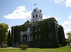
Crook County Courthouse in Prineville
|
|
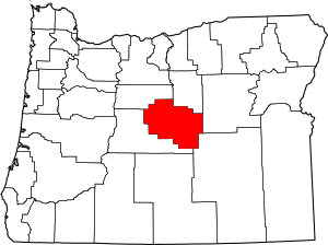
Location within the U.S. state of Oregon
|
|
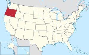 Oregon's location within the U.S. |
|
| Country | |
| State | |
| Founded | October 24, 1882 |
| Named for | George Crook |
| Seat | Prineville |
| Largest city | Prineville |
| Area | |
| • Total | 2,987 sq mi (7,740 km2) |
| • Land | 2,979 sq mi (7,720 km2) |
| • Water | 8.2 sq mi (21 km2) 0.3%% |
| Population
(2020)
|
|
| • Total | 24,738 |
| • Estimate
(2023)
|
26,952 |
| • Density | 7.0/sq mi (2.7/km2) |
| Time zone | UTC−8 (Pacific) |
| • Summer (DST) | UTC−7 (PDT) |
| Congressional district | 2nd |
Crook County is one of the 36 counties in the state of Oregon, USA. A county is a part of a state, like a smaller region with its own local government. In 2020, about 24,738 people lived here. The main city and county seat is Prineville.
The county is named after George Crook. He was an officer in the U.S. Army who served in the American Civil War and in different Indian Wars. Crook County is part of a larger area that includes Bend and Prineville.
Contents
History of Crook County
Crook County was officially created on October 9, 1882. The Oregon State Legislature made this decision. It was named after General George Crook, who was a military leader. The county was formed from a part of Wasco County. This new area included hills where the Blue Mountains meet the Cascade Mountain Range.
Getting into this area was hard at first. This made it difficult for people to settle there. In 1862, a group of people with cattle used the Scott Trail. They were the first non-native people to spend winter in central Oregon. Later, the discovery of the Santiam Pass in the 1860s made it easier to reach the area.
Prineville became the county seat. It was the only official town in the county at that time. Voters confirmed this choice in 1884.
From the very beginning, cattle ranching was a major industry. Large herds of cattle grazed across the land starting in the 1880s. Farming also grew in certain valleys that were good for growing crops.
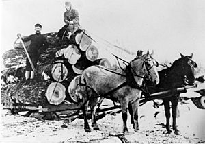
Logging in the Ochoco Mountains also helped the county grow. Timber mills, which cut wood, brought jobs and people. The first sawmill was mentioned around 1867.
Geography and Nature
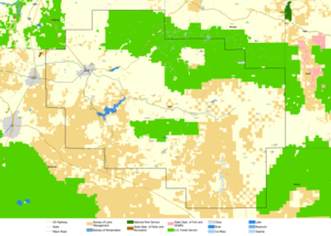
Crook County is right in the middle of Oregon. It covers about 2,987 square miles. Most of this area is land, with only a small part being water. The biggest body of water is the Prineville Reservoir.
Crook County used to be much larger. But over time, parts of it were used to create new counties. Jefferson County was formed in 1914. Then Deschutes County was created in 1916. The county's current borders were set in 1927.
The oldest rock formation in Oregon is found in Crook County. It is in the southeastern part, near Grant County. This formation is made of Devonian limestone. It was created from a large reef when most of Oregon was covered by water a very long time ago.
Neighboring Counties
- Jefferson County - to the north
- Wheeler County - to the north
- Grant County - to the east
- Harney County - to the southeast
- Deschutes County - to the southwest
Protected Natural Areas
- Ochoco National Forest (part of it is in Crook County)
People and Population
| Historical population | |||
|---|---|---|---|
| Census | Pop. | %± | |
| 1890 | 3,244 | — | |
| 1900 | 3,964 | 22.2% | |
| 1910 | 9,315 | 135.0% | |
| 1920 | 3,424 | −63.2% | |
| 1930 | 3,336 | −2.6% | |
| 1940 | 5,533 | 65.9% | |
| 1950 | 8,991 | 62.5% | |
| 1960 | 9,430 | 4.9% | |
| 1970 | 9,985 | 5.9% | |
| 1980 | 13,091 | 31.1% | |
| 1990 | 14,111 | 7.8% | |
| 2000 | 19,182 | 35.9% | |
| 2010 | 20,978 | 9.4% | |
| 2020 | 24,738 | 17.9% | |
| 2023 (est.) | 26,952 | 28.5% | |
| U.S. Decennial Census 1790–1960 1900–1990 1990–2000 2010–2020 |
|||
In 2010, there were 20,978 people living in Crook County. These people lived in 8,558 households. About 6,025 of these were families. The county had about 7 people per square mile.
Most people in the county were white (92.7%). About 1.4% were American Indian. People of Hispanic or Latino origin made up 7.0% of the population. Many people had German, English, or Irish family backgrounds.
About 27.7% of households had children under 18 living there. The average age of people in the county was 45.6 years old.
Towns and Communities
Main City
- Prineville (This is the county seat, where the main government offices are.)
Smaller Communities
These are places where people live, but they are not officially incorporated as cities.
- Juniper Canyon
- Ochoco West
- Prineville Lake Acres
Other Unincorporated Communities
- Forest Crossing
- Lone Pine
- O'Neil
- Paulina
- Post
- Powell Butte
- Roberts
- Suplee
Economy and Jobs
The economy of Crook County depends on several main things. These include forest products, agriculture (farming), raising livestock (like cattle), and tourism (people visiting for fun).
Farming is helped by special irrigation systems. These systems bring water to fields. This allows farmers to grow crops like hay, grain, mint, potatoes, and seeds. The large areas of open land and forests are used for grazing animals. The Ochoco National Forest provides a lot of ponderosa pine trees. These trees are a main source for the lumber industry.
Tourism and recreation are also very important. Many people visit Crook County each year. They come for hunting, fishing, boating, sightseeing, and looking for rocks. The Ochoco Mountains are a popular place for these activities. The Prineville Chamber of Commerce lets rockhounds (people who love to collect rocks) dig for free. They can find cool rocks like agates, limb casts, jasper, and thundereggs.
See also
 In Spanish: Condado de Crook (Oregón) para niños
 | John T. Biggers |
 | Thomas Blackshear |
 | Mark Bradford |
 | Beverly Buchanan |


