Deventer facts for kids
Quick facts for kids
Deventer
Daeventer (Sallands)
|
|||
|---|---|---|---|
|
City and municipality
|
|||
|
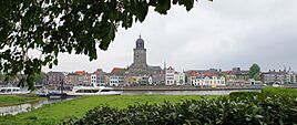
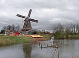
Skyline of Deventer
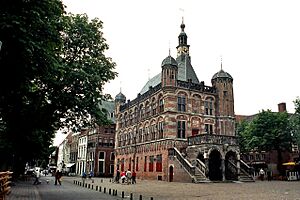
De Brink Square
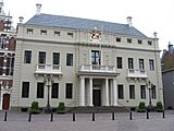
Deventer City Hall
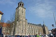
St. Lebuinus Church
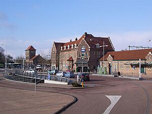
Deventer railway station
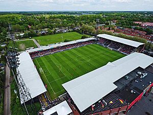
De Adelaarshorst stadium
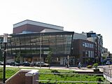
Deventer Theatre
|
|||
|
|||
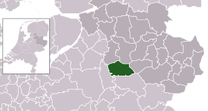
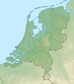
Location in Overijssel
|
|||
| Country | Netherlands | ||
| Province | Overijssel | ||
| Government | |||
| • Body | Municipal council | ||
| Area | |||
| • Total | 134.33 km2 (51.87 sq mi) | ||
| • Land | 131.23 km2 (50.67 sq mi) | ||
| • Water | 3.10 km2 (1.20 sq mi) | ||
| Elevation | 9 m (30 ft) | ||
| Population
(May 2014)
|
|||
| • Total | 98,510 | ||
| • Density | 751/km2 (1,950/sq mi) | ||
| Demonym(s) | Deventernaren | ||
| Time zone | UTC+1 (CET) | ||
| • Summer (DST) | UTC+2 (CEST) | ||
| Postcode |
7400–7438
|
||
| Area code | 0570 | ||
Deventer is an old city and municipality in the Overijssel province of the Netherlands. In 2020, about 100,913 people lived there. Most of the city is on the east side of the IJssel river. A small part is on the west side. In 2005, the nearby town of Bathmen joined Deventer.
Deventer is one of the oldest cities in the Netherlands. People first wrote about it in the 800s. In 952 AD, it was called a city. In 1123, it officially gained city rights. Deventer has the oldest stone house, the oldest walking park, and the oldest science library in the Netherlands.
Contents
History of Deventer
How Deventer Started and Grew
Deventer likely began around 768 AD. An English missionary named Lebuinus built a wooden church there. In 772 AD, a group called the Saxons burned this church. This led to a war started by Charlemagne against the Saxons. But people lived here even earlier, around 300 AD.
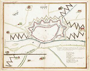
The village of Deventer was important because a trade road crossed the IJssel river there. In 882, Vikings attacked and burned it. But the people quickly rebuilt it and added an earthen wall for protection.
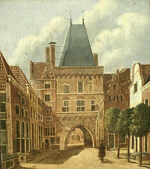
Deventer officially became a city in 956. After this, stone walls were built for defense. Between 1000 and 1500, Deventer became a busy trading city. Its harbor on the IJssel river could hold large ships. The city even joined the Hanseatic League, which was a group of powerful trading cities.
One of the main things Deventer traded was dried fish from Norway. This gave the people of Deventer their nickname: "Deventer Stokvis". In the 1400s, Deventer had a special place where coins were made for three IJssel cities: Deventer, Zwolle, and Kampen.
Deventer is the hometown of Geert Groote. He started a religious school called the Brethren of the Common Life. This school influenced famous thinkers like Thomas a Kempis and Erasmus. Deventer was also one of the first cities to have printing presses, starting in 1477. It had a famous Latin School from around 1300 until 1971. Desiderius Erasmus was a student there.
From the 1500s to the 1700s
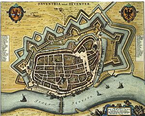
Between 1500 and 1800, the IJssel river became less important for trade. This, along with competition from other cities and the Dutch War of Independence (a religious war), caused Deventer's economy to slow down.
In the 1700s, the iron industry came to Deventer. Iron-rich sand was found east of the city. This sand was used to make iron ore, which was then brought to the city.
Modern Times
In the 1800s, Deventer became an industrial city. Factories made bicycles, carpets, food cans, cigars, heavy machines, and textiles. Some of these industries, like making beds (Auping) and publishing (Wolters Kluwer), are still important today.
The city still has some important businesses. A factory that makes central heating systems is located here. Wolters Kluwer, a big company that provides information and publishes books, also has a presence.
The famous Deventer honey cake (Bussink Deventer Koek) has been made in the city for over 500 years. It is still made locally and sold across the Netherlands and beyond.
World War II
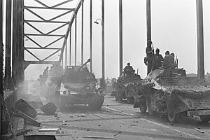
Deventer did not see many battles in its history. However, during World War II, the IJssel bridge and harbor were bombed heavily. The city center was mostly saved, but some bombs meant for the railway bridge hit buildings in the city. The railway bridge was important because it connected Amsterdam to German cities.
There were three big attacks: on October 28, 1944 (35 deaths), December 15, 1944 (33 deaths), and February 6, 1945 (61 deaths). After the last bombing, a sad event happened. A cool warehouse used by the German army caught fire, as did a nearby retirement home. The Germans only allowed firefighters to save their warehouse. The retirement home burned down, and many elderly people living there died.
The Jewish writer Etty Hillesum lived in Deventer during the war. She wrote about the persecution of Jews before she was taken to Auschwitz.
In Schalkhaar, a village near Deventer, the German army used barracks to train Nazi police. Today, this place helps asylum seekers.
Between Lettele and Okkenbroek, about 10 kilometers east of Deventer, the Germans had a launch site for V-1 flying bombs. These bombs were used from December 1944 to March 1945. Some of the 400 V-1 missiles launched there hit already freed parts of Belgium, like Antwerp, causing many deaths. A war monument in Lettele is made from concrete blocks from this launch site.
Deventer has been used for movies. In 1977, scenes for the film A Bridge Too Far were filmed in Deventer. This was because the real city of Arnhem, where the story takes place, had lost its historic center during the war.
In the 1960s, Deventer grew and added parts of the nearby municipality of Diepenveen. Later, in 1999, the whole municipality of Diepenveen joined Deventer. In 2005, Bathmen also became part of Deventer.
People of Deventer
As of July 1, 2021, Deventer has 101,378 residents.
Background of Residents
- 77.37% are Dutch
- 9.23% have a Western migration background
- 13.4% have a non-Western migration background
Geography of Deventer
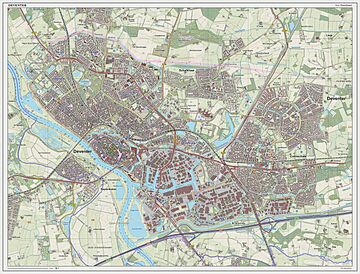
Deventer is made up of the main city and several smaller communities:
- Deventer (the main city)
- Snippeling (a small community east of the city)
- De Worp (the area west of the IJssel river)
- Colmschate (a suburb east of the city with an ice skating hall and a small train station)
- De Bannink
- Oxe
- Diepenveen (a village to the north, surrounded by forest)
- Molenbelt
- Rande
- Tjoene
- Lettele (in a forest area)
- Linde
- Oude Molen (old mill)
- Zandbelt
- Okkenbroek
- Schalkhaar (used to be the center of Diepenveen municipality)
- Averlo
- Frieswijk
- Bathmen (was its own municipality until 2005)
- Apenhuizen
- Dortherhoek
- Loo
- Pieriksmars
- Zuidloo
Climate
Deventer has an oceanic climate, which means it has mild winters and cool summers. It's similar to most of the Netherlands.
| Climate data for Deventer | |||||||||||||
|---|---|---|---|---|---|---|---|---|---|---|---|---|---|
| Month | Jan | Feb | Mar | Apr | May | Jun | Jul | Aug | Sep | Oct | Nov | Dec | Year |
| Mean daily maximum °C (°F) | 5.3 (41.5) |
6.3 (43.3) |
9.6 (49.3) |
14.1 (57.4) |
17.8 (64.0) |
20.5 (68.9) |
22.4 (72.3) |
21.8 (71.2) |
18.8 (65.8) |
14.3 (57.7) |
9.3 (48.7) |
6.0 (42.8) |
13.8 (56.8) |
| Daily mean °C (°F) | 3.1 (37.6) |
3.3 (37.9) |
5.8 (42.4) |
9.7 (49.5) |
13.6 (56.5) |
16.4 (61.5) |
18.4 (65.1) |
17.9 (64.2) |
15.1 (59.2) |
11.2 (52.2) |
7.0 (44.6) |
3.9 (39.0) |
10.4 (50.7) |
| Mean daily minimum °C (°F) | 0.9 (33.6) |
0.7 (33.3) |
2.2 (36.0) |
5.2 (41.4) |
9.0 (48.2) |
11.9 (53.4) |
14.2 (57.6) |
13.9 (57.0) |
11.6 (52.9) |
8.4 (47.1) |
4.7 (40.5) |
1.8 (35.2) |
7.0 (44.6) |
| Average precipitation mm (inches) | 71.0 (2.80) |
58.0 (2.28) |
60.0 (2.36) |
55 (2.2) |
67.0 (2.64) |
74.0 (2.91) |
86.0 (3.39) |
83.0 (3.27) |
70.0 (2.76) |
66.0 (2.60) |
66.0 (2.60) |
74.0 (2.91) |
830.0 (32.68) |
| Mean monthly sunshine hours | 72.0 | 96.0 | 127.2 | 189.6 | 216.0 | 228.0 | 235.2 | 208.8 | 165.6 | 124.8 | 86.4 | 69.6 | 1,819.2 |
| Source: Climate-Data.org | |||||||||||||
Waterways
Deventer was built on a sand dune near the IJssel river. The river was very important for trade for many centuries. In 1241, the city gained the right to collect a toll (a fee) from ships. This brought a lot of money to Deventer in the Middle Ages.
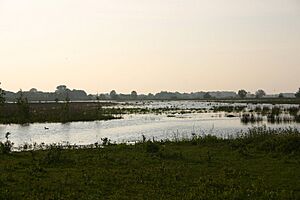
The IJssel river also caused problems because it often flooded. Today, Deventer has flood defenses. But the Welle (a street along the quay) still goes underwater when the river is very high. Past floods have created many small lakes and channels around the city.
Besides the IJssel, Deventer has other waterways. The Schipbeek is a brook that starts in Germany and flows into the IJssel near Deventer. In the past, boats could use it to bring wood and stone to the city. Another waterway, a branch of the Overijssels canal, was built for shipping in the mid-1800s. It connected Deventer to a large system of canals.
Culture in Deventer
Places to See
- The Grote Kerkhof square (Grand Churchyard).
- The Lebuïnuskerk (St. Lebuin's Church) is a beautiful Gothic style church with painted ceilings and an organ. You can climb its tower in summer.
- The City Hall has a front built in 1693 in Dutch Baroque style.
- The Brink (market square) has old houses, shops, and cafes from the 1500s to 1900s. It's also where Deventer's nightlife happens. You can find the Bussink "Koekhuisje" here, which sells the famous Deventer honey cake. Markets are held every Friday and Saturday.
- The Waag (Weighing-house) is on the edge of the Brink square. It was built in 1550 and fixed up in 2003. The Deventer City Museum is inside the Waag. It shows the city's history, paintings, silver items, and old discoveries.
- On the outside wall of the Waag, there used to be a large kettle over 500 years old. People say it was used long ago to punish a man who made fake coins. In 2017, the kettle was moved inside the museum.
- The Speelgoedmuseum (Toy Museum) is behind the Waag. It's in an old house called De Drie Haringen ('The Three Herrings').
- The Great Synagogue of Deventer is built in a Neo-Renaissance style with Moorish influences.
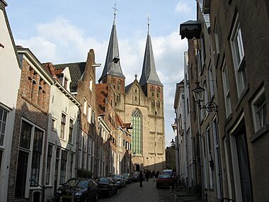
- The medieval Bergkerk (Mountain Church) is on a small hill. Now, it's used for art shows and concerts.
- The old streets around the Bergkerk are called Bergkwartier (Mountain Quarter).
- The Broederenkerk (Friars church) is a mix of Gothic and neo-Gothic styles.
- The Stadsarchief en Athenaeumbibliotheek (City Archive and Athenaeum Library) is the oldest science library in the Netherlands, started in 1560.
- De Proosdij in the Sandrasteeg is the oldest stone house in the Netherlands that is still used. Parts of it date back to around 1130.
Sports in Deventer
Deventer is home to the professional football club Go Ahead Eagles. They play in the De Adelaarshorst stadium, which is one of the oldest stadiums still used today. The club started in 1902. Famous players like Marc Overmars and Paul Bosvelt have played for them.
The De Scheg skating rink, built in 1992, is one of the fastest in the Netherlands. Olympic champion Mark Tuitert and former world champion Erben Wennemars have trained there.
Deventer also has many water sports clubs because it is on the IJssel river.
Events and Festivals
- In the first weekend of July, the city has an outdoor festival called "Deventer op stelten" (Deventer on Stilts). Actors and artists perform in the streets.
- In August, Deventer hosts Europe's largest book fair. About 125,000 people visit it.
- The Dickens Festival in December transforms some of the oldest streets into a scene from the Victorian era. In 2018, 125,000 people attended.
Economy
Businesses
- Girasolar, a company founded in 2003.
Education
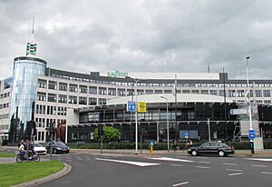
Deventer has one of the three campuses of Saxion University of Applied Sciences (Saxion Hogeschool). This school offers many different Bachelor's degrees and Master's degrees, including engineering, economics, and health care. The other campuses are in Enschede and Apeldoorn.
In 1912, the Secondary Colonial Agricultural School was founded. It later became the International Agricultural College Larenstein.
Transport
Trains
Since 1989, Deventer has two train stations: Deventer railway station and Deventer Colmschate station. In the past, there were more small train stops, but most closed around 1920. Besides the current train lines, there was a train connection from Deventer to Ommen from 1910 to 1935. This line stopped because buses became more popular.
Public Transport
In the 1800s and 1900s, Deventer was connected to a large tram network. Trams ran between Deventer and Borculo from 1885 to 1944. Another tram company ran a line between Deventer and Zutphen. The tram station in Deventer was at the Pothoofd. After World War II, the tram lines were removed.
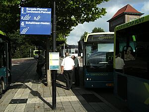
Since late 2020, bus services have been provided by Keolis Nederland under the name RRReis. Buses from the Achterhoek region are provided by Arriva.
Famous People from Deventer
Public Figures & Leaders
- Lebuinus (died around 775) - An important missionary and patron of Deventer.
- Saint Radboud (before 850 – 917) - A bishop of Utrecht.
- Geert Groote (1340–1384) - A religious leader who founded the Brethren of the Common Life.
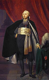
- Rutger Jan Schimmelpenninck (1761–1825) - A Dutch lawyer, ambassador, and politician.
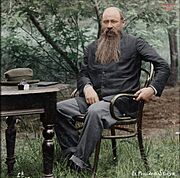
- Martinus Theunis Steyn (1857–1916) - A South African lawyer and politician.
- Etty Hillesum (1914–1943) - A writer who wrote about the persecution of Jews during the war.
- Caroline van der Plas (born 1967) - A Dutch politician and leader of the BBB political party.
Artists
- Jan Pieterszoon Sweelinck (1562–1621) - A Dutch composer and organist.
- Bartholomeus Breenbergh (1598–1657) - A Dutch painter known for Italian-style landscapes.
- Gerard Ter Borch (1617–1681) - A Dutch painter.
- Justus Hiddes Halbertsma (1789–1869) - A Frisian writer, poet, and linguist.
- Han van Meegeren (1889–1947) - A Dutch painter and art forger.
- Pieter Jan Brugge (born 1955) - A Dutch film producer.
Scientists & Business People
- Jacob van Deventer (around 1500 – 1575) - A Dutch mapmaker.
- Willem ten Rhijne (1647–1700) - A doctor and botanist with the Dutch East India Company.
- Johannes C. H. de Meijere (1866–1947) - A Dutch zoologist who studied insects.
- Hubert Schoemaker (1950–2006) - A Dutch biotechnologist.
Sports Stars
- Gerard le Heux (1885–1973) - A horse rider who won a bronze medal at the 1928 Summer Olympics.
- Bert van Marwijk (born 1952) - A former Dutch football player and manager.
- Marc Overmars (born 1973) - A famous football player and director of football at AFC Ajax.
- Bas Dost (born 1989) - A Dutch professional football player.
- Carlijn Achtereekte (born 1990) - A speed skater who won a gold medal at the 2018 Winter Olympics.
- Elis Ligtlee (born 1994) - A track cyclist who won a gold medal at the 2016 Summer Olympics.
International Friends
Deventer is twinned with four cities around the world:
|
Images for kids
See also
 In Spanish: Deventer para niños
 | Sharif Bey |
 | Hale Woodruff |
 | Richmond Barthé |
 | Purvis Young |


