Devil's Gate Pass facts for kids
Quick facts for kids Devil's Gate Pass |
|
|---|---|
 |
|
| Elevation | 7,519 ft (2,292 m) |
| Traversed by | |
| Location | Mono County, California, United States |
| Range | Sweetwater Mountains |
| Coordinates | 38°20′54″N 119°21′43″W / 38.34833°N 119.36194°W |
| Topo map | USGS Fales Hot Springs |
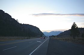
Devil's Gate Pass is a mountain pass in Mono County, California. It's a special route that goes through mountains. U.S. Route 395 crosses right over it. The pass gets its name from a cool rock formation nearby called the Devil's Gate.
Contents
Where is Devil's Gate Pass?
Devil's Gate Pass is in a beautiful part of California. To the east and south, you'll find the town of Bridgeport. The East Walker River also flows nearby. To the west and north is the West Walker River.
The towering Sierra Nevada mountains rise up to the west and south. The Sweetwater Mountains branch off from the Sierra Nevada to the northeast. A place called the Little Walker Caldera is southwest of the pass.
The pass is just a few miles east of Sonora Junction. This is where U.S. 395 meets State Route 108. This part of U.S. 395 connects different valleys. The coordinates show the highest point of U.S. Route 395 in the pass.
Visiting the Pass
If you plan to explore the area around Devil's Gate Pass, it's a good idea to get a map. A Toiyabe National Forest map is very helpful. Most of the land around the pass is public, meaning you can visit it. You can get to these areas using roads like Burcham Flat Road and Little Walker Road.
However, the land right next to U.S. Route 395 through the pass is privately owned. This means it belongs to people, not the public. The forest service map will show you which areas are public and which are private.
What Plants Grow Here?
The area around Devil's Gate Pass is home to many different kinds of plants. You'll see lots of Artemisia tridentata (big sage) and Purshia tridentata (bitterbrush).
Some other cool trees and plants include:
- Juniperus occidentalis (western juniper)
- Pinus jeffreyi (Jeffrey pine)
- Cercocarpus ledifolius (curl leaf mountain mahogany)
- Amelanchier (service berry)
- Populus tremuloides (quaking aspen)
In the fall, the serviceberry and quaking aspen trees turn bright yellow. This makes the area very popular for photographers! Some of these trees are incredibly old. Western junipers can be up to 1500 years old. Some juniper stumps are even 2200 years old! Jeffrey pines have been found to be over 400 years old. In the spring, you can see many small, colorful wildflowers.
What Animals Live Here?
The area west of Devil's Gate is a special zone for deer. Mule deer often cross U.S. 395 near the pass. You'll see signs warning drivers about deer crossing the road.
Many other animals have been seen around the pass, including:
- American badger
- Black bear
- Chipmunk
- Cougar
- Coyote
- Rabbit
- Rubber boa (a type of snake)
- Sage grouse (a bird)
- Vole (a small rodent)
During the warmer months, many different songbirds can be heard. You might also spot Ravens and hawks flying high above.
History of Devil's Gate Pass
Devil's Gate Pass has an interesting history. In January 1844, explorer John C. Fremont crossed the pass. He was exploring the western part of the Nevada Basin. But it was very cold, and there was deep snow. He had to find a way across the Sierra Nevada mountains to reach the warmer California valley.
Because of the difficult conditions, Fremont had to leave behind his cannon on January 29, 1844. It's not clear if the cannon has ever been found. However, the Mono County museum has what they say is the cannon carriage. It was found a few miles away in 2011-2012.
Over the years, people tried different businesses near the pass. In 1863, someone noted there was enough water to power a mill. You can still find parts of an old steam-powered machine, probably a saw mill, on private land near the gate.
A place called Fales Hot Spring, about 2 miles west, was a popular stop. It had a stage stop and a resort from about 1877 to 1952. The main building burned down in 1952. A new resort was built, but most of it was later taken down. The restaurant building is now a private home. A gas station next to the resort stayed open until the 1970s.
In the 1930s, a small ski run operated at Swaugger Creek, 4 miles east of the pass. From 1981 to 1999, a pack station for deer hunters was run at the pass. Today, much of the private land is used for animals to graze or for private homes.
 | Bayard Rustin |
 | Jeannette Carter |
 | Jeremiah A. Brown |

