Gaps of the Allegheny facts for kids
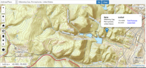
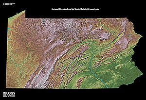
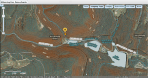
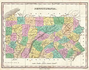
The Gaps of the Allegheny are a series of natural openings in the Allegheny Front, a large mountain ridge in west-central Pennsylvania. These gaps are like small valleys or notches carved by streams. They connect the lower eastern river valleys to the higher lands on the plateau to the west.
Before the 1930s, these gaps were super important. They were some of the only ways for wagons pulled by animals to cross the Appalachians. Without them, crossing the mountains was almost impossible, even for sure-footed mules.
The streams that created these gaps flow into rivers like the Susquehanna River and its branches. This allowed people from the rich Pennsylvania Dutch country to travel inland and climb up to the mountain divide.
Historians often use the term "gaps of the Allegheny" when talking about travel and trade before the 1930s. Geologists use the term "Allegheny Front" to describe the same landform.

Contents
How the Mountains Formed
The Allegheny Front and other ridges in this area are leftovers from an ancient time when huge forces pushed and folded the Earth's layers. This event is called the Alleghenian orogeny. The ridges you see today are made of rock layers that were strong and didn't wear away easily. The valleys are where softer rocks have eroded over time.
Most small streams follow the lines of these softer rocks. But some big rivers, like the Delaware River and Potomac River, cut straight through the hard rock ridges. This suggests these rivers are older than the mountains themselves! Scientists believe the whole region was once flat. Then, it slowly lifted up, and the rivers kept cutting their paths, carving through the rising ridges.
These mountains are tallest in central Pennsylvania. This is sometimes called the Pennsylvania climax.
A Look Back in Time
Long ago, both people and animals looked for the easiest ways to travel. They followed high ridges, mountain passes, and the beginnings of rivers. On the ridges, the forests were less dense, and fallen trees were not as much of a problem. Wind kept the trails clear of leaves and snow. This made it easier for large animals like buffalo and elk to move.
These high paths were the first travel routes for Native Americans. They used them to hunt, trade, and even go to war. Later, settlers also used these routes.
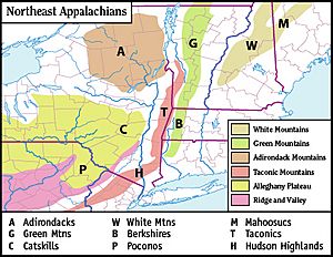
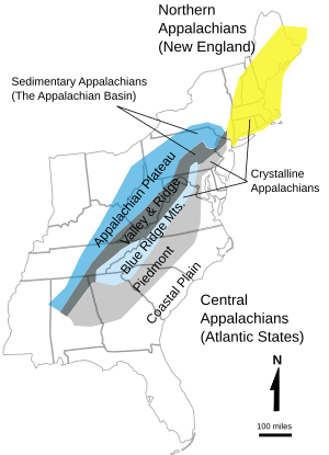
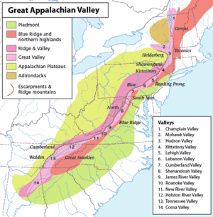
The Ridge-and-Valley Appalachians stretch from the Hudson River valley down through Pennsylvania, Maryland, and into Virginia and North Carolina. They separated the eastern parts of the country from the western lands like the Great Lakes region and Ohio Country.
The "gaps of the Allegheny" were crucial. Along with the Cumberland Narrows and Cumberland Gap further south, they were the only ways to cross into the central lowlands of the Mississippi Valley. This was true for many decades before railroads were built. Even until the 1920s, most areas of these mountains were very hard to cross without special skills.
One important gap, the Blair Gap, was used for the Allegheny Portage Railroad. This railroad was part of Pennsylvania's plan in 1824 to connect Pittsburgh to Philadelphia using canals. Today, US Route 22 follows the path through Blair Gap. Just north of it, the famous Horseshoe Curve built by the Pennsylvania Railroad uses several gaps as it climbs the mountain.
Before the 1920s, when cars became popular and new roads were built, there were only five main ways to travel through the Appalachians from east to west:
- Around the southern plains in Georgia.
- The Cumberland Gap.
- The Cumberland Narrows.
- The gaps of the Allegheny Front.
- Up the Hudson River and around the northern end of the Catskills in New York, which was a flatter water route to the Great Lakes.
Any other way to cross involved very difficult climbs that animals couldn't manage. It wasn't until the 1930s, with big public works projects and new technologies like bulldozers and steam shovels, that many more roads were built through the mountains. These new roads, less than 100 years old, made people forget how important those few bottleneck passes once were.
Important Gaps
The official U.S. Geological Survey (USGS) lists these gaps within the Allegheny Ridge:
Blair Gap
Blair Gap is a water gap along the eastern side of the Allegheny Front. Like other gaps in the Allegheny, its slopes were good for walking, pack mules, and even wagons. This allowed Native Americans and later settlers to travel west into the Ohio Country. Historically, Blair Gap was used for the upper parts of the Allegheny Portage Railroad. This railroad was part of the Pennsylvania Canal System built in 1824 to connect Pittsburgh and Philadelphia by canals.
Kittanning Gap
The official USGS Kittanning Gap has a small spring that is most active during spring floods. However, the shape of the land shows that this notch leads to paths that could be climbed. It was likely a preferred route for wagons heading towards the gently rolling hills near the source of Clearfield Creek, Pennsylvania. By reaching this height, travelers had climbed the main mountain, even if it was a longer, winding path compared to steeper, narrower gaps.
The Gap of Kittanning Run
Further upstream from Kittanning Gap, along Glen White Run, is the gap carved by Kittanning Run. This creek starts in a wooded area in Gallitzin Township, Pennsylvania, at an elevation of over 2,400 feet (730 meters).
 | Georgia Louise Harris Brown |
 | Julian Abele |
 | Norma Merrick Sklarek |
 | William Sidney Pittman |


