Kittanning Path facts for kids
The Kittanning Path was an important old trail used by Native Americans. It stretched from east to west across what is now Pennsylvania. This trail helped connect the Susquehanna River valleys in central Pennsylvania to the high lands of the Appalachian Plateau and then to the western areas near the Ohio River. Kittanning Village was a main settlement for the Delaware (Lenape) Native Americans as they moved down from the Allegheny Plateau.

- People traveling on foot could follow streams or smaller paths through the Kittanning Gap. Other paths, like those used by the Allegheny Portage Railroad, were also in the area.
- Mule trains of trappers could use steep ravines. Settlers with wagons and carts needed easier routes.
- Each 'gap of the Allegheny Front' was a likely way for Native Americans and fur traders to cross the Allegheny Front into the Allegheny Valley and reach Kittanning Village. Some gaps were steeper, while others were easier to climb.
- The land above the front is part of the Appalachian Plateau, which has low hills and small creeks. It also contains the eastern continental divide.

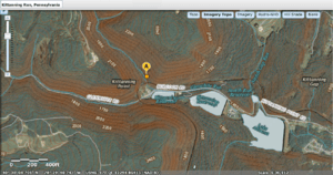
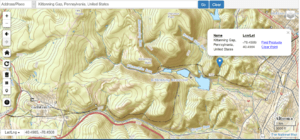
- The maps on this page also show the nearby PRR Horseshoe Curve. This curve crosses three other gaps. It also shows where Kittanning Run meets Glen White Run.
- The Kittanning Gap offered an easier way for wagons or mule trains to climb the steep mountain side. This was part of the Kittanning Path leading to the west side of the Allegheny Mountains and Kittanning, PA. Following a winding route across the slopes was longer but much easier than pulling wagons straight up steep creek beds or other gaps of the Allegheny Front.
The Path Through Nature
The Kittanning Path wasn't just one single trail. It was a group of different paths that travelers could choose from. Some parts were easier to cross depending on the season or direction. These paths went through "gaps" in the mountains. These gaps were some of the very few places where people could cross the Appalachian Mountains from east to west using animals to carry things.
Over many centuries, the Kittanning Path was the main overland route through very difficult country. These mountains were covered with huge, old trees, much bigger than most trees we see today. Native American groups like the Erie, Susquehannock, Iroquois, Lenape, Miami, and Shawnee used this path. Early European explorers and settlers also learned to use these Native American trails to cross the Allegheny Mountains.
The path used one of the special "gaps of the Allegheny." These gaps were near streams that flowed into the Juniata River. This river is a branch of the Susquehanna River. The path ended at the Native American Kittanning Village, which is now the town of Kittanning, Pennsylvania, in Armstrong County, Pennsylvania.
By the time the French and Indian War started in 1754, Europeans believed Kittanning Village was the largest Native American village west of the Alleghenies. This area was originally closed to white settlers by a treaty between William Penn and the Lenape people.
After the French and Indian War, the English and Native Americans signed the Treaty of Fort Stanwix in 1768. This treaty opened some land west of the Alleghenies in Pennsylvania for white settlement. Before this, in the 1750s, there had been conflicts between Native Americans and white settlers in this area.
Today, a part of the original path is still preserved in northwestern Cambria County.
Path Description (East to West)
The Kittanning Path began southeast of Altoona at Frankstown, which is on the Juniata River.
It then went west, crossing the Allegheny Front about 5 miles (8 km) west of Altoona at Kittanning Gap. This spot later became famous for the Horseshoe Curve railroad site.
The path continued northwest through Cambria County, passing east of Carrolltown. It entered Indiana County about 1 mile (1.6 km) south of Cherry Tree. This spot was called "Canoe Place" because it was the highest point on the West Branch of the Susquehanna where Native Americans could carry their canoes.
From there, the path followed a southwest direction. It went through Yellow Creek State Park and along the start of Two Lick Creek. It passed areas like Cookport and Diamondville, roughly following the path of what is now U.S. Highway 422. It continued west and northwest through Indiana to Shelocta. Finally, it crossed into Armstrong County near Elderton and ended at Kittanning Village on the east bank of the Allegheny River.
History of the Path
The Kittanning Path was used as early as 1721. In 1744, an English trader named John Hart received permission to trade with Native Americans in western Pennsylvania. This land was not open to white settlers at that time. Hart set up a campsite called Hart's Sleeping Place near the continental divide in Cambria County. This campsite appeared on old maps. Important people like Governor James Hamilton used it in 1752, and John Harris, Sr., who founded Harrisburg, used it in 1754. The last time Native Americans were recorded camping there was in 1781.
In the 1750s, the path became a route for raids by the Lenape people. They were unhappy about a treaty that took away much of their land in western Pennsylvania. They used the trail to attack white settlements in central Pennsylvania. In 1755, the Lenape chief Shingas used the trail to attack British settlements along the Juniata River. He returned to Kittanning village with people he had captured. In August 1756, the Lenape used the path again to attack and burn Fort Granville near Lewistown, taking more prisoners.
After Fort Granville was burned, the British sent Lt. Colonel John Armstrong to respond. He followed the Lenape along the path and camped at Canoe Place in early September. He continued to the village of Kittanning, which he destroyed on September 8. Armstrong became known as "the Hero of Kittanning" for this attack. He later became a Major General for the United States during the American Revolutionary War and was elected to the Second Continental Congress.
The path was also traveled by an early German pioneer named Conrad Weiser. He was joined by William Franklin, who was the son of Benjamin Franklin. Weiser wrote about his journey in his journal.
It's important not to confuse the Kittanning Path with the Kittanning Road. The Kittanning Road was built by American forces in 1779 during the Sullivan Expedition. This road followed a more northern route, going from Kittanning to where Olean, New York is today.
Preservation
Historians have studied and mapped the trail through Cambria County. A real part of the original trail is preserved near Eckenrode Mill, east of Carrolltown.
 | Ernest Everett Just |
 | Mary Jackson |
 | Emmett Chappelle |
 | Marie Maynard Daly |

