Geology of the Northland Region facts for kids
The Northland Region in New Zealand is built on very old rocks, like a strong foundation. These rocks are mostly a type called greywacke, which you can see on the eastern side of the peninsula. There are also older coal layers from the Eocene time (about 34 to 56 million years ago) near Whangārei, and Oligocene limestone (about 23 to 34 million years ago) near Hikurangi.
Millions of years ago, a process called subduction (where one part of the Earth's crust slides under another) happened northeast of Northland. This pushed a huge sheet of rock, called the Northland Allochthon, over much of the peninsula. It also caused volcanoes to form on both sides of Northland. More recently, since the late Miocene (about 5 to 23 million years ago), new volcanoes have popped up around Kaikohe, the Bay of Islands, and Whangārei. The western coast has many sand dunes that came from volcanoes further south. The Aupouri Peninsula is a large land bridge, called a tombolo, that connects what used to be separate islands to the mainland.
Contents
- What are the Oldest Rocks in Northland?
- Coal and Limestone: What are the Te Kuiti Group Rocks?
- What is the Northland Allochthon?
- How Did Volcanoes Shape Northland?
- What is Waitemata Sandstone?
- How Did Northland Rise Up?
- What are Northland's Coastal Dunes?
- Where are the Hot Springs in Northland?
- What Natural Resources Come from Northland's Geology?
- What are the Geological Risks in Northland?
- Where Can You See Interesting Geology in Northland?
- Where Can You Find Geological Maps?
What are the Oldest Rocks in Northland?
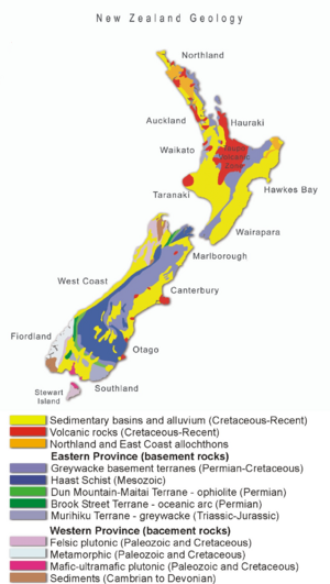
Just like most of New Zealand, Northland's oldest rocks, known as the basement rocks, are mainly made of greywacke (which is hardened sandstone), argillite (a type of mudstone), and chert (a hard, fine-grained rock). They also include volcanic rocks like basalt pillow lava (lava that cooled underwater). These basement rocks are divided into different sections called terranes. Scientists believe these sections came together through processes like subduction or strike-slip faults (where two blocks of land slide past each other) around 100 million years ago.
- Murihiku Terrane: These rocks are under the western side of Northland, but you can't see them on the surface. They formed between 145 and 220 million years ago.
- Caples Terrane: These rocks appear on the surface in areas like the Omahuta and Puketi forests. They formed between 200 and 300 million years ago.
- Hunua Terrane: You can see these rocks across much of eastern Northland, south of Whangaroa. They are usually fine-grained and have been greatly changed by Earth's forces. They formed between 145 and 250 million years ago.
- Mount Camel Terrane: These rocks are found near Mount Camel and the Karikari Peninsula. They formed about 104 to 131 million years ago.
Coal and Limestone: What are the Te Kuiti Group Rocks?
The Te Kuiti Group rocks sit on top of the older basement rocks. You can find them in Northland, Auckland, the Waikato, and King Country, though they are often worn away or covered up.
- Coal: Rocks containing coal formed from ancient swamps about 34 to 37 million years ago.
- Limestone: After the land sank and the sea covered it, calcareous sandstone, mudstone, and limestone were laid down between 24 and 34 million years ago.
You can see the Eocene coal layers in the east, between Kerikeri and Waipu. Coal used to be mined around Kamo, north of Whangārei. Limestone can be seen around Whangārei, with a cool example at the Waro Rocks Scenic Reserve, north of Hikurangi.
What is the Northland Allochthon?
About 21 to 24 million years ago, a huge stack of rock layers, called thrust sheets, was pushed over Northland. These rocks came from the northeast and ended up in Northland in a flipped order, but still the right way up. These original rocks were formed between 25 and 90 million years ago and include mudstone, limestone, and basalt lava. You can see these rocks around Silverdale, Warkworth, and Wellsford.
This huge rock mass, known as an allochthon, includes some displaced Te Kuiti group rocks. The basalt lava of the Tangihua Complex is thought to be old seafloor that was pushed up onto Northland, forming high mountains like Reinga, Ahipara, and Maungataniwha.
How Did Volcanoes Shape Northland?
Early Volcanoes (Miocene Period)
About 23 million years ago, a chain of volcanoes linked to subduction became active west of Northland. This volcanic chain slowly moved south towards Taranaki. These volcanoes mainly produced andesitic stratovolcanoes (cone-shaped volcanoes). Most of these old volcanoes have worn away, but parts of them remain, like the Waipoua Plateau and Waitākere Ranges.
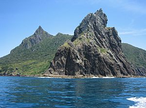
Another volcanic chain formed on the eastern side of Northland, creating volcanoes around Karikari, Whangaroa, and Whangarei Heads (like Bream Head). They also formed the Hen and Chicken Islands.
Recent Volcanoes (Late Miocene to Today)

More recent volcanic activity, not linked to subduction, has happened in Northland from the late Miocene period (about 5 million years ago) up to today. The Kerikeri volcanic group covers the area from Kaikohe, Kerikeri, to Whangārei. This activity started about 9 million years ago, and some of the youngest volcano cones are only tens of thousands of years old.
Little Barrier Island is actually the top part of a large dacitic-rhyodacitic stratovolcano that erupted in two main periods (3 million years ago, and 1.2 to 1.6 million years ago).
What is Waitemata Sandstone?
The old Miocene volcanoes and the Northland Allochthon wore down over time. The eroded material formed the Waitemata sandstone, which you can find between Whangārei and Auckland, on the eastern side of Northland.
How Did Northland Rise Up?
By the middle Miocene period, Northland was lifted above sea level. It tilted slightly towards the west, which exposed the older basement rocks on the eastern side. This tilt also caused many rivers to flow towards the west.
What are Northland's Coastal Dunes?

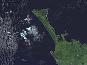
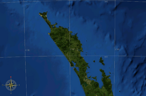
The sandy areas along the coast, both north and south of the Kaipara Harbour, are mostly old sand dunes that have hardened over millions of years. Similar dunes have formed in the north, from Ahipara to Cape Reinga. These dunes have connected what used to be separate islands to the main part of the North Island, creating a large land bridge called a tombolo. The sand on the eastern coast is often very pure quartz and looks white.
Where are the Hot Springs in Northland?
Northland has several hot springs.
- Ngawha Springs has warm water, usually around 40–50°C.
- There are also hot springs at Waiwera and Parakai, which are in the southern part of the Northland Peninsula (in the Auckland Region).
All these hot springs are used for relaxing hot pools. The Ngawha geothermal field is also used to create electricity.
What Natural Resources Come from Northland's Geology?
Northland's geology provides several valuable resources:
- Metals: Copper has been mined at Kaeo, while silver, gold, and mercury were found at Puhipuhi. Antimony was mined at Russell.
- Coal: Coal has been mined in places like Kawakawa, Hikurangi, Kamo, and Kiripaka.
- Oil and Gas: The Northland Basin, which is west of the Northland Peninsula, is thought to have potential for oil and gas.
- Clay: A special type of clay called Halloysite is mined at Matauri Bay and Mahimahi.
- Sand: High-quality quartz sand is taken from near Parengarenga Harbour.
What are the Geological Risks in Northland?
The main geological risk in Northland is the chance of landslides. This is especially true in areas with mudstones and sandstones from the Northland Allochthon. Northland has the fewest earthquakes of anywhere in New Zealand. While volcanic activity is currently quiet, it's not completely gone. However, tsunamis (giant ocean waves) caused by earthquakes around the Pacific Ocean can happen on the east coast.
Where Can You See Interesting Geology in Northland?
If you want to see Northland's geology up close, here are some cool places:
- Hunua Terrane: You can see these rocks along much of the coast between the Bay of Islands and Whangārei.
- Mount Camel Terrane: Look for these rocks at Parerake Bay, on the Karikari Peninsula.
- Kamo Coal Measures: You can see these coal layers near Kamo.
- Whangarei Limestone: Visit the Waro Rocks Scenic Reserve, north of Hikurangi, to see this limestone.
- Tangihua Complex: Many of Northland's hills are made from these rocks, which are part of the Northland Allochthon.
- Old Volcanoes: Maungaraho, north of Tokatoka, is a great example of what's left of an early Miocene andesitic volcano. Whangarei Heads is another example.
- Sand Dunes: You can see large sand dunes on both the east and west coasts between Kaitaia and Cape Reinga.
Where Can You Find Geological Maps?
Geological maps of New Zealand are now available online for free from GNS Science. This is a New Zealand Government Research Institute that studies geology and nuclear science. There's also a detailed map of the Whangarei Urban Area, published in 2003.
 | Charles R. Drew |
 | Benjamin Banneker |
 | Jane C. Wright |
 | Roger Arliner Young |


