Goffle Hill facts for kids
Quick facts for kids Goffle Hill |
|
|---|---|
| Watchung Mountains | |
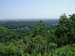
The western flank of Goffle Hill is seen from High Mountain in Wayne, New Jersey.
|
|
| Highest point | |
| Elevation | 602 ft (183 m) |
| Dimensions | |
| Length | 6 mi (9.7 km) north–south |
| Geography | |
| Country | United States of America |
| Geology | |
| Age of rock | Triassic and Jurassic |
| Type of rock | extrusive igneous and trap rock |
Goffle Hill, also called Goffle Mountain, is a cool part of the Watchung Mountains in northern New Jersey. It's made of a special kind of rock called trap rock. This hill sits on the edge of the Newark Basin, which is like a big, ancient valley.
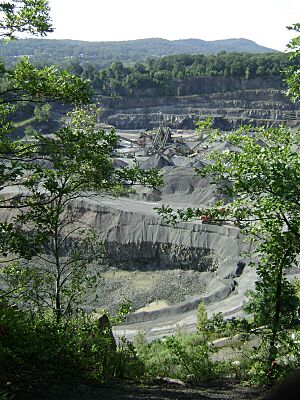
Goffle Hill is partly in Bergen County and partly in Passaic County. Even though it's mostly in a suburban area, it still has forests, wetlands, and rocky open spaces. Sadly, a lot of the hill has been dug up for its trap rock, especially in North Haledon and Prospect Park. People are working to protect the remaining natural areas, like the Save the Woods group.
Contents
Exploring Goffle Hill's Geography
Goffle Hill is usually the name for the northern part of the First Watchung Mountain ridge. This ridge runs north from the Passaic River up to Campgaw Mountain. To the west of Goffle Hill, there's a narrow valley that separates it from the taller Preakness Range. On the east side, the hill looks out over a wide, shallow valley that stretches towards the Palisades.
Long ago, the whole ridge was known as Totoway Mountain. The name Goffle Hill was only used for the southern, more noticeable part. But today, people use Goffle Hill to describe the entire ridge. Even so, the northern and southern parts of the hill look quite different.
Southern Part of the Ridge
The southern part of Goffle Hill goes through towns like Prospect Park, Haledon, North Haledon, Hawthorne, and Wyckoff. It generally runs from north to south.
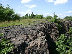
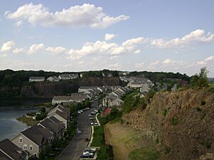
It starts near the Great Falls of the Passaic River and gently rises to the north. The highest point on Goffle Hill is 602 feet (about 183 meters) high. This spot is in Hawthorne, close to North Haledon and Wyckoff. The southern ridge is special because it has rocky open areas and tall, straight basalt cliffs on its eastern side.
Northern Part of the Ridge
The northern part of Goffle Hill is in areas like Sicomac, Franklin Lakes, and Oakland. This section is mostly a lower, broken ridge with fewer big cliffs.
Modern maps show only one named peak here, called Knob Hill. It's about 518 feet (about 158 meters) high and is in Franklin Lakes. This peak is one of the few places where the trap rock is visible on the surface in the northern ridge. There are also five other unnamed peaks over 500 feet tall, with the highest reaching 584 feet (about 178 meters) in Franklin Lakes.
Goffle Hill's Past
The Lenape people were the first to live on Goffle Hill. The hill's old name, Totoway Mountain, comes from their language. Totoway, or Totowa, means 'the falls between river and mountain'. This name described the Great Falls of the Passaic River, which flow over a gap in the First Watchung Mountain ridge. Later, Europeans used this name for the part of the ridge north of the falls.
The hill's current name, Goffle Hill, comes from the Dutch word gaffel, which means 'fork'. This is because Goffle Hill was located at a fork in an important Lenape trail. For a while, Goffle Hill was also called Wagaraw Mountain. Wagaraw was another Lenape term, meaning 'low country at the bend of the river'. This referred to the northern bend of the Passaic River.
It makes sense that the Lenape names for the ridge are connected to the Passaic River. Lenape camps were often found along the river's smaller streams at the base of the hill. These streams were important for fresh water and fishing. When Europeans arrived, the streams powered mills, helping people settle and farm the northern Passaic River valley. The trap rock and sandstone from the hill were also used for building during the 1800s and 1900s.
During the American Revolutionary War, Goffle Hill, like other Watchung Mountains, was used as a lookout point. In 1780, General Lafayette's soldiers were stationed on the eastern side of the hill. Lafayette's headquarters were at the bottom of the hill, in what is now Goffle Brook Park in Hawthorne.
How Goffle Hill Was Formed (Geology)
Goffle Hill was formed about 185 million years ago. This happened when hot, melted rock (lava) flowed out onto the surface. At that time, the area was part of an active rift valley, which was like a giant crack in the Earth's crust. This valley ran through northern and central New Jersey and parts of Pennsylvania.
After the rift stopped being active, the land was lifted up. Over time, wind and water wore away the softer sandstone and shale rocks around the harder basalt lava flows of Goffle Hill. This process made the hill stand out.
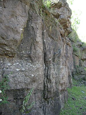
Most of the northern part of Goffle Hill is covered by layers of sand, gravel, and other materials left behind by glaciers. This makes it less prominent. The southern part of the ridge shows a lot of trap rock. However, in some places, red sandstone can be seen where quarrying has removed the trap rock above it. Most of the exposed trap rock is found along tall, steep cliffs facing east.
There are also some interesting rocks called hornfels on Goffle Hill. These are found where sandstone and basalt meet. The heat from the ancient lava flow baked the red sandstone, turning it into a harder, grey hornfels.
Goffle Hill's Nature (Ecology)
The natural forests on Goffle Hill have changed a lot because of new homes and diseases. An old report from 1894 said that oak trees, redcedar, and chestnut trees were very common on Goffle Hill.
Today, chestnut trees are almost gone because of a disease called chestnut blight that arrived in the early 1900s. Redcedar trees, which were once the most common, are now only found in a few small groups along the southern ridge.
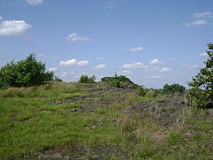
Some special rocky open areas called trap rock glades still exist on Goffle Hill. But new buildings are slowly making them disappear. Many of the remaining glades are along the ridge where North Haledon and Hawthorne meet. Building homes here has been a bit difficult because of the tall, steep basalt cliffs. However, quarrying has removed a large part of these unique glades.
There are also wetlands scattered along the ridge. One of the bigger wetlands includes Goffle Pond, which feeds a stream that becomes Goffle Brook. Other important wetlands help feed Molly Ann Brook and Deep Voll Brook.
Protecting Goffle Hill (Conservation)
More and more homes are being built on Goffle Hill, with new houses and yards appearing on what used to be forests and trap rock glades. As the mountain ridge becomes more suburban, people are worried about water runoff and the loss of natural areas.
Local residents in Hawthorne and Wyckoff started a group called Save the Woods. They are trying to protect about 19 acres (about 7.7 hectares) of woodlands that are planned for development. Other efforts to stop building projects in Hawthorne and Wyckoff have not been successful. Some people believe these new developments have led to more local flooding.
As of 2009, Goffle Hill does not have any officially protected land. Only one park, Hofstra Park, is entirely on Goffle Hill. It's a town park managed by Prospect Park. Goffle Brook Park, managed by Passaic County, is at the foot of the hill and partly covers the lowest eastern side.
Fun Things to Do (Recreation)
From north to south, you can find:
- High Mountain Golf Club
- Goffle Brook Park
- Hofstra Park
 | Bessie Coleman |
 | Spann Watson |
 | Jill E. Brown |
 | Sherman W. White |


