
Hamilton County, Illinois facts for kids
Quick facts for kids
Hamilton County
|
||
|---|---|---|

Hamilton County Courthouse in McLeansboro
|
||
|
||

Location within the U.S. state of Illinois
|
||
 Illinois's location within the U.S. |
||
| Country | ||
| State | ||
| Founded | 1821 | |
| Named for | Alexander Hamilton | |
| Seat | McLeansboro | |
| Largest city | McLeansboro | |
| Area | ||
| • Total | 436 sq mi (1,130 km2) | |
| • Land | 435 sq mi (1,130 km2) | |
| • Water | 1.2 sq mi (3 km2) | |
| Population
(2020)
|
||
| • Total | 7,993 | |
| • Density | 18.333/sq mi (7.078/km2) | |
| Time zone | UTC−6 (Central) | |
| • Summer (DST) | UTC−5 (CDT) | |
| Congressional district | 12th | |

Hamilton County is a place in the state of Illinois, USA. It is a type of local government area called a county. In 2020, about 7,993 people lived here. The main town and government center is McLeansboro. Hamilton County is in the southern part of Illinois, an area sometimes called "Little Egypt".
Contents
History of Hamilton County
Hamilton County was created in 1821. It was formed from a part of White County. The county is named after Alexander Hamilton. He was a hero in the American Revolutionary War, which was a fight for America's independence. He was also the first United States Secretary of the Treasury, meaning he helped manage the country's money.
-
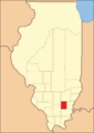
Hamilton County when it was first created in 1821.

On March 18, 1925, a very strong tornado hit the county. This tornado was called the Tri-State Tornado. It destroyed many homes and farms in areas like Flannigan and Twigg. Sadly, 37 people lost their lives because of this storm.
Geography and Nature
According to official records, Hamilton County covers about 436 square miles. Most of this area, about 435 square miles, is land. A small part, about 1.2 square miles, is water.
Climate and Weather
| Weather chart for McLeansboro, Illinois | |||||||||||||||||||||||||||||||||||||||||||||||
|---|---|---|---|---|---|---|---|---|---|---|---|---|---|---|---|---|---|---|---|---|---|---|---|---|---|---|---|---|---|---|---|---|---|---|---|---|---|---|---|---|---|---|---|---|---|---|---|
| J | F | M | A | M | J | J | A | S | O | N | D | ||||||||||||||||||||||||||||||||||||
|
3.2
39
20
|
2.8
45
24
|
4.5
55
34
|
4.6
66
43
|
4.7
76
53
|
3.9
85
62
|
3.5
89
66
|
3
88
63
|
2.9
81
55
|
3
70
43
|
4.5
56
35
|
3.6
44
25
|
||||||||||||||||||||||||||||||||||||
| temperatures in °F precipitation totals in inches source: The Weather Channel |
|||||||||||||||||||||||||||||||||||||||||||||||
|
Metric conversion
|
|||||||||||||||||||||||||||||||||||||||||||||||
In McLeansboro, the county seat, temperatures change a lot. In January, the average low is around 20°F (about -7°C). In July, the average high can reach 89°F (about 32°C). The coldest temperature ever recorded was -23°F (-31°C) in January 1930. The hottest was 113°F (45°C) in July 1936.
The county also gets rain and snow. The driest month is usually February, with about 2.76 inches of rain. May is often the wettest, with about 4.67 inches of rain.
Transportation and Roads
- Rides Mass Transit District is a public transportation service.
Main Roads
 Illinois Route 14
 Illinois Route 142
 Illinois Route 242
Neighboring Counties
Hamilton County shares borders with several other counties:
- Wayne County to the north
- White County to the east
- Gallatin County to the southeast
- Saline County to the south
- Franklin County to the west
- Jefferson County to the northwest
Population and People
| Historical population | |||
|---|---|---|---|
| Census | Pop. | %± | |
| 1830 | 2,616 | — | |
| 1840 | 3,945 | 50.8% | |
| 1850 | 6,362 | 61.3% | |
| 1860 | 9,915 | 55.8% | |
| 1870 | 13,014 | 31.3% | |
| 1880 | 16,712 | 28.4% | |
| 1890 | 17,800 | 6.5% | |
| 1900 | 20,197 | 13.5% | |
| 1910 | 18,227 | −9.8% | |
| 1920 | 15,920 | −12.7% | |
| 1930 | 12,995 | −18.4% | |
| 1940 | 13,454 | 3.5% | |
| 1950 | 12,256 | −8.9% | |
| 1960 | 10,010 | −18.3% | |
| 1970 | 8,665 | −13.4% | |
| 1980 | 9,172 | 5.9% | |
| 1990 | 8,499 | −7.3% | |
| 2000 | 8,621 | 1.4% | |
| 2010 | 8,457 | −1.9% | |
| 2020 | 7,993 | −5.5% | |
| 2023 (est.) | 7,911 | −6.5% | |
| U.S. Decennial Census 1790-1960 1900-1990 1990-2000 2010-2013 |
|||

In 2010, there were 8,457 people living in Hamilton County. This means there were about 19.5 people for every square mile. Most people (98.2%) were white. A small number were black or African American (0.4%), Asian (0.2%), or American Indian (0.2%). About 1.2% of the people were of Hispanic or Latino background.
Many families in the county have German (33.1%), Irish (20.7%), or English (11.4%) roots. About 29.8% of households had children under 18 living with them. The average age of people in the county was 43.1 years old.
The average yearly income for a family in the county was about $50,878. Some people in the county live below the poverty line, which means they have a very low income. This included about 14.5% of all people, and 21.5% of those under 18.
Towns and Villages
Hamilton County has several communities, from small villages to its main city.
City
Incorporated Town
Villages
- Broughton
- Dahlgren
- Macedonia (partly in Franklin County)
Unincorporated Communities
These are smaller places that are not officially organized as cities or villages.
- Aden
- Blairsville (Flannigan's Store)
- Braden
- Dale
- Delafield
- Piopolis
- Rural Hill
- Tuckers Corners
- West Rural Hill
Townships
Hamilton County is divided into twelve smaller areas called townships. These help manage local services.
- Beaver Creek
- Crook
- Crouch
- Dahlgren
- Flannigan
- Knights Prairie
- Mayberry
- McLeansboro
- South Crouch
- South Flannigan
- South Twigg
- Twigg
See also
 In Spanish: Condado de Hamilton (Illinois) para niños
