Hapuakohe Range facts for kids
Quick facts for kids Hapuakohe Range |
|
|---|---|

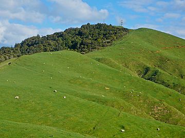
Maungakawa summit from north
|
|
| Highest point | |
| Elevation | 535 m (1,755 ft) |
| Geography | |
| Geology | |
| Age of rock | Jurassic |
| Type of rock | Greywacke |
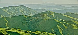
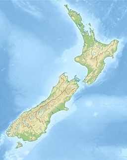
The Hapuakohe Range is a line of hills that runs from north to south in the Waikato region of New Zealand. It sits between the Waikato River and the Hauraki Plains. The range is separated from the Taupiri Range by a gap near Mangawara. This gap was once a path for the Waikato River about 20,000 years ago.
Rivers like the Waitakaruru and Whangamarino flow from the northern part of the range. Further south, streams on the east side flow into the Piako River. On the west side, streams flow towards the Waikato River.
A historical boundary from the 1865 land confiscations followed this range. Today, the borders between the Waikato, Hauraki, and Matamata Piako Districts still follow a similar line.
Contents
Exploring the Hapuakohe Range: Peaks and Paths
The LINZ map shows many named peaks and features along the Hapuakohe Range. They are listed from north to south.
- Pukekamaka: 275 meters (about 902 feet) high.
- Okaeria: 321 meters (about 1,053 feet) high.
- Karamuroa: 440 meters (about 1,444 feet) high.
- Otane: 432 meters (about 1,417 feet) high.
- Ikeike: 452 meters (about 1,483 feet) high. This peak is west of the main ridge.
- Matahuru Road: Reaches about 300 meters (about 984 feet) high. In 2007, about 61 vehicles used the lower part of this road each day. Beyond this point, the road is gravel for over 8 kilometers (about 5 miles). It leads towards the junction of Ohinewai Road and State Highway 27, near Kaihere.
- Maungakawa: 535 meters (about 1,755 feet) high. There is a 28-meter (about 92-foot) tall microwave tower on its summit. There is also another Maungakawa hill near Cambridge that is 495 meters (about 1,624 feet) high.
- Pukeitionga: 510 meters (about 1,673 feet) high.
- Tirotiro: 279 meters (about 915 feet) high. This peak is east of the main ridge.
- Maukoro: 92 meters (about 302 feet) high. This peak is also east of the main ridge.
- Pororua: 267 meters (about 876 feet) high. This peak is west of the main ridge.
- Hapuakohe: 515 meters (about 1,690 feet) high.
- Ngaraparapa: 521 meters (about 1,709 feet) high.
- Te Hoe: 516 meters (about 1,693 feet) high. This area has an old pā (a fortified Māori village) called Te Hoe. It was used by the Ngāti Wairere and Ngāti Hauā tribes.
- Tauwhare: 481 meters (about 1,578 feet) high.
- Te Heru: 200 meters (about 656 feet) high.
- Puketutu Pā: 220 meters (about 722 feet) high.
- Ruakiwi Pā: 240 meters (about 787 feet) high.
What's the Hapuakohe Range Made Of?
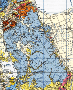
The Hapuakohe Range is mostly made of a type of rock called greywacke. This rock formed during the Jurassic period, which was about 145 to 200 million years ago.
Over time, volcanic ash covered these rocks. This created clay soils that don't drain water very well. These soils can easily wash away, especially on steep hills where animals graze.
At both ends of the range, you can find older volcanic rocks. These rocks formed from magma that cooled underground. For example, at the south end, there are rocks from 6 to 7 million years ago, including basaltic andesite and pyroxene andesite. At the north end, there are rocks from 10 to 13 million years ago, which also include dacite and tuff.
Exploring the Hapuakohe Walkway

There's a long walking track called the Hapuakohe Walkway. It's about 24.8 kilometers (about 15.4 miles) long and is managed by the Department of Conservation. As you walk along the range, you can enjoy amazing views. You might see Te Aroha, the Firth of Thames, the Huntly power station, and the hills south of Auckland. You can also see the wide Waikato Plains.
Wildlife and Nature in the Hapuakohe Range
The Hapuakohe Range is home to important natural areas. These include the Hapuakohe Conservation and Ecological areas, which cover about 970 hectares (about 2,400 acres). There are also the Mangapiko Valley (321 hectares or 793 acres) and Matahuru (1,336 hectares or 3,301 acres) scenic reserves. Some of this land has been protected since 1906.
The climate here is warm and humid, with about 120 to 160 centimeters (about 47 to 63 inches) of rain each year.
Plants of the Range
The Hapuakohe Range was once covered in kauri forests. These forests often had other native trees like podocarps. At the southern end, you would find hard beech trees. Higher up, there were rimu and tawa forests. On the flat flood plains, kahikatea trees grew tall.
Other common plants include tanekaha, rewarewa, mingimingi, prickly mingimingi, and silver ferns. You can also find wheki, kanuka, and puriri trees. Some taraire trees are also present.
Sadly, all the large kauri trees were cut down a long time ago. However, about 42% of the native plants are now protected. The remaining areas are mostly covered in manuka and kanuka scrubland, especially on the eastern foothills.
Animals of the Range
While there hasn't been a full study of the animals here, we know some creatures live in the Hapuakohe Range. You can find kereru (New Zealand pigeons) and copper skinks. It's also likely that long-tailed bats, New Zealand falcons, and different types of frogs like Hochstetter's and Archey's frogs live here. Forest geckos and green geckos are probably present too.
Until the 1980s, the kokako bird lived in this area. It was thought to be gone from here, but its numbers have grown in the Hunua Ranges to the north.
 | Calvin Brent |
 | Walter T. Bailey |
 | Martha Cassell Thompson |
 | Alberta Jeannette Cassell |


