
Hebron, New York facts for kids
Quick facts for kids
Hebron
|
|
|---|---|

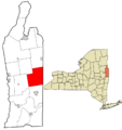
Location in Washington County and the state of New York.
|
|
| Country | United States |
| State | New York |
| County | Washington |
| Area | |
| • Total | 56.42 sq mi (146.12 km2) |
| • Land | 56.11 sq mi (145.33 km2) |
| • Water | 0.31 sq mi (0.79 km2) |
| Elevation | 794 ft (242 m) |
| Population
(2010)
|
|
| • Total | 1,853 |
| • Estimate
(2016)
|
1,809 |
| • Density | 32.24/sq mi (12.45/km2) |
| Time zone | UTC-5 (Eastern (EST)) |
| • Summer (DST) | UTC-4 (EDT) |
| ZIP codes |
12832 and 12865
|
| Area code(s) | 518 |
| FIPS code | 36-33040 |
| GNIS feature ID | 0979059 |
Hebron is a small town in Washington County, New York, in the United States. It is part of the Glens Falls Metropolitan Statistical Area, which is a group of nearby cities and towns. In 2010, about 1,853 people lived there. The town is named after an ancient city called Hebron, which is in the West Bank today.
Contents
Geography of Hebron
Hebron is known for its beautiful hills and valleys. These are part of the Taconic Mountains and the larger Great Appalachian Valley. Because of this, many of Hebron's hills, valleys, and roads run diagonally, just like the Appalachian Mountains.
Mountains and Valleys in Hebron
Hebron is a special place where different valleys and mountain areas meet. It sits between the Champlain Valley and the Hudson River Valley. The Taconic Mountains become smaller hills here, leading towards the Adirondack Mountains in New York and the Green Mountains in Vermont. So, Hebron is like a bridge between these different mountain and valley regions.
Size and Borders of Hebron
The town of Hebron covers about 56.4 square miles (146.1 square kilometers). Most of this area is land, with only a small part being water.
Hebron shares its eastern border with Vermont, which is the start of New England. To the south, it borders the town of Salem. On its western and northern sides, Hebron borders the towns of Argyle, Hartford, and Granville. Granville is famous for its colorful slate rock.
Roads and Waterways in Hebron
NY Route 22 is a main road that runs north and south through the eastern part of Hebron, close to the Vermont border. Route 30 connects Salem to Hartford through the western part of the town. Route 31 is the longest road in Hebron. It crosses the town diagonally, connecting West Hebron to West Pawlet, Vermont.
Hebron is also a place where two major watersheds meet. A watershed is an area of land where all the water drains into one main river or lake. In Hebron, some water flows north into Lake Champlain and then into the Saint Lawrence River. This water eventually reaches the Atlantic Ocean far to the northeast. Other water in Hebron flows south into Black Creek, then into the Batten Kill, and finally into the Hudson River. This water also reaches the Atlantic Ocean, but much further south, near New York City.
The two parts of Black Creek meet in West Hebron. This happens just west of the main street, after a waterfall on the West Branch of Black Creek.
People of Hebron
| Historical population | |||
|---|---|---|---|
| Census | Pop. | %± | |
| 1820 | 2,754 | — | |
| 1830 | 2,685 | −2.5% | |
| 1840 | 2,498 | −7.0% | |
| 1850 | 2,548 | 2.0% | |
| 1860 | 2,543 | −0.2% | |
| 1870 | 2,399 | −5.7% | |
| 1880 | 2,383 | −0.7% | |
| 1890 | 2,044 | −14.2% | |
| 1900 | 1,679 | −17.9% | |
| 1910 | 1,505 | −10.4% | |
| 1920 | 1,184 | −21.3% | |
| 1930 | 1,191 | 0.6% | |
| 1940 | 1,228 | 3.1% | |
| 1950 | 1,134 | −7.7% | |
| 1960 | 1,026 | −9.5% | |
| 1970 | 1,212 | 18.1% | |
| 1980 | 1,288 | 6.3% | |
| 1990 | 1,540 | 19.6% | |
| 2000 | 1,773 | 15.1% | |
| 2010 | 1,853 | 4.5% | |
| 2016 (est.) | 1,809 | −2.4% | |
| U.S. Decennial Census | |||
In 2000, there were 1,773 people living in Hebron. The town had 687 households, and 489 of these were families. Most people in Hebron were White (97.18%).
About 32.3% of households had children under 18 living with them. Most households (58.2%) were married couples. The average household had 2.57 people, and the average family had 3.02 people.
The population was spread out by age. About 27.1% were under 18, and 13.2% were 65 or older. The average age in Hebron was 38 years old.
The median income for a household was $37,639. For families, it was $41,680. This means half of the households earned more than this amount, and half earned less. About 9.7% of the population lived below the poverty line.
History of Hebron
Hebron was first settled in the late 1700s and was known as the District of Black Creek. The British government gave land in this area to soldiers who fought in the French and Indian War (1754-1763). Many of these soldiers were from a Scottish regiment. These land grants were often sold to new settlers from New England and Scotch-Irish families.
The town of Hebron was officially formed on March 23, 1786. It was named after Hebron, Connecticut. That town, in turn, was named after the ancient city of Hebron in the Middle East.
The main road through Hebron, now Route 22, used to be called the "Great Northern Turnpike." You can still see two old mile markers along this road in Hebron.
Hebron started as a farming community and still is today. In 1864, it was the main area in Washington County for growing potatoes. Today, dairy farming is more common. Many families have lived in Hebron for generations, but new people are also moving there, some for second homes or to retire.
Hebron Volunteer Fire Company
The West Hebron Volunteer Fire Company started in 1947. Later, in 1978, the East Hebron Fire Company was formed after two homes burned down. The land for the East Hebron station was donated, and volunteers built the station. Eventually, the two companies joined together to form the Hebron Volunteer Fire Company.
This fire company also has a First Response Team. These firefighters are also trained as EMTs (Emergency Medical Technicians). They help people with medical emergencies and injuries. All first responders are licensed by New York State.
Hebron Preservation Society
The Hebron Preservation Society was started in 1975. This group works to save and share the history of Hebron. They have a museum with collections in two old buildings in East Hebron. One building is a former one-room schoolhouse built in 1845. The other is a small farm house from the early 1800s.
The society has also published a book about Hebron's history called HEBRON: A Century In Review. The museum displays items from old schoolhouses, ledgers, books, and family histories of people who lived in Hebron.
Beauty of Hebron Potato
The "Beauty of Hebron" is a special type of potato. It was promoted by a local seed seller named Edward L. Coy. This potato was a natural seedling of another potato type. The first time it was mentioned in print was in 1876. The next year, in 1877, the US Department of Agriculture sent the Beauty of Hebron potato to growers in 26 states to test it out.
In 1879, Coy shipped these potatoes to London. The Beauty of Hebron potato was important because it helped restock farms in the British Isles after the potato blight and the Great Famine of Ireland. It became popular in places like New Zealand and New Caledonia. By the early 1900s, it was a favorite for gardeners in the United States too.
Even though it wasn't widely grown commercially in the US by 1946, it was still listed in a potato handbook in 1959. Today, the Beauty of Hebron potato is on the RAFT list of Threatened American Foods. This means it's a food that needs to be preserved. Amateur gardeners in Hebron started growing it again in 2006.
Notable People from Hebron
- Hiram Barton — a former mayor of Buffalo, New York
- James M. Hinds — a United States Representative who was born in East Hebron in 1833.
- Homer Nelson — a former member of the Wisconsin State Assembly.
- Solomon Northup (1808-c. 1863) — a free man who had a farm in Hebron. He wrote a famous book called Twelve Years a Slave about his life. He also spoke out against slavery.
- Ralph Randles Stewart — a botanist, someone who studies plants.
Locations in Hebron
Hebron has seven smaller communities called hamlets: Porter, Hebron, North Hebron, East Hebron, West Hebron, Belcher, and Slateville.
The Town Clerk's office is in West Hebron. The Hebron Volunteer Fire Company also has its main station there. Another fire station is in East Hebron. Hebron does not have its own school buildings anymore. Students from Hebron go to schools in nearby towns like Granville and Salem.
Communities in Hebron
- Belcher – A hamlet near the western edge of the town.
- Castle Green – A place near the western town line.
- East Hebron – A hamlet near the eastern border. The Hebron District School No. 16 is a historic building here.
- North Hebron – A hamlet near the northern border.
- Porter – A community north of East Hebron.
- Slateville – A hamlet in the northeastern part of Hebron.
- Tiplady – A community south of East Hebron.
- West Hebron (also known as Chamberlain Mills) – A hamlet in the southwestern part of the town. The Hebron Valley Grange No. 1103 is a historic building here.
Geographical Features in Hebron
- Barkley's Lake – A small lake north of West Hebron.
- Black Creek – A stream that runs through the town.
- Black Creek Falls – A waterfall in West Hebron.
- Green Pond – A small lake northeast of Slateville.
- Grimes Hill – A hill in the northern part of the town.
- Hebron Mountain – A small mountain that looks over West Hebron.
- Irwin Road Pond – A small lake west of East Hebron.
- Pine Hill – A hill northeast of West Hebron.
- Smith Pond – A small lake south of North Hebron.
Images for kids
-
Location of Hebron in Washington County, New York.
See also
 In Spanish: Hebron (Nueva York) para niños
