Hopkinton, Rhode Island facts for kids
Quick facts for kids
Hopkinton
Hopkinton, Rhode Island
|
|
|---|---|
| Country | |
| State | |
| County | Washington |
| Area | |
| • Total | 44.1 sq mi (114.0 km2) |
| • Land | 43.0 sq mi (111.0 km2) |
| • Water | 1.1 sq mi (2.8 km2) |
| Population
(2020)
|
|
| • Total | 8,398 |
| • Density | 196/sq mi (75.7/km2) |
| Time zone | UTC-5 (Eastern (EST)) |
| • Summer (DST) | UTC-4 (EDT) |
| ZIP codes | |
| Area code(s) | 401 |
| Website | http://www.hopkintonri.org |
Hopkinton is a town in Washington County, Rhode Island, United States. In 2020, about 8,398 people lived there. It's a cool place with a lot of history and natural beauty.
Contents
History of Hopkinton
Hopkinton got its name from Stephen Hopkins. He was a very important person who signed the Declaration of Independence. He was also the Governor of the Colony of Rhode Island and Providence Plantations when Hopkinton became its own town in 1757. Before that, it was part of a town called Westerly.
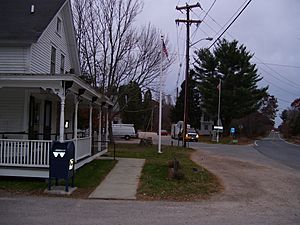
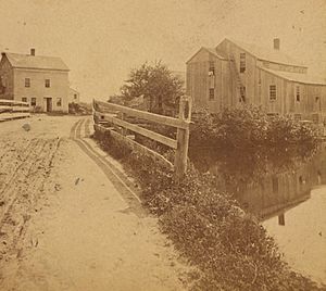
Long ago, Hopkinton had many small factory towns. These were places like Locustville and Moscow. Each town was named after the mill (factory) it was built around. Today, only a few of these places still have their own post offices. These include Hope Valley, Rockville, Ashaway, and Bradford. There's also a post office just called "Hopkinton."
The main town building, called the town hall, is in a village called Hopkinton City. This spot used to be a busy stop for stagecoaches, which were like old-time buses.
Geography of Hopkinton
Hopkinton is located in Rhode Island. It's found at about 41.461 degrees North and 71.778 degrees West. It shares borders with the towns of Richmond and Charlestown. The Pawcatuck River runs through Hopkinton, and the town is right next to the border with Connecticut.
The United States Census Bureau says that Hopkinton covers about 44.1 square miles (114.0 square kilometers) in total. Most of this area, about 43.0 square miles (111.0 square kilometers), is land. The rest, about 1.1 square miles (2.8 square kilometers), is water.
Hopkinton is the first town you enter in Rhode Island if you are driving north on Interstate 95. This makes it a gateway to the state for many travelers.
Villages in Hopkinton
Hopkinton has two main villages: Hope Valley in the northern part and Ashaway in the southern part. Two of the four elementary schools in the Chariho Regional School District are in Hopkinton. One is in Hope Valley, and the other is in Ashaway.
Other villages in or partly in Hopkinton include:
- Barberville
- Bethel
- Bradford
- Burdickville
- Canonchet
- Centerville
- Hopkinton City
- Locustville
- Moscow
- Rockville
- South Hopkinton
- Woodville
- Yawgoog
Many of these villages grew up around mills that were built on rivers. Hope Valley and Ashaway are the biggest villages. They are often used for postal addresses and school zones.
Neighboring Towns
Hopkinton is surrounded by several other towns:
 |
Voluntown, Connecticut | Exeter |  |
|
| North Stonington, Connecticut | Richmond | |||
| Westerly | Charlestown |
People of Hopkinton
| Historical population | |||
|---|---|---|---|
| Census | Pop. | %± | |
| 1790 | 2,462 | — | |
| 1800 | 2,276 | −7.6% | |
| 1810 | 1,774 | −22.1% | |
| 1820 | 1,821 | 2.6% | |
| 1830 | 1,777 | −2.4% | |
| 1840 | 1,726 | −2.9% | |
| 1850 | 2,477 | 43.5% | |
| 1860 | 2,738 | 10.5% | |
| 1870 | 2,682 | −2.0% | |
| 1880 | 2,952 | 10.1% | |
| 1890 | 2,864 | −3.0% | |
| 1900 | 2,602 | −9.1% | |
| 1910 | 2,324 | −10.7% | |
| 1920 | 2,316 | −0.3% | |
| 1930 | 2,823 | 21.9% | |
| 1940 | 3,230 | 14.4% | |
| 1950 | 3,676 | 13.8% | |
| 1960 | 4,174 | 13.5% | |
| 1970 | 5,392 | 29.2% | |
| 1980 | 6,406 | 18.8% | |
| 1990 | 6,873 | 7.3% | |
| 2000 | 7,836 | 14.0% | |
| 2010 | 8,188 | 4.5% | |
| 2020 | 8,398 | 2.6% | |
| U.S. Decennial Census | |||
In 2000, there were 7,836 people living in Hopkinton. These people lived in 2,965 households, and 2,182 of these were families. About 35.2% of the households had children under 18 living there. Most households, 61.9%, were married couples.
The average household had about 2.64 people, and the average family had about 3.07 people. The population was spread out by age. About 25.7% of the people were under 18 years old. About 11.1% were 65 years or older. The average age in Hopkinton was 38 years.
The median income for a household in the town was $52,181. For families, the median income was $59,143. This means half the households earned more than this amount and half earned less.
Many different backgrounds make up the people of Hopkinton. In 2017, the largest groups of people based on their family's origin were:
| Largest ancestries (2017) | Percent |
|---|---|
| English | 24.8% |
| Irish | 22.8% |
| Italian | 18.6% |
| German | 10.5% |
| French (except Basque) | 10.2% |
| Polish | 6.5% |
| Portuguese | 4.5% |
| American | 3.6% |
| Scottish | 3.6% |
| Swedish | 3.3% |
Famous People from Hopkinton
Hopkinton is the birthplace of several notable individuals:
- Prudence Crandall: She was a teacher who ran the first school in the United States that was not separated by race.
- Edward Lee Greene: A famous botanist, someone who studies plants.
- Benjamin Randall: He was a politician who served in the Wisconsin State Assembly.
- Dorcas James Spencer (1841–1933): A social activist and writer.
- John Wilbur: A Quaker minister.
Historic Places in Hopkinton

Hopkinton has several places that are listed on the National Register of Historic Places. These sites are important because they help tell the story of the past. Some of these include:
- Black Farm
- Bradford Village Historic District (partly in Westerly)
- Hope Valley Historic District
- Hopkinton City Historic District
- Tomaquag Rock Shelters
- Upper Rockville Mill
- Wyoming Village Historic District
See also
 In Spanish: Hopkinton (Rhode Island) para niños
 | Anna J. Cooper |
 | Mary McLeod Bethune |
 | Lillie Mae Bradford |


