Hughes River (West Virginia) facts for kids
Quick facts for kids Hughes River |
|
|---|---|

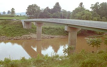
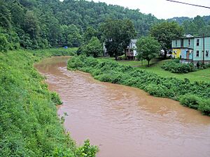
Hughes River at Freeport
|
|
| Country | United States |
| State | West Virginia |
| Counties | Ritchie, Wirt |
| Physical characteristics | |
| Main source | South Fork Hughes River Doddridge County 1,074 ft (327 m) 39°09′46″N 80°44′44″W / 39.16278°N 80.74556°W |
| 2nd source | North Fork Hughes River Ritchie County 1,098 ft (335 m) 39°23′14″N 80°55′59″W / 39.38722°N 80.93306°W |
| River mouth | Little Kanawha River near Newark 584 ft (178 m) 39°08′24″N 81°23′43″W / 39.14000°N 81.39528°W |
| Length | 18 mi (29 km) |
The Hughes River is a river in western West Virginia, United States. It flows into the Little Kanawha River. The Little Kanawha River then joins the Ohio River, which eventually flows into the mighty Mississippi River. This means the Hughes River is part of the huge watershed of the Mississippi River.
From where its two main parts meet, the Hughes River is about 18 miles (29 km) long. It flows through a countryside area of the Allegheny Plateau. This part of the plateau was not covered by glaciers a long time ago.
People believe the river was named after an early settler from the 1700s, Jesse Hughes. However, it might also have been named after other people with the same last name who lived in the area around that time. It was also once known as the Junius River.
Contents
Journey of the Hughes River
The Hughes River is formed by two main streams. These streams flow mostly through Ritchie County. Let's learn about each one:
North Fork Hughes River
The North Fork Hughes River is about 57 miles (92 km) long. It starts in northern Ritchie County, near a place called Mountain. It flows generally towards the southwest.
This fork passes through North Bend State Park. In 2003, a dam was built here to create North Bend Lake. The North Fork also flows through the town of Cairo.

The North Bend Rail Trail crosses the North Fork six times. This trail used to be a railroad line built between 1853 and 1857.
South Fork Hughes River
The South Fork Hughes River is about 54 miles (87 km) long. It begins in western Doddridge County. It flows generally towards the west.
This fork travels through southern Ritchie County. It passes by small communities like Berea, Smithville, and Macfarlan. West Virginia Route 47 is a road that runs alongside the lower part of the South Fork.
Where the Forks Meet
The North and South Forks of the Hughes River come together near a community called Cisco. From this meeting point, the Hughes River flows for another 18 miles (29 km).
It travels through northern Wirt County. Finally, it joins the Little Kanawha River near the community of Newark. This spot is about 12 miles (19 km) southeast of Parkersburg.
Fish in the Hughes River
The Hughes River is home to many different kinds of fish. Some of the fish you might find there include:
- Muskellunge
- Different types of bass, such as rock, smallmouth, and spotted bass
- Catfish, including flathead and channel catfish
- Several kinds of sunfish
 | Chris Smalls |
 | Fred Hampton |
 | Ralph Abernathy |


