
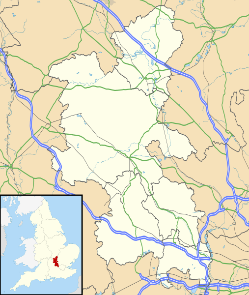
Image: Buckinghamshire UK location map

Description: Map of Buckinghamshire, UK with the following information shown: Administrative borders Coastline, lakes and rivers Roads and railways Urban areas Equirectangular map projection on WGS 84 datum, with N/S stretched 160% Geographic limits: West: 1.33W East: 0.33W North: 52.21N South: 51.47N
Title: Buckinghamshire UK location map
Credit: Ordnance Survey OpenData. Administrative borders and coastline data from Boundary-Line product. All other geographic data from Meridian 2 product. Inset derived from England location map.svg by Spischot.
Author: Nilfanion, created using Ordnance Survey data
Permission: This file is licensed under the Creative Commons Attribution-Share Alike 3.0 Unported license. Attribution: Contains Ordnance Survey data © Crown copyright and database right You are free: to share – to copy, distribute and transmit the work to remix – to adapt the work Under the following conditions: attribution – You must give appropriate credit, provide a link to the license, and indicate if changes were made. You may do so in any reasonable manner, but not in any way that suggests the licensor endorses you or your use. share alike – If you remix, transform, or build upon the material, you must distribute your contributions under the same or compatible license as the original. https://creativecommons.org/licenses/by-sa/3.0 CC BY-SA 3.0 Creative Commons Attribution-Share Alike 3.0 truetrue
Usage Terms: Creative Commons Attribution-Share Alike 3.0
License: CC BY-SA 3.0
License Link: https://creativecommons.org/licenses/by-sa/3.0
Attribution Required?: Yes
Image usage
The following 53 pages link to this image:
- Addingrove
- Amersham
- Angling Spring Wood
- Aylesbury
- Beaconsfield
- Bledlow-cum-Saunderton
- Bledlow Ridge
- Bletchley
- Bletchley and Fenny Stratford
- Boarstall Tower
- Bolbec Castle
- Bottom Wood
- Bourne End, Buckinghamshire
- Bradwell Abbey
- Buckingham
- Buckingham Castle
- Castlethorpe Castle
- Chesham
- Cholesbury
- Desborough Castle
- Fleet Marston
- Gerrards Cross
- Great and Little Kimble cum Marsh
- High Wycombe
- Ivinghoe
- Little Chalfont
- Marlow, Buckinghamshire
- Medmenham
- Milton Keynes
- Missenden Abbey
- Newport Pagnell
- Olney, Buckinghamshire
- Philipshill Wood
- Princes Risborough
- Quarrendon
- RAF Halton
- St Mary's Church, Old Amersham
- St Mary and St George Church, High Wycombe
- St Michael and All Angels Church, Hughenden
- St Paul's Church, West Wycombe
- Stoke Mandeville
- Stokenchurch BT Tower
- Stony Stratford
- Taplow
- Taplow Barrow
- Two Mile Ash
- Water Stratford
- Wendover
- West Wycombe
- Wing, Buckinghamshire
- Winslow, Buckinghamshire
- Wolverton and Greenleys
- Yeomanry House, Buckingham
