Ingleby Barwick facts for kids
Quick facts for kids Ingleby Barwick |
|
|---|---|
| Town and civil parish | |
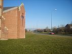
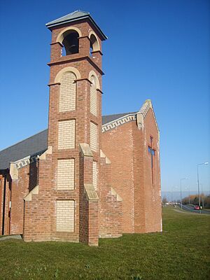 St Francis Church, Ingleby Barwick |
|
| Population | 20,378 (2011 census) |
| OS grid reference | NZ445140 |
| Civil parish |
|
| Unitary authority |
|
| Ceremonial county | |
| Region | |
| Country | England |
| Sovereign state | United Kingdom |
| Post town | STOCKTON-ON-TEES |
| Postcode district | TS17 |
| Dialling code | 01642 |
| Police | Cleveland |
| Fire | Cleveland |
| Ambulance | North East |
| EU Parliament | North East England |
| UK Parliament |
|
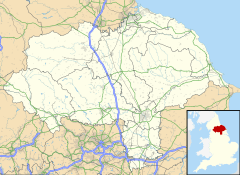
Ingleby Barwick is a town and civil parish in the Borough of Stockton-on-Tees, North Yorkshire, England. It is located south of the River Tees and north-east of the River Leven.
This town started growing in the late 1970s. It was built on farmland south-west of Thornaby. The first part of the town officially opened on 30 July 1981. In 2007, Ingleby Barwick officially became a town.
In 2011, about 20,378 people lived in Ingleby Barwick. If you include nearby small villages, the population was 21,045.
Contents
- Understanding the Name: Ingleby Barwick
- A Look Back: History of Ingleby Barwick
- How Ingleby Barwick is Governed
- Population and People
- Exploring Ingleby Barwick: Geography
- Sports and Activities
- Getting Around: Transport
- Learning in Ingleby Barwick: Education
- Places of Worship: Religion
- Things to Do: Amenities
- Famous People from Ingleby Barwick
Understanding the Name: Ingleby Barwick
Ingleby Barwick was originally two separate places. People often just say "Ingleby" unless they need to be very clear.
Where "Ingleby" Comes From
The name "Ingleby" comes from an old language called Old Norse. It means "place of the Angles". The Angles were a group of people who came to England a long time ago.
Where "Barwick" Comes From
"Barwick" comes from Anglo-Saxon words. "Bere" means barley, and "Wick" means farm. So, Barwick means "barley farm".
How to Say "Barwick"
You can say "Barwick" in two ways. Some people say "Bar-ick," which is an older way of speaking. Others say "Bar-wick," which is closer to how the words are spelled today. Both ways are common in Ingleby Barwick.
A Look Back: History of Ingleby Barwick
People have lived in the area of Ingleby Barwick for thousands of years.
Early History: Stone Age to Roman Times
- Stone Age: There are signs that people lived here as far back as the Stone Age.
- Iron Age: Tools made of flint and old farm fields from the Iron Age have been found.
- Bronze Age Discoveries: In 1996, archaeologists found five ancient burials from the Bronze Age. They also found special items made of stone, jet, and copper. This discovery was very important for understanding how people lived and traded during that time.
- Roman Settlement: A Roman settlement was also found. Part of a Roman Villa (a large Roman house) was dug up. This area is now a public green space called Condercum Green in The Rings area of town.
Norman Era and Middle Ages
After the Norman Conquest, the land of Barwick was given to a powerful Norman family. Later, in the 1200s, it was owned by religious groups like Guisborough Priory. Ingleby and Barwick were separate places for a long time.
Modern History and Growth
In the 1600s, the land was sold to important people like Sir Thomas Lynch, who was a Governor of Jamaica. Later, it was owned by the Turner family. They used money from the land to support a free school and hospital in Kirkleatham.
Industrial Revolution Changes
The northern part of Ingleby Barwick used to be a quarry, where a type of stone called Whinstone was dug up. Today, much of this area is a golf course. Old maps show that the stone was moved by a small railway and loaded onto boats.
In 1887, Ingleby Barwick was a small village with only 132 people. The land was sold off by the Turner family around this time.
World War II Incidents
During the Second World War, Ingleby Barwick was close to Thornaby Airfield. Several aircraft crashed in the area where the town now stands. One crash site, where a de Havilland Mosquito plane fell, is now marked by a stone near Ingleby Mill School.
Old Farms in the Town
Even with all the new buildings, some old farmhouses from before the 1980s still exist:
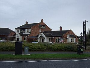
- Low Farm: Part of this farm is now the Teal Arms pub.
- Cleveland View: This was once part of Lane House Farm.
- Ingleby Hill Farm: Some original buildings are still there.
- Myton House Farm: The pub called Myton House Farm marks the original site.
Historic Mills
- Black Mill: This is what's left of an old corn mill.
- The Old Mill: Now a bed and breakfast, it's at the end of Barwick Lane.
How Ingleby Barwick is Governed
Ingleby Barwick has its own local government called a Town Council.
Ingleby Barwick Town Council
The Town Council was formed in 1990. In 2007, it officially became a "Town Council," which gave Ingleby Barwick its town status.
The Town Council has six councillors. They help manage local facilities like The Rings Community Hub and the war memorial in Romano Park.
Town's Coat of Arms
| Arms of Ingleby Barwick Town Council | |
|---|---|
| Crest | On a Wreath Or and Gules a Teal proper supporting with the dexter wing a Garb Or. |
| Blazon | Or three barrulets wavy Azure over all three Mill-rinds Gules. |
| Motto | Stepping Stones To The Future |
| Granted in October 2000. | |
The town received its Coat of Arms in October 2000.
- It shows three wavy lines, representing the three rivers around Ingleby Barwick.
- It also has symbols linked to the Turner family, who used to own much of the land.
- The bird on the crest is a Teal. This refers to a famous racehorse named Teal, which won the Grand National in 1952. The Teal Arms pub in town is also named after this horse.
Local Government: Borough and County
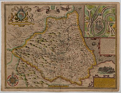
Historically, Ingleby Barwick was part of the North Riding of Yorkshire. Today, it is part of the Borough of Stockton-on-Tees, which is a local authority.
Ingleby Barwick has six councillors who represent the town in the Borough Council. These councillors work on bigger issues for the area.
Population and People
Ingleby Barwick has grown a lot! In 1881, only 132 people lived here. By 2016, the population was estimated to be 22,290.
Most homes in Ingleby Barwick are owned by the people who live in them. The town has many families with children, and the average age is younger than in other nearby areas. Many residents have a good level of education, with a high number having university degrees.
Most people in Ingleby Barwick work full-time or part-time. Many travel by car to jobs outside the town.
Exploring Ingleby Barwick: Geography
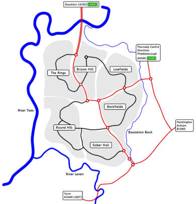
The town is divided into several areas:
- Ingleby Barwick Centre
- Lowfields
- Beckfields
- Sober Hall
- Round Hill (named after a nearby ancient monument)
- Broom Hill
- The Rings (named after old settlements)
Rivers, Streams, and Ponds
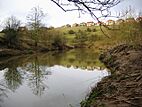
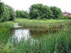
Ingleby Barwick is almost surrounded by water. The River Leven is to the south and west, the Tees to the north and west, and Bassleton Beck to the east. Barwick Pond, in the middle of town, is a small nature reserve.
Barwick Farm
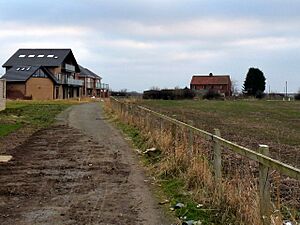
Barwick Farm is still a working farm next to The Rings area. The main path through Ingleby Barwick, Barwick Lane, was originally the road to this farm.
Sports and Activities
Ingleby Barwick has many sports facilities:
- Football: The town has a football club called Thornaby & Ingleby Barwick Football Club ("TIBS"). There are also modern 3G and 4G football pitches at the secondary schools.
- Golf: Ingleby Barwick Golf Course is a nine-hole course. It has a floodlit driving range, which is the only double-decker one in the North of England.
- Swimming: The IB Leisure complex has a 25-meter swimming pool.
- Angling: You can go fishing along the banks of the River Tees.
Getting Around: Transport
Roads
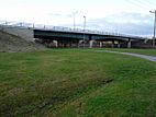
2. Queen Elizabeth Way's Jubilee Bridge
Ingleby Barwick can be reached by three main roads: Queen Elizabeth Way, Ingleby Way, and Barwick Way. Because many people live here and travel for work, there can be traffic jams during busy times.
In 2016, some roads like Myton Way and Ingleby Way were made wider to help with traffic.
Buses run regularly from Ingleby Barwick to Stockton, Middlesbrough, and Yarm. Teesside International Airport is about 8 miles away.
Trains
Nearby towns like Yarm, Eaglescliffe, and Thornaby have train stations, which are about four miles away. From these stations, you can connect to bigger train lines at Darlington or York.
Paths and Walking Routes
The original Barwick Lane, which was once a farm road, is now mostly a public footpath. It goes through different parts of the town, like Sober Hall, and passes by Barley Fields Primary School.
Learning in Ingleby Barwick: Education
Library
The town's library is located inside the IB Leisure Centre. It is open to everyone and offers free computer access, books, and other resources.
Schools
Ingleby Barwick has eight schools: six primary schools and two secondary schools.
Primary Schools
- Whinstone: Named after the stone once quarried in the area.
- Barley Fields: Opened in 2006, named because "Barwick" comes from "barley farm."
- St Francis of Assisi: A Church of England school.
- St. Thérèse of Lisieux: A Roman Catholic school.
- Myton Park: Named after Myton Farm House.
- Ingleby Mill: Named after an old mill near its site.
Secondary Schools
- All Saints Academy:
This is the oldest secondary school in Ingleby Barwick, located in the town centre. It is a Church of England school. It opened in 2009 and became an "academy" in 2013.
- Ingleby Manor Free School & Sixth Form:
This is the newest secondary school and the first to offer a sixth form (for older students) in Ingleby Barwick. It is located in the south-east of the town.
Places of Worship: Religion
- An Anglican church, dedicated to St Francis of Assisi, holds services in the town centre.
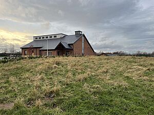
A Catholic church, St Therese of Lisieux, was completed in February 2016. Before the church was built, services were held in the primary school hall.
Things to Do: Amenities
Town Centre Facilities
- Bannatyne Health Club: The first Bannatyne health club was built here in 1997.
- Supermarket: A large Tesco supermarket is in the centre.
- Romano Park: This park behind Tesco has a play area for children and a multi-use sports ground.
- IB Leisure Centre: Opened in 2020, this centre next to All Saints Academy has a swimming pool, gym, and the town library.
Other Local Areas
- Sandgate Park: This shopping area in The Rings has a convenience shop, DIY shop, and places to eat. There's also a community hall and play park nearby.
- Beckfields: This area has shops, a bistro, a pub, and a community centre.
- Lowfields: Here you'll find shops, a post office, a doctor's surgery, a dentist, and a pub.
Famous People from Ingleby Barwick
- Ben Houchen: The first and current Tees Valley Mayor, grew up in Ingleby Barwick.
- Juninho Paulista: A famous footballer who lived in Ingleby Barwick when he played for Middlesbrough FC.
- Katherine Copeland: A rower who won a gold medal at the 2012 Summer Olympics in London. A gold-painted Royal Mail postbox in the town celebrates her win.
- Nathan Thomas (footballer): A footballer born in Ingleby Barwick.
- Nathan Wood: A footballer for Middlesbrough FC, also born in Ingleby Barwick.
 | Emma Amos |
 | Edward Mitchell Bannister |
 | Larry D. Alexander |
 | Ernie Barnes |


