Inuit navigation facts for kids

The Inuit are indigenous peoples who live in the Arctic and subarctic areas of Greenland, Canada, and Alaska. For thousands of years, they have used amazing navigation skills to travel across vast, often featureless, landscapes.
Inuit hunters often traveled long distances to find food. They needed to know how to find their way back home, even when far from land or in bad weather. They used a lot of knowledge passed down through stories to navigate. This knowledge helped them cross the tundra, sea ice, and open water. These places can look very similar, making it hard to find your way.
Even during a blizzard or white-out, when it's hard to see, Inuit hunters could find their way. They understood prevailing winds, how snowdrifts formed, and the movements of animals like caribou, fish, and birds. They also used the stars to guide them. Their languages had many words to describe different types of snow and ice, which helped them understand the landscape. When natural landmarks were not enough, the Inuit built inuksuk (rock piles) to help with navigation.
The Arctic has very long periods of sunlight in summer and cold, dark, snowy winters. The Arctic Ocean freezes over. The Arctic region is generally defined as the area north of the Arctic Circle (about 66° 34'N). This is where the midnight sun (sun never sets) and polar night (sun never rises) begin. The closer you get to the North Pole, the more days of midnight sun or polar night there are.
Contents
Celestial navigation means using the sun, moon, and stars to find your way. Inuit travelers could use this method, but it wasn't always easy. The amount of daylight changes a lot throughout the year in the Arctic. Cloudy weather, blizzards, and the bright aurora borealis (Northern Lights) could make it hard to see the sky. Snow blown by the wind could also create a kind of fog. Even on clear nights, moonlight reflecting off the ice and snow could hide the stars.
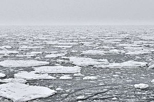
The Inuit languages have words to describe the main winds and how they affect sea ice. They also describe how tides and currents shape the ice. Inuit travelers could find their way and give directions by describing specific sea-ice conditions that happened in the same places each year.
These conditions included:
- Ice dunes and pressure ridges: These are piles of ice formed by wind or currents.
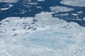
- Polynyas: These are areas of open water surrounded by sea ice. They are caused by winds or ocean currents.
- Ice cracks or leads: These are openings in the drift ice zone.
Areas of open water like polynyas and ice cracks could be seen on the horizon. The water would reflect a blue color onto the sky, which looked different from the sky's usual background color. This helped navigators spot open water from a distance.
The prevailing wind was the most reliable way for Inuit travelers to find their direction. This is because the wind created consistent shapes and patterns in the snowdrifts. One example is sastrugi, which the Inuit call kalutoqaniq. These unique shapes in the snow showed the direction of the wind.
Inuit travelers used these snow patterns to set their course when crossing flat tundra. They were especially helpful when blizzards, bad weather, or darkness hid other landmarks.
The Inuit also built inuksuk (rock cairns). These stone structures had different designs for different purposes. Some marked the grave of an angakkuq (shaman). Others were used to guide caribou during hunts. These inuksuk also served as important navigation markers.
Transport Methods

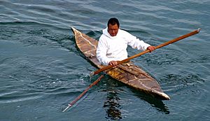
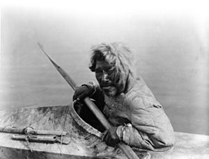
In summer, the Inuit hunted sea animals from small, covered boats called qajaq. These boats were made from seal skins stretched over a frame. They were very stable and could be easily righted by a person sitting inside, even if they flipped over completely. Europeans and Americans later copied this design, and we still call them kayaks today.
The Inuit also used larger, open boats called umiaq. These were sometimes called "woman's boats" in certain areas. They were made of wood frames covered with animal skins. Umiak were used to transport people, goods, and dogs. They were typically 6 to 12 meters (about 20 to 40 feet) long and had a flat bottom. This design allowed the boats to come very close to shore.
In winter, the Inuit used dog sleds (qamutik) for travel on both land and sea ice. The Siberian Husky dog breed comes from Siberia. Evidence suggests their ancestors were first tamed in Siberia about 23,000 years ago. They then spread eastward into the Americas and westward across Eurasia. A team of dogs would pull the sled. The sleds were made from wood, animal bones, baleen (from a whale's mouth), or even frozen fish. Dogs would pull the sleds over snow and ice in either a tandem (one behind the other) or fan formation.
Making Maps
Inuit navigators understood how maps worked. They could create a relief map using sand, sticks, and pebbles to show others directions. They also drew maps on animal skins using natural dyes. For example, the bark of the alder tree made a red-brown color. Spruce trees provided red, and berries, lichen, moss, and algae also gave different colors.
The Greenlandic Inuit made unique Ammassalik wooden maps. These were portable maps carved from driftwood. They showed the shape of the coastline, helping people navigate along the shore.
See also
- Polynesian navigation
- Micronesian navigation
 | Percy Lavon Julian |
 | Katherine Johnson |
 | George Washington Carver |
 | Annie Easley |


