Juneau County, Wisconsin facts for kids
Quick facts for kids
Juneau County
|
|
|---|---|
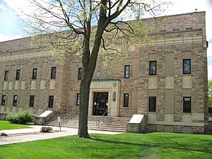
Juneau County Courthouse
|
|
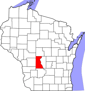
Location within the U.S. state of Wisconsin
|
|
 Wisconsin's location within the U.S. |
|
| Country | |
| State | |
| Founded | 1857 |
| Named for | Solomon Juneau |
| Seat | Mauston |
| Largest city | Mauston |
| Area | |
| • Total | 804 sq mi (2,080 km2) |
| • Land | 767 sq mi (1,990 km2) |
| • Water | 37 sq mi (100 km2) 4.6%% |
| Population
(2020)
|
|
| • Total | 26,718 |
| • Estimate
(2023)
|
26,594 |
| • Density | 34.8/sq mi (13.4/km2) |
| Time zone | UTC−6 (Central) |
| • Summer (DST) | UTC−5 (CDT) |
| Congressional districts | 3rd, 7th |
Juneau County is a place in Wisconsin, a state in the United States. It's called a county. In 2020, about 26,718 people lived here. The main town, or county seat, is Mauston.
Contents
History of Juneau County
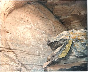
Long ago, before settlers came, Native American tribes lived in the area now known as Juneau County. They left behind amazing things. For example, you can see thunderbirds carved into rocks at Twin Bluffs. There are also special earth mounds, like the Gee's Slough mounds, near New Lisbon.
Juneau County was officially created in 1857. The Wisconsin Legislature decided to separate this land from what was then Adams County. After some debate, Mauston became the county seat. The county was named after Solomon Juneau, who helped start the city of Milwaukee.
Geography and Nature
Juneau County covers a total area of about 804 square miles. Most of this land is dry, about 767 square miles. The rest, about 37 square miles, is water, like lakes and rivers.
Main Roads and Travel
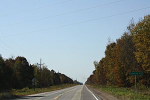
You can find several important roads in Juneau County. These include major highways that connect to other parts of the state and country.
|
Railroads and Public Transport
Trains also run through Juneau County. Companies like Amtrak, Canadian National, Canadian Pacific, and Union Pacific use these tracks. You can also find bus stops for intercity travel.
Airports in the County
Juneau County has two airports. Necedah Airport (KDAF) serves the county and nearby areas. The Mauston–New Lisbon Union Airport (82C) also helps people travel by air.
Neighboring Counties
Juneau County shares its borders with several other counties:
- Wood County to the north
- Adams County to the east
- Columbia County to the southeast
- Sauk County to the south
- Vernon County to the southwest
- Monroe County to the west
- Jackson County to the northwest
Protected Natural Areas
Part of Juneau County is home to the Necedah National Wildlife Refuge. This is a special place that protects wildlife and their natural homes.
Population and People
| Historical population | |||
|---|---|---|---|
| Census | Pop. | %± | |
| 1860 | 8,770 | — | |
| 1870 | 12,372 | 41.1% | |
| 1880 | 15,582 | 25.9% | |
| 1890 | 17,121 | 9.9% | |
| 1900 | 20,629 | 20.5% | |
| 1910 | 19,569 | −5.1% | |
| 1920 | 19,209 | −1.8% | |
| 1930 | 17,264 | −10.1% | |
| 1940 | 18,708 | 8.4% | |
| 1950 | 18,930 | 1.2% | |
| 1960 | 17,490 | −7.6% | |
| 1970 | 18,455 | 5.5% | |
| 1980 | 21,039 | 14.0% | |
| 1990 | 21,650 | 2.9% | |
| 2000 | 24,316 | 12.3% | |
| 2010 | 26,664 | 9.7% | |
| 2020 | 26,718 | 0.2% | |
| U.S. Decennial Census 1790–1960 1900–1990 1990–2000 2010 2020 |
|||
2020 Census Information
In 2020, the population of Juneau County was 26,718 people. This means there were about 34.8 people living in each square mile. There were also about 14,441 homes.
Most people in the county, about 90.9%, identified as White. About 2.1% were Black or African American, and 1.4% were Native American. About 0.6% were Asian. Some people (0.9%) were from other backgrounds, and 4.1% identified with two or more races. About 2.7% of the population was Hispanic or Latino.
Cities, Towns, and Villages
Juneau County has several different types of communities.
Cities
- Elroy
- Mauston (This is the county seat, the main town)
- New Lisbon
- Wisconsin Dells (Most of this city is in other counties)
Villages
- Camp Douglas
- Lyndon Station
- Necedah
- Union Center
- Wonewoc
Towns
Unincorporated Communities
These are smaller places that are not officially cities, towns, or villages.
See also
 In Spanish: Condado de Juneau para niños
 | Selma Burke |
 | Pauline Powell Burns |
 | Frederick J. Brown |
 | Robert Blackburn |


