Kantō region facts for kids
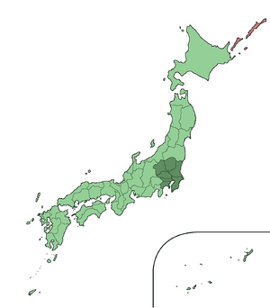
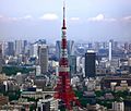
The Kantō region (関東地方, Kantō-chihō) is a very important part of Japan. It's one of Japan's eight main regions. These regions help people understand Japan's geography, history, and culture. They have been used for a long time to describe different parts of the country. The Kantō region is special because it includes Tokyo, the capital city of Japan.
Contents
History of the Kantō Region
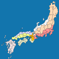
In ancient times, around the late 600s, Japan was divided into big administrative areas. One of these was called Tōkaidō. This system was known as Gokishichidō. The Kantō region today covers a similar area in the east-central part of Honshū, which is Japan's largest island.
Later, during the Meiji period (1868-1912), Japan created a modern system of regions. The country was divided into these regions, including Kantō. Each region had a special council. This council was led by the governor of the most powerful prefecture in that region. It also included important officials from the central government.
Over time, the Kantō region developed its own unique ways of speaking, traditions, and culture.
Important Dates for Kantō
- 1923 (Taishō 12): A very strong earthquake, known as the Great Kantō earthquake, hit the region. Its center was near Tokyo and Yokohama.
Geography of Kantō
The Kantō region is home to the Greater Tokyo Area, which is one of the biggest cities in the world. The Kantō region includes seven prefectures:
Subdivisions of Kantō
Sometimes, people divide the Kantō region into smaller parts to make it easier to talk about.
North and South Kantō
- "North Kantō" (北関東, Kita Kantō) includes Ibaraki, Tochigi, and Gunma.
- "South Kantō" (南関東, Minami-Kantō) includes Saitama, Chiba, Tokyo, and Kanagawa. South Kantō is often used to mean the Greater Tokyo Area.
East and West Kantō
- East Kantō (東関東, Higashi-Kantō): This part includes Ibaraki, Tochigi, and Chiba.
- West Kantō (西関東, Nishi-Kantō): This part includes Gunma, Saitama, Tokyo, and Kanagawa. Sometimes, Yamanashi Prefecture is also included here.
Inland and Coastal Kantō
- Inland Kantō (関東内陸部, Kantō nairiku-bu): This area is away from the coast and includes Tochigi, Gunma, and Saitama. Yamanashi might also be included.
- Coastal Kantō (関東沿岸部, Kantō engan-bu): This area is along the coast and includes Ibaraki, Chiba, Tokyo, and Kanagawa.
Greater Kantō Area
The Japanese government has a special name for the National Capital Region (首都圏, Shuto-ken). This area includes the entire Kantō region plus Yamanashi Prefecture.
Japan's national TV and radio broadcaster, NHK, also has its own "Kantō broadcast area." This area, called "Kantō broadcast area" (関東甲信越, Kantō-kō-shin-etsu), includes Yamanashi, Nagano, and Niigata prefectures for its regional TV shows.
Related pages
Images for kids
See also
 In Spanish: Región de Kantō para niños


