Khorasan province facts for kids
Quick facts for kids
Khorasan Province
استان خراسان
Khurasan
Khorassan |
|
|---|---|

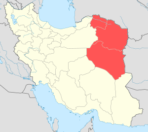
Location of Khorasan within Iran (pre-2004)
|
|
| Country | Iran |
| Dissolved | September 2004 |
| Area | |
| • Total | 299,231 km2 (115,534 sq mi) |
| Time zone | UTC+03:30 (IRST) |
| • Summer (DST) | UTC+04:30 (IRST) |
| Main language(s) | Persian |

Khorasan (pronounced: kho-ra-SAHN) was a very large province in northeastern Iran. Its name comes from Persian words that mean "where the sun arrives from" or "land of the rising sun." This name was first used for an eastern part of Persia during the Sasanian Empire.
Historically, Khorasan was much bigger than the province in Iran. It included parts of what are now Iran, Afghanistan, Tajikistan, Turkmenistan, and Uzbekistan. Most people in the Iranian province of Khorasan are Shia Muslims. The borders of the Iranian province were set in the late 1800s. In 2004, this large province was divided into three smaller ones.
History of Khorasan
The name Khorasan means "land of the rising sun." It was first used for the eastern part of Persia during the Sasanian Empire. The old Iranian province of Khorasan was about half of a much larger historical area called Greater Khorasan.
Greater Khorasan included many important historical cities. Some of these cities are Nishapur and Tus (in modern Iran). Others include Merv (in Turkmenistan), Samarkand and Bukhara (in Uzbekistan), and Herat (in Afghanistan).
The term Khorasan was also used later, especially after the Mongol invasions. This helped to tell it apart from a nearby region called Transoxiana. The modern borders of the Iranian province of Khorasan were officially set in the late 1800s.
This region has experienced several strong earthquakes. In 1968 and 1978, two major earthquakes caused many deaths. Another big earthquake happened in 1997, leading to more deaths and injuries. Many people also lost their homes.
Modern Divisions
Khorasan was the largest province in Iran for a long time. But in September 2004, it was divided into three separate provinces. This made it easier to manage such a big area.
The three new provinces are:
- North Khorasan: Its main city is Bojnourd. Other important areas include Shirvan and Esfarayen.
- South Khorasan: Its main city is Birjand. Other areas include Ferdows and Qaen.
- Razavi Khorasan: Its main city is Mashhad. This is the largest of the three. Other big cities are Sabzevar and Neyshabour.
Some parts of the original Khorasan province were also added to other nearby provinces. For example, some southern parts went to Sistan and Baluchestan Province. Some western parts were added to Yazd Province.
People of Khorasan
The main group of people in the Khorasan region are Persians. There are also smaller groups like Kurds, Khorasani Turks, and Turkmen. Other smaller groups include Baluch people and Gypsy communities.
Most people in the region speak different forms of the Persian language. There is also a notable group of Sunni Muslims living in the area. The biggest areas where people live and farm are around the city of Mashhad. This area includes towns like Quchan, Shirvan, and Bojnourd.
See also
 In Spanish: Jorasán para niños
- Provinces of Iran
- Transoxiana
- Khwarezm
- Afsharid dynasty
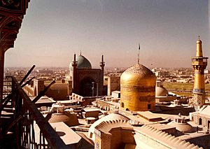
- Delhi Multan Road to Mashhad capital of Khorasan province of Iran, providing access to capital city Ashgabat of Turkmenistan.
 | Victor J. Glover |
 | Yvonne Cagle |
 | Jeanette Epps |
 | Bernard A. Harris Jr. |

