Laguna Canyon facts for kids
Quick facts for kids Laguna Canyon |
|
|---|---|
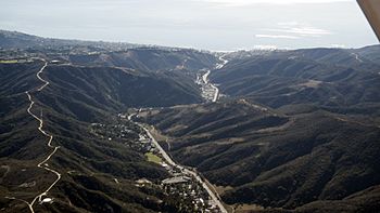
Laguna Canyon
|
|
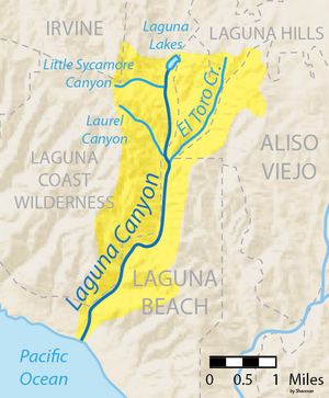
Map of Laguna Canyon drainage area
|
|
| Other name(s) | Cañada de Las Lagunas |
| Country | United States |
| State | California |
| Region | Orange County |
| Physical characteristics | |
| Main source | San Joaquin Hills 380 ft (120 m) 33°37′22″N 117°45′20″W / 33.62278°N 117.75556°W |
| River mouth | Laguna Beach 0 ft (0 m) 33°32′32″N 117°47′05″W / 33.54222°N 117.78472°W |
| Length | 7 mi (11 km) |
| Basin features | |
| Basin size | 10.5 sq mi (27 km2) |
| Tributaries |
|
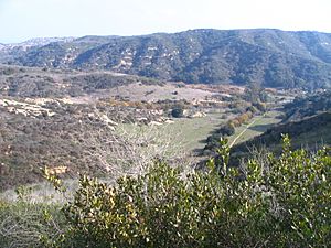
Laguna Canyon (also known as Cañada de las Lagunas) is a long valley that cuts through the San Joaquin Hills in southern Orange County, California. Its Spanish name means "Lake Canyon." The canyon is located just south of the city of Irvine.
The canyon runs from the northeast to the southwest. Water from the north side flows into San Diego Creek. Water from the south side flows into Laguna Canyon Creek. The canyon gets deeper and more rugged near Laguna Beach.
Scientists believe the canyon formed millions of years ago. It was likely created when San Diego Creek cut through the rising San Joaquin Hills. Later, the creek changed its path. This left Laguna Canyon as a "wind gap," which is a valley that used to have a river but no longer does.
California State Route 133 runs through the entire canyon. It connects Laguna Beach and Irvine. Another road, California State Route 73, crosses the canyon. Most of the canyon is part of the Laguna Coast Wilderness Park. Smaller parts are in Aliso and Wood Canyons Wilderness Park and nearby cities.
Contents
Exploring Laguna Canyon's Geography
Laguna Canyon is about 8 miles (13 km) long. At its widest points, it is about 1 mile (1.6 km) wide. The city of Irvine is to the northeast. Lake Forest and Aliso Viejo are to the east. The undeveloped San Joaquin Hills are to the west. Laguna Beach is to the south.
A natural boundary separates Laguna Canyon Creek from the San Diego Creek area. This boundary is near the canyon's northern end.
Roads and Natural Features
State Route 133, also called Laguna Canyon Road, goes through the entire canyon. California State Route 73 crosses the canyon from east to west. The lower part of the canyon is in the Laguna Coast Wilderness. The upper part has smaller wilderness areas.
The upper canyon is home to the Laguna Lakes. These are small natural lakes. They formed when groundwater came up along a fault line. The canyon is named after these lakes. A part of the lower canyon in Laguna Beach is very developed. The northernmost part of the canyon is near a neighborhood next to Interstate 405.
How the Canyon Formed
The canyon probably formed when San Diego Creek cut through the San Joaquin Hills. This happened over about 1.22 million years. At some point, the creek changed its path. The valley it had made was then separated by the mountains. It became its own watershed, meaning it collected its own water.
The land separating Laguna Canyon from the San Diego Creek area is very flat. This is why the canyon is now used as a route for roads.
The Journey of Laguna Canyon Creek
Laguna Canyon Creek starts as a seasonal creek. It drains a mountainside into the canyon. For a short part, it flows underground beneath Laguna Canyon Road. But most of its upper part flows in a natural channel.
It soon passes the Laguna Lakes. Then, Little Sycamore Canyon joins it from the right. This creek drains a narrow side canyon. The main creek continues south. It goes under Laguna Canyon Road again. Then, Camarillo Canyon, a short and steep creek, joins it from the right.
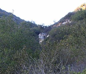
The creek then flows south under the two California State Route 73 bridges. It enters an underground pipe beneath a road ramp. While underground, Laurel Canyon (which has a 100-foot (30 m) waterfall) and the larger Willow Canyon join it. About 0.5 miles (0.80 km) later, the creek comes out from underground. It flows in a channel lined with rocks for the next few miles.
Its main branch, El Toro Creek, joins it from the left. El Toro Creek follows El Toro Road for much of its path. It drains parts of Laguna Hills and Aliso Viejo. Then it flows into Laguna Canyon Creek.
The creek turns sharply west and then back south. Soon after, it goes into a concrete box underground. This carries it through downtown Laguna Beach. This part is also called Broadway Creek. It then goes completely underground. Its channel winds to an exit at Main Beach, a popular beach in Laguna Beach.
Changes to the Canyon and Creek
Laguna Canyon and its smaller creeks have been changed to help control floods. These changes include special basins at the start of most major creeks. These are called "retention basins." They are round dips built to slow down sudden floods.
There are also parts of the creek that are lined with concrete or rocks. These improvements help protect roads and buildings from storms and landslides.
Not much building has happened in the main canyon. However, the El Toro Creek area has many homes. There are also some homes and businesses downstream of State Route 73. The concrete channel in this area is small. It is not big enough for major floods. This caused it to overflow in the late 1990s and again in 2010.
Wildlife and Plants of Laguna Canyon
Animals in the Canyon
Laguna Canyon is home to many animals native to Southern California. These include large mammals like mountain lions, bobcats, coyotes, and mule deer. Like the nearby Aliso and Wood Canyons Regional Park, the canyon has over one hundred types of birds.
Some rare animals found here include the California gnatcatcher, cactus wren, and orange-throated whiptail. Except for the Laguna Lakes, the canyon does not have fish habitats. There are not many areas along the creek where plants grow because the local creeks only flow during certain seasons.
Plants in the Canyon
The main type of plant cover is called coastal sage scrub. This plant life usually goes through cycles of about 25 years. It reaches its best growth about 10 years after a new cycle begins. These cycles often start after wildfires. Fires clear away old plants, leaving space for new growth.
The canyon is one of the last safe places for many plants native to Southern California. About one hundred types of plants are found in Laurel and Willow Canyons alone. Most of these are native to California. They include monkey flower, goldenrod, and sagebrush.
Fun and Recreation in the Canyon
Laguna Canyon is the middle part of a large wilderness area. This area is about 17,500-acre (71 km2) and runs along the Pacific coast. Most of the canyon is covered by Laguna Coast Wilderness Park, which is 7,000 acres (28 km2).
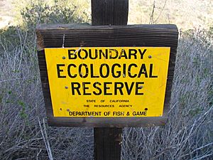
To the south, it borders Aliso and Wood Canyons Regional Park. To the north, it borders Crystal Cove State Park. These parks are managed by Orange County and the California Department of Fish and Game. Parts of Laguna Coast are also owned by the City of Laguna Beach.
There isn't a trail that follows the main canyon, because State Route 133 runs through it. However, there are many hiking trails that go up the narrow side canyons. There is also a trail that goes around the Laguna Lakes. Several trails connect to Aliso and Wood Canyons. This allows people to move between the two park areas.
A Look Back: Laguna Canyon's History
Laguna Canyon is north of Aliso Canyon. This area was once part of the land of the Tongva, a Native American group. Their land stretched from north-central Orange County into the Los Angeles Basin. Aliso Creek, which is next to Laguna Canyon, was the boundary between the Tongva and Acjachemen tribes.
Laguna Canyon Creek was a seasonal stream. But the Laguna Lakes, fed by springs from a small fault, had water all year. Native Americans used a path through the canyon to reach the Laguna Beach area. There, they fished and collected shellfish like abalone and limpets. The Tongva lived in villages of 50-100 people. Their huts were made of brushes and reeds on a wooden frame.
When Spanish explorers arrived in the mid-18th century, they named the canyon "Cañada de las Lagunas." This referred to the Laguna Lakes. A large land grant called La Bolsa de San Joaquín covered the canyon area until the 19th century. By 1905, Laguna Beach started getting its drinking water from springs in Laguna Canyon.
Before Laguna Canyon became a wilderness park, there was a plan to build a housing development there. It was called "Laguna Laurel." This plan included 3,200 homes and businesses on 2,150-acre (8.7 km2) of land. But the plan was stopped in the 1990s. The City of Laguna Beach bought four parts of the land for a wilderness park. The City of Irvine bought one part. Laguna Coast Wilderness Park opened in 1993. Sometimes, more land is added to the park system through donations.
Many people supported stopping the development. On November 11, 1989, eight to eleven thousand people gathered in downtown Laguna Beach. They marched to a large photo mural called "The Tell" in the Sycamore Hills area of Laguna Canyon. This protest was known as the "Walk to Save Laguna Canyon." Several years later, two to three thousand people protested the building of California State Route 73 across the canyon. However, the highway was built anyway.
In 1993, a huge wildfire burned over 16,000 acres (65 km2) in Laguna Canyon and Laguna Beach. It was one of the worst fires in Orange County history. Strong Santa Ana winds helped the fire spread. The flames rose up to 200 feet (61 m) high.
What's Next for Laguna Canyon?
Laguna Canyon is one of the last wild areas in Orange County. It is part of a strip of preserves along the San Joaquin Hills. This strip is about 20 miles (32 km) long and 8 miles (13 km) wide.
Recently, State Route 133 between the 405 and 73 freeways was made wider. It now has four lanes instead of two. Much of the old road in the middle of the canyon was removed and new plants were added. The new road was built farther from the creek. This helps protect the environment.
The very northern part of the canyon is being developed into a neighborhood. It will have 590 homes and is called Laguna Crossing. The first part of this project opened in 2013.
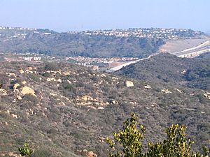
Other parts of Laguna Canyon have also been affected by building. The last 3 miles (4.8 km) of the canyon, closest to downtown Laguna Beach, is now urbanized. It includes the Laguna College of Art and Design, the Sawdust Art Festival venues, and other places. Most of the remaining wild areas are now in the side canyons.
Water runoff from cities has caused bacteria pollution at Main Beach in Laguna Beach. Several groups are now working to protect the remaining wild areas of the canyon. One of these is the Laguna Canyon Foundation.
 | Georgia Louise Harris Brown |
 | Julian Abele |
 | Norma Merrick Sklarek |
 | William Sidney Pittman |


