Lansing, Illinois facts for kids
Quick facts for kids
Lansing, Illinois
|
|||
|---|---|---|---|

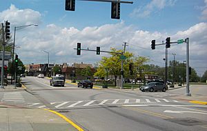
Ridge Road in downtown Lansing
|
|||
|
|||
| Motto(s):
"A community of pride, progress, and possibilities"
|
|||

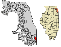
Location of Lansing in Cook County, Illinois.
|
|||
| Country | United States | ||
| State | Illinois | ||
| County | Cook | ||
| Townships | Thornton, Bloom | ||
| Incorporated | 1893 | ||
| Government | |||
| • Type | Mayor-Trustee | ||
| • Body | Board of Trustees | ||
| Area | |||
| • Total | 7.52 sq mi (19.48 km2) | ||
| • Land | 7.46 sq mi (19.33 km2) | ||
| • Water | 0.06 sq mi (0.15 km2) 0.88% | ||
| Population
(2020)
|
|||
| • Total | 29,076 | ||
| • Density | 3,896.54/sq mi (1,504.42/km2) | ||
| Standard of living (2009-11) | |||
| • Per capita income | $24,329 | ||
| • Median home value | $148,500 | ||
| ZIP code(s) |
60438
|
||
| Area code(s) | 708 | ||
| Geocode | 42028 | ||
| FIPS code | 17-42028 | ||
Lansing is a village located in Cook County, Illinois, United States. It is a south suburb of the big city of Chicago. In 2020, about 29,076 people lived there.
Contents
History of Lansing
The first family to settle in the Lansing area was August Hildebrandt's family in 1843. Later, in 1846, Henry, George, and John Lansing also settled here. The village officially became a town (was incorporated) in 1893.
At first, many people who moved to Lansing were immigrants from the Netherlands and Germany. As industries grew in the nearby Calumet region, more immigrants came in the 1900s. These new residents were often from Ireland and Eastern Europe.
Over time, the population of Lansing has become very diverse. By the early 2000s, many residents were of African American, Latino, and Southeast Asian backgrounds.
Geography of Lansing
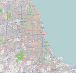
Lansing is located about 6.9 miles (11.1 km) south of Chicago's city limits. It is also about 25.6 miles (41.2 km) from the center of Chicago, known as the Chicago Loop.
The village covers a total area of about 7.52 square miles (19.48 km²). Most of this area is land, with only a small part being water. Lansing is built on the Calumet Shoreline, which is an old shoreline from Lake Michigan.
Neighboring Areas
Lansing shares its borders with several other towns:
- To the northwest: South Holland
- To the north: Calumet City
- To the northeast: Hammond
- To the east and southeast: Munster
- To the south: Lynwood
- To the southwest: Glenwood
- To the west: Thornton
Population and People
| Historical population | |||
|---|---|---|---|
| Census | Pop. | %± | |
| 1900 | 830 | — | |
| 1910 | 1,060 | 27.7% | |
| 1920 | 1,409 | 32.9% | |
| 1930 | 3,378 | 139.7% | |
| 1940 | 4,462 | 32.1% | |
| 1950 | 8,682 | 94.6% | |
| 1960 | 17,475 | 101.3% | |
| 1970 | 22,916 | 31.1% | |
| 1980 | 28,958 | 26.4% | |
| 1990 | 28,131 | −2.9% | |
| 2000 | 28,332 | 0.7% | |
| 2010 | 28,331 | 0.0% | |
| 2020 | 29,076 | 2.6% | |
| U.S. Decennial Census 2010 2020 |
|||
According to the 2020 census, Lansing had a population of 29,076 people. There were 10,741 households and 6,818 families living in the village.
The population of Lansing is very diverse. In 2020, about 46.62% of residents were African American, and 32.17% were White. About 20.61% of the population identified as Hispanic or Latino (who can be of any race).
Many households (31.7%) had children under 18 living with them. The average household had about 3.23 people. The median age in the village was 40.2 years old.
The median income for a household in Lansing was $57,659. For families, the median income was $70,775.
Education
Lansing has several schools for students of all ages.
Colleges
- Visible Music College Chicago Branch
Public High Schools
- Thornton Fractional South
Private High Schools
Public Primary and Middle Schools
- Memorial Junior High School
- Nathan Hale Elementary School
- Heritage Middle School
- Oak Glen Elementary School
- Reavis Elementary School
- Coolidge Elementary School
Private Primary and Middle Schools
- Lansing Christian School
- Eagle Academy
Transportation and Infrastructure
Lansing has good transportation options. The Pace bus service helps people travel around Lansing and the wider Southland area.
The village is also served by the Grand Trunk Western Main Line, which is a railway line connecting Chicago to Port Huron.
Notable People from Lansing
Many interesting people have connections to Lansing:
- Bill W. Balthis (1936–2016), a former Illinois state representative and mayor of Lansing.
- Tom Gorzelanny, a baseball pitcher who played for the Milwaukee Brewers, spent part of his childhood here.
- Curtis Granderson, an outfielder for the New York Mets, graduated from Thornton Fractional South High School.
- Nnamdi Ogbonnaya, a Musician.
- Harry Smith, a well-known journalist and former co-anchor for CBS' The Early Show.
- Pierre Thomas, a running back for the New Orleans Saints, also graduated from Thornton Fractional South High School.
- Jack E. Walker, an Illinois politician who practiced law in Lansing.
See also
 In Spanish: Lansing (Illinois) para niños
 | William L. Dawson |
 | W. E. B. Du Bois |
 | Harry Belafonte |


