Lincoln County, Arkansas facts for kids
Quick facts for kids
Lincoln County
|
|
|---|---|
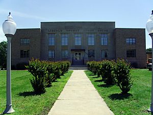
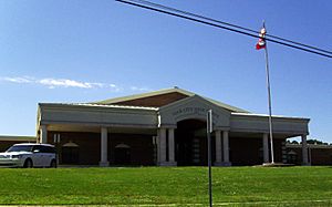
Lincoln County Courthouse in Star City
|
|
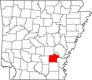
Location within the U.S. state of Arkansas
|
|
 Arkansas's location within the U.S. |
|
| Country | |
| State | |
| Founded | March 28, 1871 |
| Named for | Abraham Lincoln |
| Seat | Star City |
| Largest city | Star City |
| Area | |
| • Total | 572.17 sq mi (1,481.9 km2) |
| • Land | 561.20 sq mi (1,453.5 km2) |
| • Water | 10.97 sq mi (28.4 km2) 1.9%% |
| Population
(2020)
|
|
| • Total | 12,941 |
| • Estimate
(2023)
|
12,898 |
| • Density | 22.6174/sq mi (8.7326/km2) |
| Time zone | UTC−6 (Central) |
| • Summer (DST) | UTC−5 (CDT) |
| Congressional district | 1st |
Lincoln County is a county in the U.S. state of Arkansas. It is located between the Arkansas Timberlands and Arkansas Delta regions. The county is named after President Abraham Lincoln. It was created on March 28, 1871, as Arkansas's 65th county.
Lincoln County has three main cities. Star City is the county seat and the largest city. The county also has many smaller unincorporated communities and ghost towns. You can find Cane Creek State Park here, where Cane Creek meets Bayou Bartholomew. There are also nine places listed on the National Register of Historic Places. These sites help preserve the county's history and culture.
Lincoln County covers about 572 square miles (1,482 square kilometers). In 2020, its population was 12,941 people. The economy in this rural area mainly relies on farming. The state has also built two prisons here, which provide jobs for local residents.
Two school districts serve Lincoln County: Star City School District and Dumas Public Schools. For higher education and healthcare, people can go to Pine Bluff in the north or Monticello in the south. While there are no major Interstate highways, the county has access to two U.S. highways (U.S. Route 65 and U.S. 425) and eight Arkansas state highways. The Star City Municipal Airport also serves the county. Six community water systems provide clean drinking water.
Contents
History of Lincoln County
The county was formed in 1871 during the Reconstruction era. The Arkansas General Assembly created it from parts of other counties. It was named after President Abraham Lincoln. Many formerly enslaved people, known as freedmen, supported the Republican Party. This was because the party helped them gain freedom after the Civil War.
The county government was first set up permanently in Star City. For a time, from 1885 to 1912, Varner also served as a county seat.
Exploring Lincoln County's Geography
Lincoln County's landscape is shaped by two main regions of Arkansas. These are the Arkansas Timberlands and the Arkansas Delta. These two areas are separated by Bayou Bartholomew, which is the longest bayou in the world. This bayou roughly divides the county into eastern and western halves.
The eastern part of the county is in the Arkansas Delta. This area is a flat plain with rich, fertile soil. This soil comes from sediment left by the Mississippi River. The western half is part of the Arkansas Timberlands. This region has flat pine and cypress forests. Here, people focus on growing trees for wood, not just crops. Lincoln County is the eighth-smallest county in Arkansas.
The county is about 68 miles (109 km) southeast of Little Rock. It is surrounded by other counties. To the east are Arkansas County and Desha County. To the west is Cleveland County. Jefferson County is to the north, and Drew County is to the south.
Parks and Natural Areas
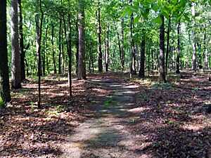
Lincoln County has two protected natural areas. Cane Creek State Park covers 2,053 acres (831 ha). It sits where the West Gulf Coastal Plain meets the Arkansas Delta. The park has a 1,675-acre (678 ha) lake at its center. Visitors can enjoy fishing, canoeing, and kayaking on the lake. On land, there are pavilions, trails, and a visitor center. The park also offers 29 camping sites for RVs and tents. The Arkansas Department of Parks and Tourism manages this park.
Huff's Island Public Use Area is located on the Arkansas River in the northeastern part of the county. The United States Army Corps of Engineers manages it. This park is for day use only. It offers access to the river bank from March to September and has four picnic sites.
People of Lincoln County
As of the 2020 United States census, 12,941 people lived in Lincoln County. There were 3,773 households and 2,711 families. The county is home to a diverse population.
Economy and Jobs
The main jobs in Lincoln County come from farming. The Arkansas Department of Correction also operates two prisons here. These are the Cummins Unit and the Varner Unit. They are important employers for the county.
Community Resources
Education and Learning
Lincoln County's education levels are similar to other rural areas in Arkansas. Many residents have a high school degree.
Schools for Kids
One public school district is based in Lincoln County: the Star City School District. It serves the western two-thirds of the county. The rest of the county is served by the Dumas Public School District. Students from these districts graduate from Star City High School or Dumas New Tech High School. Both high schools offer advanced courses and are approved by the Arkansas Department of Education.
In 2004, the school districts at Gould and Grady joined the Dumas and Star City districts.
Colleges and Universities
Lincoln County does not have its own colleges. However, there are three nearby options. These include the University of Arkansas at Monticello to the south. Also, Southeast Arkansas College (SEARK) and the University of Arkansas at Pine Bluff are in Pine Bluff to the north. All are public four-year colleges.
Local Library
The Star City Branch Library is in downtown Star City. It is part of the Southeast Arkansas Regional Library system. The library offers books, e-books, movies, and services for youth and businesses.
Staying Healthy
The Jefferson Regional Medical Center in Pine Bluff is a local hospital. It provides emergency care, heart care, and surgery. For more specialized care, larger hospitals like Baptist Health Medical Center and CHI St. Vincent Infirmary are in Little Rock.
Keeping Safe
The Lincoln County Sheriff's Office is in charge of law enforcement. The Sheriff is elected by the people every four years.
The county has its own court system, the Lincoln County District Court. This court handles criminal, civil, and traffic cases. There are also state prisons in the county. The Arkansas Department of Correction runs the Varner Unit and the Cummins Unit near Varner.
How Lincoln County is Governed
The county government follows the rules set by the Constitution of Arkansas. The quorum court is the law-making part of the county government. It decides on spending and collecting money. Members are called justices of the peace and are elected every two years. Lincoln County's Quorum Court has nine members.
The county judge leads the quorum court meetings. This person is like the chief manager of the county. The county judge is elected by all voters and can veto decisions made by the quorum court.
| Position | Officeholder | Party |
|---|---|---|
| County Judge | Buddy Lynn Earnest | Republican |
| County Clerk | Stephanie James | Republican |
| Circuit Clerk | Cindy Glover | Independent |
| Sheriff | Steve Young | Republican |
| Treasurer | Lisa McGehee | Independent |
| Collector | Melissa Bumpass | Independent |
| Assessor | Amy Harrison | Independent |
| Coroner | Matthew Padgett | Republican |
After the 2024 elections, the Quorum Court has 4 Republicans, 3 Democrats, and 2 Independents.
Politics and Voting
Lincoln County used to vote mostly for Democrats. However, over time, it has started to vote more for Republicans. This change has been seen in state and local elections.
In the U.S. Congress, Arkansas has two Republican senators. In the House of Representatives, Lincoln County is part of Arkansas's 1st congressional district. This district is represented by Republican Rick Crawford.
In the Arkansas State Senate, Lincoln County is split between two districts. The northern half is in District 25, represented by Democrat Stephanie Flowers. The southern half is in District 26, represented by Democrat Eddie Cheatham.
In the Arkansas House of Representatives, Lincoln County is split among three districts. The western part is in District 10, represented by Republican Mike Holcomb. The eastern part is in District 12, represented by Democrat Chris Richey. A small northern part, including Grady and Varner, is in District 16, represented by Democrat Ken Ferguson.
Communities in Lincoln County
Cities
Lincoln County has many smaller communities that are not officially cities. These are called unincorporated communities or ghost towns. Early settlers often lived in small groups rather than large towns. Some of these places used to have post offices and many buildings. Others are just a few homes at a crossroads.
Unincorporated communities
- Avery
- Branchville
- Cades
- Calhoun
- Cornerville
- Crigler
- Cummins Unit
- Douglas
- Feenyville
- Flynn
- Fresno
- Garnett
- Garrett Bridge
- Glendale
- Gourd
- Little Garnett
- Maroney
- Mills
- Nebo
- Palmyra
- Phenix
- Relfs Bluff
- Rose Hill
- Sarassa
- Shannon Tank
- Tarry
- Tyro
- Varner
- Warrenton
- Whitefield
- Woodville
- Yorktown
Historical communities
- Champion
- Four Groves
- Kimbrough
- Oakdale
- Quawpaw Village
- Rest
- Silt
- South Bend
- Todd
- Villa Vale
- Youngstown
Townships
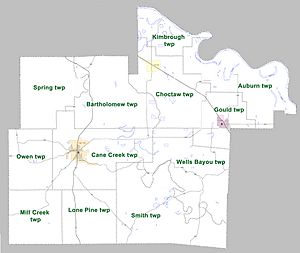
Townships in Arkansas are the divisions of a county. Each township includes unincorporated areas; some may have incorporated cities or towns within part of their boundaries. Arkansas townships have limited purposes in modern times. However, the United States Census does list Arkansas population based on townships (sometimes referred to as "county subdivisions" or "minor civil divisions"). Townships are also of value for historical purposes in terms of genealogical research. Each town or city is within one or more townships in an Arkansas county based on census maps and publications. The townships of Lincoln County are listed below; listed in parentheses are the cities, towns, and/or census-designated places that are fully or partially inside the township.
Transportation and Utilities
Air Travel
Lincoln County has one public airport, the Star City Municipal Airport. It is used for general aviation, meaning smaller planes. The closest airport with commercial flights is Clinton National Airport in Little Rock.
Major Roads
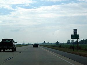
The busiest road in Lincoln County is U.S. Highway 65. It connects travelers to Pine Bluff in the north and to Mississippi and Louisiana in the south. U.S. Highway 425 also crosses the county, going through Star City.
Several state highways also serve the county. These include Highway 11, which runs through Star City and Grady. Highway 54 crosses the county from east to west. Other highways like Highway 114 and Highway 212 are important east-west routes.
Water and Wastewater Services
The Arkansas Department of Health oversees public water systems. Six main water systems are based in Lincoln County. These include Yorktown Water Association, Star City Water, and Gould Municipal Water/Sewer. All these systems get their water from the Sparta Sand Aquifer.
The Arkansas Department of Environmental Quality manages wastewater treatment. Lincoln County has three municipal wastewater systems.
See also
 In Spanish: Condado de Lincoln (Arkansas) para niños
 | Audre Lorde |
 | John Berry Meachum |
 | Ferdinand Lee Barnett |


