Liquiçá Municipality facts for kids
Quick facts for kids
Liquiçá
|
||
|---|---|---|
|
||

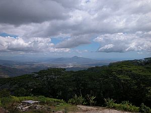
Fazenda Algarve in Liquiçá
|
||
|
||

|
||
|
OpenStreetMap
|
||
| Country | ||
| Capital | Liquiçá | |
| Administrative posts |
|
|
| Area | ||
| • Total | 559.9 km2 (216.2 sq mi) | |
| Area rank | 12th | |
| Population
(2015 census)
|
||
| • Total | 71,927 | |
| • Rank | 8th | |
| • Density | 128.464/km2 (332.72/sq mi) | |
| • Density rank | 3rd | |
| Households (2015 census) | ||
| • Total | 11,885 | |
| • Rank | 10th | |
| Time zone | UTC+09:00 (TLT) | |
| ISO 3166 code | TL-LI | |
| HDI (2017) | 0.636 medium · 2nd |
|
Liquiçá is a special area, or municipality, in the country of East Timor. It used to be called a district. The main town in this area is also named Liquiçá.
Contents
What's in a Name? The Meaning of Liquiçá
The name Liquiçá has a few interesting stories behind it.
The Python Story
One idea is that the name comes from an old local name, Liku Saen. This means 'python' in the Tokodede language, which is spoken by many people in the area. Some think it might also be a mix of words, like Likusaen.
The Moving Story
Another idea comes from the Tokodede words Likis Aá. These words mean 'motion' or 'change'. This story says that when the Portuguese were choosing a place for the town, they asked locals for the name. The locals didn't understand. So, the Portuguese used hand gestures, moving their hands back and forth. The locals then said Likis Aá, meaning 'moving' or 'changing'.
Geography of Liquiçá
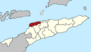
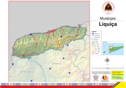
Liquiçá municipality is located on the northern coast of East Timor. It shares borders with other municipalities. To the east is Dili, where the country's capital is. To the southeast is Aileu, to the south is Ermera, and to the southwest is Bobonaro. The Savu Sea is to the northwest.
Size and Population
The municipality covers an area of about 549 square kilometers. In 2010, its population was around 73,027 people. The borders of the municipality are the same as they were when it was a district under Portuguese Timor.
Administrative Areas
Liquiçá is divided into three main administrative posts:
- Bazartete
- Liquiçá
- Maubara
These posts are further divided into 23 smaller areas called sucos, which are like villages.
Natural Beauty
Liquiçá is known for its beautiful views. You can see the amazing Ombai Strait as you drive into the area from Dili. The beaches here are mostly rocky, like many in East Timor, but they are still very pretty. A river flows from the mountains to the sea, but it's usually dry except during the monsoon season. During heavy rains, the main road can sometimes wash out, but local people always work to fix it. It's important to be aware of mosquitoes in the area, as they can carry illnesses like malaria and dengue fever.
History of Liquiçá
Liquiçá has a long and interesting history, shaped by different periods of control and important events.
Early Colonial Times
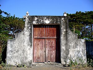
During the time when Portugal controlled eastern Timor, the kingdom of Maubara (which is now part of Liquiçá) was taken by the Netherlands in 1667. The areas around it remained under Portuguese rule. The old Dutch fort in Maubara, near the beach, is still well-preserved. It even has the original cannon that once guarded the bay. Later, in 1859, Portugal and the Netherlands made a deal. Portugal traded Maubara for Flores Island in 1861, which the Portuguese had been occupying.
Indonesian Occupation and Aftermath
During the time of Indonesian control, many buildings were constructed in Liquiçá. However, after a vote in 1999 for East Timor's independence, and during a difficult period of conflict, most of these buildings were destroyed. There was a very sad event in April 1999 at a church in Liquiçá, where many East Timorese people lost their lives. The group known as Besi Merah Putih was first formed in Maubara.
Return of Peacekeepers
From September to November 1999, life slowly began to return to normal in Liquiçá. UN Peace Keeping Forces from Portugal set up a base in Maubara. The International Police also set up their main office in downtown Liquiçá. These police officers came from many countries, including Sweden, Canada, Great Britain, Ghana, Malaysia, and the United States. The International Police even used the same church compound where the sad event of 1999 had happened. The peacekeeper military support for Liquiçá came from Portuguese Marines. Liquiçá also served as a main base for the UN team that investigated crime scenes.
Languages Spoken in Liquiçá
Besides the official languages of East Timor, which are Tetum and Portuguese, most people in Liquiçá also speak a language called Tocodede. This is a Malayo-Polynesian language.
Fun Things to See and Do in Liquiçá
Liquiçá has lovely beaches that are great for visitors, even though they don't have white sand. The area also has coffee plantations and some natural minerals like gold. Along the coast, there are several wonderful spots for diving.
Buildings and Infrastructure
During the Portuguese colonial period, there were not many buildings apart from the traditional huts used by local East Timorese people. Most of the buildings you see today were built during the Indonesian occupation. However, many of them were damaged or destroyed during the conflicts around the 1999 vote for independence. Some of the older Portuguese buildings are still standing. Many of the Indonesian-style buildings were able to be repaired. Their design is a traditional Indonesian style, which is both old-fashioned and interesting.
See also
 In Spanish: Distrito de Liquiçá para niños
 | Leon Lynch |
 | Milton P. Webster |
 | Ferdinand Smith |


