List of California hurricanes facts for kids
Since 1854, 85 tropical cyclones have affected the U.S. state of California. A hurricane in 1858 even brought strong winds near San Diego. However, it's very rare for a tropical storm to actually hit California directly. This is because of cold ocean waters and how most Pacific hurricanes usually move.
Only one tropical storm has ever made landfall in California. This was a storm in 1939 that hit Los Angeles. It sadly caused 45 deaths in the state.
Most of the time, these storms only bring rain to California. Sometimes, this rain is very heavy and causes floods and damage. Since 1850, only six other tropical cyclones have brought strong winds to the Southwestern United States.
For example:
- In 1963, the leftover parts of Tropical Storm Jennifer-Katherine brought strong winds and heavy rain.
- Hurricane Emily in 1965 and Hurricane Joanne in 1972 did too.
- Former Hurricane Kathleen in 1976 killed at least nine people due to heavy rain and severe flooding in Ocotillo.
- Tropical Storm Nora in 1997 entered California. It brought strong winds and heavy rain, leading to three traffic deaths.
- The leftovers of Hurricane Kay in 2022 caused floods and winds up to 100 miles per hour (160 km/h) in southern California. One person died.
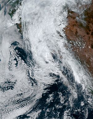
- In August 2023, the leftovers of Hurricane Hilary brought winds of 87 miles per hour (140 km/h) and very heavy rain. Floods from this storm killed one person.
Contents
Why Tropical Cyclones Rarely Hit California
There are two main reasons why tropical cyclones almost never hit California directly with strong winds:
- The ocean water is cold.
- The usual winds in the upper atmosphere steer storms away.
The cold ocean water is the most important reason.
Cold Ocean Water
Tropical cyclones need very warm ocean water to form and stay strong. The water usually needs to be warmer than 26.5 °C (80 °F) down to about 50 meters (160 feet) deep.
However, the waters off California are cold, even in summer. They rarely get above 24 °C (75 °F) near the southern California coast. Along most of the rest of the coast, they stay below 17 °C (63 °F). Sometimes, during El Niño events, the water can get a bit warmer.
This cold water is mainly because of something called "upwelling." Strong winds from the northwest push surface water away from the coast. When this happens, colder water from deep below rises to take its place. This process cools the already cool California Current, which flows south along the California coast. This is also why coastal California often has fog.
In contrast, the ocean temperatures along the East Coast of the U.S. (from New York to Florida) are much warmer. They are often around 26.5 °C (80 °F) or even 29.4 °C (85 °F) in summer and fall. This is why the East Coast sees many more tropical storms and hurricanes.
How Storms Usually Move
The second reason is how tropical cyclones in the eastern Pacific usually move. They generally travel northwest or westward. This path takes them far out into the ocean, away from land.
These two factors make it very unlikely for tropical cyclones to hit California directly. When the winds do allow a storm to move north towards California, the cooler ocean water quickly weakens it. Even if the storm weakens, it can still bring very heavy rain. For example, the record for the most rain in Los Angeles in 24 hours (in September) was set by the 1939 storm.
While rare, tropical cyclones do affect California. They can sometimes cause serious rainfall and flooding. Experts believe that if a storm like the 1858 hurricane happened today, it could cause hundreds of millions of dollars in damage. A repeat of the 1939 storm could cause around 200 million dollars in damage. Most of this damage would be from rain, not wind or storm surges. However, distant hurricanes can still create big waves, which can be dangerous for people.
Getting Ready for Storms
When Hurricane Linda was expected to hit California in 1997, weather experts issued warnings. They explained that it was hard to be sure about a storm's path so far in advance.
When Nora was approaching, different weather agencies worked together very well. This teamwork was "smooth and effective." However, no special tropical storm warnings were issued for inland areas of the United States as Nora approached.
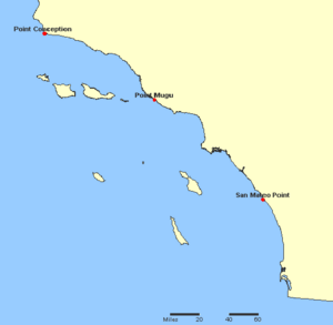
There are specific points along the Pacific Coast where warnings are issued. These are called "breakpoints." For the first time, warnings were issued for these areas when Hurricane Hilary approached in 2023. It's very unlikely that any tropical cyclone will threaten areas further north in California because of the strong influence of the cold California Current.
Notable Tropical Cyclones Affecting California
Most hurricanes that affect California are actually the weakened remains of hurricanes or tropical storms. In the 20th century, only four eastern Pacific tropical cyclones brought tropical storm-force winds to the Continental United States:
- The 1939 Long Beach Tropical Storm
- Tropical Storm Joanne in 1972
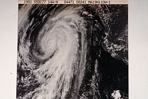
- Tropical Storm Kathleen in 1976
- Tropical Storm Nora in 1997
Early Storms (Before 1930)
- October 1854: A tropical cyclone might have hit Northern California, just north of the Golden Gate.
- October 2, 1858: A hurricane near San Diego caused ships to wash ashore. It brought strong winds to the southern California coast from San Diego to Long Beach. Experts in 2012 said this was the only tropical cyclone known to have brought hurricane-force winds to a small coastal area of southern California.
- August 11–12, 1873: A tropical storm brought rain to San Diego. The rain on August 12 set a record for the wettest August day.
- July 20–21, 1902: The leftovers of a hurricane brought rain to southern California.
- September 11–12, 1918: The leftovers of a tropical cyclone produced six inches (150 mm) of rain in the mountains of southern California.
- September 18, 1929: A tropical cyclone in the Pacific Ocean dropped rain over southern California.
1930s Storms
- September 28–October 1, 1932: The leftovers of a hurricane brought four days of rain. Flash floods killed 15 people.
- September 25, 1939: The 1939 California tropical storm made landfall near Long Beach. Winds were about 50 miles per hour (80 km/h) and rain was almost 12 inches (300 mm). At sea, 48 people died. On land, 45 people died in floods. This is the only tropical storm known to have made landfall in California in the 20th century.
Later Storms (1940s-1960s)
- September 9–10, 1945: The leftovers of a tropical cyclone moved north and brought rain to southern California.
- August 27–29, 1951: The leftovers of a tropical cyclone brought enough rain to wash out some roads in southern California.
- September 17–19, 1963: Tropical Storm Jennifer-Katherine weakened over northern Baja California. It dropped several inches of rain over California.
- September 4–5, 1965: Hurricane Emily's leftovers brought rain to California.
1970s Storms
- October 6, 1972: Hurricane Joanne made landfall in Mexico. It still managed to bring strong winds and rain to Arizona and California.
- September 9–12, 1976: Hurricane Kathleen crossed the Baja California peninsula and moved into California as a tropical storm. Winds of 57 miles per hour (91 km/h) were reported in Yuma, Arizona. Rains from Kathleen caused huge damage to Ocotillo, California and killed three to six people.
- August 18–19, 1977: Hurricane Doreen weakened off the coast of California. Its leftovers moved inland and caused flooding and crop damage.
- October 6–7, 1977: Hurricane Heather's leftovers moved into Arizona. They brought very heavy rain to Arizona and significant rain to southern California. This led to big floods in both states.
1980s Storms
- September 24–26, 1982: The leftovers of Hurricane Olivia produced over 7 inches (177 mm) of rain in California.
- September 22–23, 1987: The leftovers of Hurricane Norma caused thunderstorms over Southern California, which led to some flooding.
1990s Storms
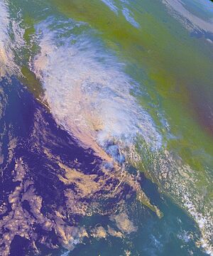
- June 1990: The leftovers of Hurricane Boris caused heavy rain in Southern California. This made it the wettest June in San Diego since records began in 1850.
- July 1992: The leftovers of Hurricane Darby caused clouds in California. These clouds were so thick they delayed the landing of the Space Shuttle Columbia for a day. The shuttle had to land in Florida instead of California.
- August 5, 1997: Big waves from Hurricane Guillermo caused dangerous rip currents near Corona Del Mar. This injured three people and killed one.
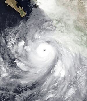
- September 13–14, 1997: Hurricane Linda was once expected to hit Southern California. Instead, it moved out to sea. However, its large waves washed five people off a jetty in Newport Beach. Also, Linda's outer rainbands caused thunderstorms and flash floods in some areas of southern California.
- September 24–26, 1997: After hitting Baja California, Tropical Storm Nora moved into the southwestern United States near the California-Arizona border. Slippery roads led to three traffic deaths in southern California.
2000s Storms
- September 2001: Leftover moisture from Hurricane Flossie caused thunderstorms, lightning, and floods in Southern California. Lightning struck four people, killing two of them.
- July 2006: Leftovers of Tropical Storm Emilia caused unsettled weather across the southwestern United States. Rain from the storm helped put out the Horse Fire in southern California.
- October 11–15, 2009: The leftovers of Typhoon Melor affected California and broke several rainfall records. This storm system also brought a "Pineapple Express" – a stream of moisture from near Hawaii.
2010s Storms
- August 25–26, 2013: Moisture from the leftovers of Tropical Storm Ivo caused some thunderstorms and flooding in southern California.
- August 26–29, 2014: Large waves from Hurricane Marie caused high waves and rip currents.
- September 8, 2014: The leftovers of Hurricane Norbert caused thunderstorms and flooding in Southern California.
- September 16–17, 2014: Hurricane Odile's outer rainbands brought thunderstorms to parts of Southern California. These storms caused high winds and powerful thunderstorms in San Diego County. Winds reportedly uprooted trees, broke branches, cut power lines, crushed cars, and even flipped an airplane.
- June 9–10, 2015: The leftovers of Hurricane Blanca brought showers to Southern California. Some flooding was reported. Many rainfall records were broken.
- July 18–20, 2015: The leftovers of Hurricane Dolores brought scattered showers and thunderstorms throughout Southern California. This broke many rainfall records and caused flooding. One flash flood caused a bridge to collapse, closing Interstate 10. However, the rain also helped firefighters control the North Fire.
- September 8–15, 2015: The leftovers of Hurricane Linda brought heavy rain from Santa Barbara to San Diego. On September 15, Los Angeles received 2.39 inches of rain, making it one of the wettest September days since 1877.
- September 3–4, 2017: Moisture from Tropical Storm Lidia's leftover low brought flash flooding and thunderstorms to Southern California.
- October 1, 2018: Hurricane Rosa brought scattered thunderstorms to parts of Southern California as a tropical storm, causing flash flood warnings.
- October 12, 2018: The leftovers of Hurricane Sergio caused many thunderstorms in Southern California. One thunderstorm caused a power outage in parts of Los Angeles County.
2020s Storms
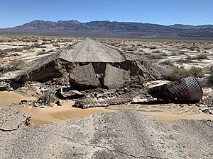
- August 16–17, 2020: Moisture from Tropical Storm Fausto caused huge thunderstorms across parts of Northern California. These thunderstorms mostly produced lightning without much rain. This lightning sparked 367 wildfires across the state. Several of these fires grew very quickly, threatening buildings and forcing people to leave their homes.
- September 9-10, 2022: Tropical Storm Kay became a post-tropical cyclone off the southern California coast. However, its moisture brought heavy rainfall for several days. Mount Laguna recorded 5.85 inches (149 mm) of rain. The rains led to mudslides, killing one woman. Strong winds also caused widespread power outages, affecting over 63,000 people.
- August 20–21, 2023: Former Hurricane Hilary weakened over Baja California. It brought strong winds and very heavy rainfall across Southern California. The highest rainfall was 13.07 inches (332 mm). Flash flooding swept away a mobile home, killing a woman. The floods also washed away roads, damaged houses, and caused mudslides. Winds reached 87 miles per hour (140 km/h) at Magic Mountain.
- September 8, 2023: High waves from Hurricane Jova caused dangerous waves and rip currents. Five people needed to be rescued.
Storm Statistics
Most tropical cyclones that affect California happen in September. September 1939 was very unusual because four tropical cyclones affected the state that month.
| Month | Number of storms |
|---|---|
| January |
0
|
| February |
0
|
| March |
0
|
| April |
0
|
| May |
0
|
| June |
4
|
| July |
7
|
| August |
21
|
| September |
41
|
| October |
12
|
| November |
0
|
| December |
0
|
| Period | Number of storms |
|---|---|
| Pre-1930 |
11
|
| 1930s |
7
|
| 1940s |
3
|
| 1950s |
5
|
| 1960s |
3
|
| 1970s |
7
|
| 1980s |
9
|
| 1990s |
7
|
| 2000s |
11
|
| 2010s |
18
|
| 2020s |
5
|
Deadliest Storms
Here is a list of all known deaths in California caused by tropical cyclones.
| Name | Year | Number of deaths |
|---|---|---|
| Unnamed | 1939 | 45–93 |
| Unnamed | 1932 | 15 |
| Kathleen | 1976 | 11 |
| Nora | 1997 | 3–4 |
| Flossie | 2001 | 2 |
| Guillermo | 1997 | 1 |
| Dolores | 2015 | 1 |
| Kay | 2022 | 1 |
| Hilary | 2023 | 1 |
See also
 In Spanish: Anexo:Huracanes de California para niños
- List of Arizona hurricanes
- List of Baja California Peninsula hurricanes
- List of California tornadoes
 | Dorothy Vaughan |
 | Charles Henry Turner |
 | Hildrus Poindexter |
 | Henry Cecil McBay |


