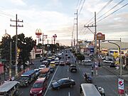
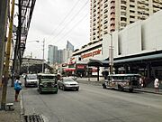
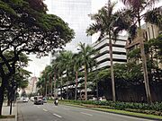
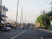
List of roads in Metro Manila facts for kids
Quick facts for kids Metro Manila's major road network |
|
|---|---|
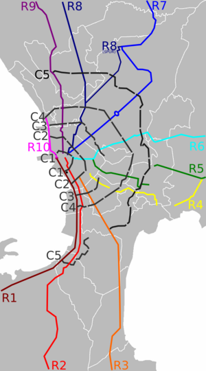
Simplified map of radial (solid and colored lines) and circumferential (dashed and gray lines) roads in Metro Manila
|
|
| System information | |
| Maintained by the Department of Public Works and Highways (DPWH) and the Metropolitan Manila Development Authority (MMDA) | |
| Formed | 1945 |
| Highway names | |
| Radial road | Rx, Rxx |
| Circumferential road | Cx |
| System links | |
Roads in the Philippines
|
|
This article is about the main roads in Metro Manila, Philippines. It explains how these roads are named and organized.
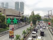
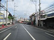
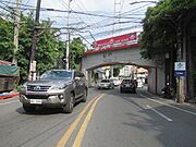
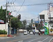
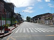
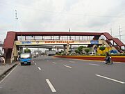
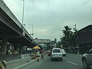
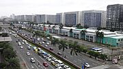
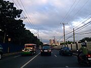
Metro Manila has a big network of roads. These include six ring roads (called circumferential roads) and ten main roads (called radial roads). They connect many cities like Caloocan, Las Piñas, Makati, Manila, Quezon City, and more. These roads help people travel across the entire metro area.
Contents
How are Roads Classified?
The Department of Public Works and Highways (DPWH) gives different names to roads based on their importance.
- National Primary Roads are like the main highways. They connect big cities and form the backbone of the national road system.
- National Secondary Roads connect important places like major ports, airports, and tourist spots to the primary roads.
- National Tertiary Roads are other roads managed by the DPWH that serve local areas.
Some roads are also called Expressways. These are special highways where traffic moves very fast. They usually have interchanges (special ramps for getting on and off) and sometimes you pay a toll to use them.
Understanding Numbered Routes
In 1945, a special plan was made for Metro Manila's roads. It suggested building 10 radial roads and completing six circumferential roads. This plan created a web-like system to help traffic flow in and out of Manila.
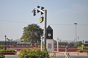
What are Radial and Circumferential Roads?
Radial roads are like spokes on a wheel. They start from the center (Manila) and go outwards to different provinces. They are numbered R-1 to R-10. R-1 is in the south, and the numbers go up as you move counter-clockwise around Manila.
Circumferential roads are like rings around the center. They act as beltways, helping traffic go around the city instead of through it. They are numbered C-1 to C-6. C-1 is the innermost ring, and C-6 is the outermost.
Radial Roads: Connecting Manila to Provinces
There are ten radial roads that help traffic move in and out of Manila. They all start near Kilometer Zero in Rizal Park.
| Name | Image | Route | Major cities | Component highways | Length | Ref. |
|---|---|---|---|---|---|---|
| R-1 Radial Road 1 |
  |
Manila–Cavite |
|
42.67 km (26.51 mi) | ||
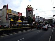
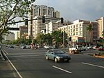
| Radial Road 1 connects Manila to Cavite. It starts at Bonifacio Drive and becomes Roxas Boulevard. After crossing NAIA Road, it turns into the Manila–Cavite Expressway. This road follows the coastline of Manila Bay. | ||||||
| R-2 Radial Road 2 |
  |
Manila–Cavite |
List (8)
Bacoor
Dasmariñas Imus Las Piñas Manila Parañaque Pasay Tagaytay |
|
56.51 km (35.11 mi) | |
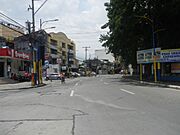
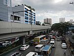
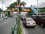
| This road runs next to Radial Road 1. It links Manila to Cavite and Batangas. It starts as Taft Avenue in Ermita, then becomes Elpidio Quirino Avenue in Pasay. In Las Piñas, it's Diego Cera Avenue, and then the Aguinaldo Highway in Cavite. | ||||||
| R-3 Radial Road 3 |
  |
Manila–Batangas |
|
96.32 km (59.85 mi) | ||
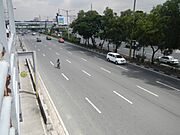
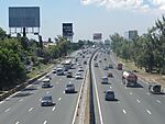
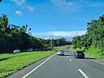
| This is mostly an expressway. It starts near Quirino Avenue in Paco, Manila. It passes through Laguna and Cavite. It then becomes the Southern Tagalog Arterial Road (STAR Tollway) in Santo Tomas, Batangas, leading to Batangas City. | ||||||
| R-4 Radial Road 4 |
  |
Manila–Muntinlupa |
List (5)
|
|
26.2 km (16.3 mi) | |
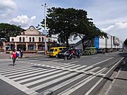
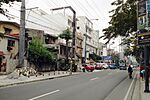
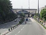
| This road begins at Pedro Gil Street in Paco, Manila. It goes through Makati and Pasig, then turns south. It reaches Pateros and ends in Alabang, Muntinlupa. | ||||||
| R-5 Radial Road 5 |
  |
Manila–Laguna |
List (3)
|
|
97.9 km (60.8 mi) | |
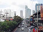
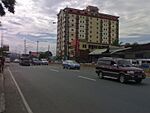
| Radial Road 5 starts in Sta. Mesa as V. Mapa Street. It continues as P. Sanchez Street, then Shaw Boulevard, and Pasig Boulevard. After C-5 Road, it becomes Ortigas Avenue. It then turns into Taytay Diversion Road and finally the Manila East Road, which goes through Rizal and ends in Pagsanjan, Laguna. | ||||||
| R-6 Radial Road 6 |
  |
Manila–Quezon |
List (5)
|
|
121.6 km (75.6 mi) | |
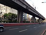
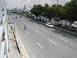
| This road starts at the junction of Mendiola Street, Recto Avenue, and Legarda Street. It's an important road in Santa Mesa, Manila. It enters Quezon City and becomes Aurora Boulevard. After crossing Katipunan Avenue, it turns into Marikina–Infanta Highway (Marcos Highway). This highway goes through Marikina and Pasig, then into Rizal, ending in Infanta, Quezon. | ||||||
| R-7 Radial Road 7 |
  |
Manila–Bulacan |
List (4)
|
|
53.6 km (33.3 mi) | |
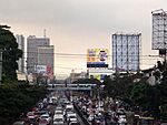
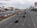
| Radial Road 7 starts in Sampaloc, Manila, and goes straight to Quezon City. After the Quezon City Memorial Circle, it becomes Commonwealth Avenue, which is one of the widest roads in the Philippines. It then follows Regalado Highway and ends near Quirino Highway. | ||||||
| R-8 Radial Road 8 |
  |
Manila–La Union |
List (10)
Angeles City
Caloocan Mabalacat Malolos Manila Meycauayan San Fernando Tarlac City Urdaneta Valenzuela |
Spur:
|
210.0 km (130.5 mi) | |
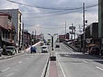
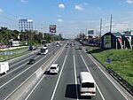
| Radial Road 8 starts at Quezon Bridge in Quiapo, Manila. It goes north and becomes the North Luzon Expressway after crossing EDSA. It then connects to SCTEX and TPLEX, ending in Rosario, La Union. | ||||||
| R-9 Radial Road 9 |
  |
Manila–La Union |
List (11)
Angeles
Caloocan Mabalacat Malabon Malolos Manila Meycauayan San Fernando Tarlac City Urdaneta Valenzuela |
|
228.0 km (141.7 mi) | |
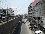
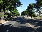
| This road is part of the Pan-Philippine Highway. It starts as Rizal Bridge from Padre Burgos Avenue. It runs north, parallel to R-8. After the Monumento Roundabout in Caloocan, it becomes MacArthur Highway. It ends in Rosario, La Union. | ||||||
| R-10 Radial Road 10 |
 |
Manila–Navotas |
List (2)
Manila
Navotas |
|
6.2 km (3.9 mi) | |
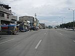
| Radial Road 10 is a highway that goes from Anda Circle in Manila to C-4 Road in Navotas. | ||||||
Circumferential Roads: Rings Around Manila
There are six ring roads around Manila. The first two are inside Manila, and the others are outside. They all circle around Intramuros.
| Name | Image | Route | Major cities | Component highways | Length | Ref. |
|---|---|---|---|---|---|---|
| C-1 Circumferential Road 1 |
  |
Manila |
List (1)
Manila
|
|
5.98 km (3.72 mi) | |
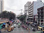
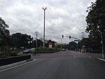
| Circumferential Road 1 (C-1) is inside Manila. It passes through areas like Tondo, Quiapo, and Ermita. It starts as Recto Avenue and ends at Roxas Boulevard. | ||||||
| C-2 Circumferential Road 2 |
  |
Manila |
List (1)
Manila
|
|
10.18 km (6.33 mi) | |
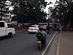
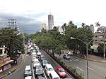
| C-2 Road starts in Tondo, Manila. It goes through Santa Cruz, Sampaloc, and Malate. It begins as Capulong Street, then becomes Tayuman Street, Arsenio H. Lacson Avenue, Nagtahan Street, and finally President Quirino Avenue. | ||||||
| C-3 Circumferential Road 3 |
  |
Navotas–Pasay |
List (6)
Caloocan
Makati Navotas Pasay Quezon City San Juan |
|
14.93 km (9.28 mi) | |
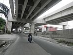
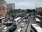
| C-3 Road is outside Manila. It starts in Navotas as C-3 Road, then becomes 5th Avenue in Caloocan. It turns into Sgt. Rivera Avenue and then G. Araneta Avenue in Quezon City. It continues through San Juan and Makati, ending as Gil Puyat Avenue in Pasay. | ||||||
| C-4 Circumferential Road 4 |
  |
Navotas–Pasay |
List (8)
Caloocan
Makati Malabon Mandaluyong Navotas Pasay Quezon City San Juan |
|
27.35 km (16.99 mi) | |
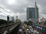
| C-4 Road starts in Navotas. It becomes Paterio Aquino Avenue, then Gen. San Miguel Street, and then Samson Road in Caloocan. After the Monumento Roundabout, C-4 becomes Epifanio de los Santos Avenue (EDSA). EDSA is the busiest and most congested highway in Metro Manila. C-4 ends at Roxas Boulevard in Pasay. | ||||||
| C-5 Circumferential Road 5 |
  |
Valenzuela–Las Piñas |
List (8)
Las Piñas
Makati Parañaque Pasay Pasig Quezon City Taguig Valenzuela |
|
43.87 km (27.26 mi) | |
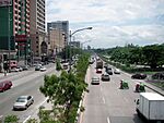
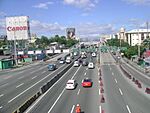
| This road starts at the Karuhatan Exit of the NLEX Harbor Link. It then becomes Mindanao Avenue, Congressional Avenue, Luzon Avenue, and Tandang Sora Avenue. After crossing Magsaysay Avenue, it becomes Katipunan Avenue. It continues as Col. Bonny Serrano Avenue, Eulogio Rodriguez Jr. Avenue, and then Carlos P. Garcia Avenue in Taguig. Its southern part extends to Coastal Road in Las Piñas. | ||||||
| C-6 Circumferential Road 6 |
  |
Taguig–Pasig |
List (2)
Pasig
Taguig |
|
50.8 km (31.6 mi) | |
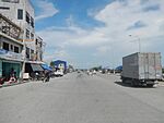
| C-6 Road is currently open in San Jose del Monte, Bulacan, San Mateo, Rizal, and from Taytay, Rizal to Taguig. There are plans to extend it further. This road helps buses and other vehicles avoid passing through the busy parts of Metro Manila. | ||||||
Expressway Network
Expressways are given numbers with an "E" prefix (like E1, E2) to avoid confusion with regular national roads. These are special highways designed for fast travel.
| Expressway route | Image | Route | Component tollways | Length | Notes |
|---|---|---|---|---|---|
 |
Quezon City–Rosario (La Union) |
|
226 km (140 mi) | Part of R-8 | |
 |
Makati–Batangas City |
|
123 km (76 mi) | Part of R-3 | |
 |
Muntinlupa |
|
14 km (8.7 mi) | Spur of E2 | |
 |
Parañaque–Kawit |
|
14 km (8.7 mi) | Part of R-1 | |
 |
Quezon City–Navotas |
|
21.7 km (13.5 mi) | NLEX Mindanao Avenue Link and NLEX Karuhatan Link are part of C-5. | |
 |
Parañaque–Taguig |
|
11.6 km (7.2 mi) | Serves Ninoy Aquino International Airport |
Other Important Roads
Besides the radial and circumferential roads, many other streets in Metro Manila are also very important. Some are national primary roads, while others are secondary or tertiary.
Roads in Manila
Manila has many important roads that help people get around the city.
| Route | Name | Type | Traffic direction | # of lanes | Districts | Notes |
|---|---|---|---|---|---|---|
| Abad Santos Avenue | Secondary | two-way | 6–8 | Tondo | Road continues south as R. Regente Street | |
| Adriatico Street | Tertiary | one-way, two-way | 6 | Ermita and Malate | ||
| C-1 |
Ayala Boulevard | Secondary | two-way | 4 | Ermita | |
| Blumentritt Road | Secondary | two-way | 2–4 | Santa Cruz and Sampaloc | ||
| R-1 |
Bonifacio Drive | Secondary | two-way | 8 | Port Area, Intramuros, and Ermita | |
| R-8 |
Dimasalang Street | Secondary | two-way | 4–6 | Santa Cruz and Sampaloc | |
| R-7 |
España Boulevard | Secondary | two-way | 8 | Sampaloc | |
| Escolta Street | Tertiary | one-way | 2 | Binondo | ||
| C-2 |
Lacson Avenue | Secondary | two-way | 4–8 | Santa Cruz and Sampaloc | |
| C-1 |
Legarda Street | Secondary | two-way | 4–8 | Quiapo and Sampaloc | |
| R-6 |
Magsaysay Boulevard | Secondary | two-way | 8 | Sampaloc and Santa Mesa | |
| R-3
|
Osmeña Highway | Secondary | two-way | 10 | Paco, Malate, and San Andres | Road starts at Quirino Avenue |
| C-1 |
Padre Burgos Avenue | Secondary | two-way | 8 | Ermita | Road continues west as Katigbak Parkway, ends at Jones Bridge |
| R-4 | Pedro Gil Street | Tertiary | one-way, two-way | 2 | Ermita, Malate, Paco, and Santa Ana | |
| R-7 |
Quezon Boulevard | Secondary | two-way | 6–10 | Ermita, Quiapo, and Sampaloc | Road continues north as A. Mendoza Street, continues south as Padre Burgos Avenue |
| C-2 |
Quirino Avenue | Secondary | two-way | 4–6 | Malate, Paco and Pandacan | Includes the extension as N156 running from Quirino Avenue to UN Avenue |
| C-1 |
Recto Avenue | Secondary | two-way | 4–6 | Tondo, Binondo, Santa Cruz, and Sampaloc | |
| R-9 |
Rizal Avenue | Secondary | two-way | 2–6 | Santa Cruz and Tondo | |
| R-1 |
Roxas Boulevard | Primary | two-way | 8 | Ermita and Malate | Road continues north as Bonifacio Drive |
| R-2 |
Taft Avenue | Secondary | two-way | 4–8 | Ermita and Malate | Road continues north as Padre Burgos Avenue |
| C-2 |
Tayuman Street | Secondary | two-way | 4 | Tondo and Santa Cruz | Road starts at Juan Luna Street and ends at Lacson Street |
| United Nations Avenue | Secondary | two-way | 4–6 | Ermita and Paco | Road starts at Roxas Boulevard and continues as Paz Mendoza Guazon Street | |
| R-5 |
Victorino Mapa Street | Secondary | one-way, two-way | 4–6 | Santa Mesa | Road starts at Magsaysay Boulevard and continues as P. Sanchez Street |
Roads in Eastern Metro Manila
This section lists important roads in cities like Mandaluyong, Marikina, Pasig, Quezon City, and San Juan.
Mandaluyong Roads
| Route | Name | Type | Traffic direction | # of lanes | Barangays | Notes |
|---|---|---|---|---|---|---|
| Acacia Lane | Tertiary | two-way | 2–4 | Hagdang Bato Libis and Addition Hills | Also known as Welfareville Road. | |
| Barangka Drive | Tertiary | one-way, two-way | 2 | Highway Hills, Mauway, Barangka Itaas, Barangka Ibaba, Hulo | Leads to Estrella–Pantaleon Bridge in the south. | |
| Boni Avenue | Tertiary | two-way | 2–8 | Old Zañiga and Ilaya | Road continues as Rev. Aglipay Street in the west. | |
| C-4 |
EDSA | Primary | two-way | 10–12 | Wack-Wack Greenhills | |
| General Kalentong Street | Tertiary | two-way | 2–4 | Old Zañiga and Daang Bakal | Road continues as New Panaderos Extension. | |
| Ortigas Avenue | Primary | two-way | 6–8 | Wack-Wack Greenhills | ||
| R-5 |
Shaw Boulevard | Secondary | two-way | 4–8 | Daang Bakal, Addition Hills, Highway Hills, Wack-Wack Greenhills East | Road continues as P. Sanchez Road in the west. |
Marikina Roads
| Route | Name | Type | Traffic direction | # of lanes | Barangays | Notes |
|---|---|---|---|---|---|---|
| A. Bonifacio Avenue | Secondary | two-way | 4 | Barangka, Tañong, Jesus Dela Peña | Road continues east as Sumulong Highway. | |
| C-5 |
FVR (Fidel V. Ramos) Road | Primary | two-way | 6-8 | Industrial Valley Complex | Known as C5 Access Road. |
| J. P. Rizal Street | Secondary | two-way | 2-4 | Calumpang, San Roque, Santa Elena, Santo Niño, Malanday, Concepcion Uno, Nangka | Road continues north as General Luna Avenue. | |
| R-6 |
Marikina–Infanta Highway | Primary | two-way | 8-10 | Barangka, Calumpang, San Roque | Known as Marilaque Highway and Marcos Highway. |
| Mayor Gil Fernando Avenue | Secondary | two-way | 4 | San Roque, Santa Elena, Santo Niño | Formerly known as Angel Tuazon Avenue. | |
| Shoe Avenue | Tertiary | two-way | 4 | San Roque, Santa Elena, Santo Niño | Formerly an old train track line. | |
| Sumulong Highway | Secondary | two-way | 6 | Santo Niño | Road continues west as A. Bonifacio Avenue. |
Pasig Roads
| Route | Name | Traffic direction | # of lanes | Barangays | Notes |
|---|---|---|---|---|---|
| ADB Avenue | two-way | 4–6 | San Antonio and Ugong | ||
| C-5 |
Eulogio Rodriguez Jr. Avenue | two-way | 8–10 | Ugong and Bagong Ilog | Road continues south as Carlos P. Garcia Avenue. |
| Julia Vargas Avenue | one-way, two-way | 4–6 | San Antonio and Ugong | Road starts from EDSA. | |
| Meralco Avenue | two-way | 4–8 | Ugong and San Antonio | ||
| R-5 |
Ortigas Avenue | two-way | 6–8 | Ugong, Santa Lucia, and Rosario | Road continues east as Manila East Road. |
| Pasig Boulevard | two-way | 4 | Bagong Ilog and Sagad | Road is a continuation of Shaw Boulevard. | |
| Pioneer Street | two-way | 4 | Kapitolyo | ||
| R-5 |
Shaw Boulevard | two-way | 4–8 | Road continues as Pasig Boulevard. |
Quezon City Roads
- N.S. Amoranto Sr. Avenue (formerly Retiro)
- Balete Drive (New Manila area)
- Banawe Street (Santa Mesa Heights area)
- Batasan Road (Batasan Hills)
- Bonny Serrano Avenue (formerly Santolan Road) – N185
- D. Tuazon Street
- East Avenue (Diliman area) – N174
- Eulogio Rodriguez Sr. Avenue
- General Luis Street (Novaliches) - N118
- Gilmore Avenue (New Manila area)
- Kalayaan Avenue
- Mindanao Avenue (part of C-5 Road)
- North Avenue – N173
- Regalado Avenue
- Regalado Highway
- Roosevelt Avenue
- Susano Road (Novaliches)
- Timog Avenue – N172
- Tomas Morato Avenue
- Visayas Avenue
- West Avenue – N171
- White Plains Avenue
- Zabarte Road
San Juan Roads
| Route | Name | Traffic direction | # of lanes | Barangays | Notes |
|---|---|---|---|---|---|
| R-6 |
Aurora Boulevard | two-way | 4 | Ermitaño, Balong-Bato, Salapan | |
| C-4 |
EDSA | two-way | 8–10 | Greenhills | |
| F. Blumentritt Street | two-way | 2–4 | Rivera, San Perfecto, Pedro Cruz, Batis, Tibagan, Kabayanan | Road continues as General Kalentong Street. | |
| C-3 | Gregorio Araneta Avenue | two-way | 6–8 | Progreso | |
| Nicanor Domingo Street | two-way | 2–4 | Progreso, San Perfecto, Rivera, Pedro Cruz, Balong-Bato, Corazon de Jesus, Ermitaño, Pasadeña | Road continues west as Old Santa Mesa Road. | |
| Ortigas Avenue | two-way | 4–8 | Greenhills | Road continues west as Granada Street. | |
| Pinaglabanan Road | two-way | 2–6 | Pedro Cruz, Balong-Bato, Corazon de Jesus | Road continues as Bonny Serrano Avenue. |
This section covers important roads in Caloocan, Malabon, Navotas, and Valenzuela.
Caloocan Roads
- 5th Avenue – N130
- 10th Avenue
- A. Mabini Street
- Samson Road – N120
- Camarin Road
- Deparo Road
- Susano Road
- Zabarte Road
Malabon Roads
- Governor Pascual Avenue
- Paterio Aquino Avenue
- North Bay Boulevard
Valenzuela Roads
- General Luis Street - N118
- Maysan Road – N118
Roads in Southern Metro Manila
This section lists important roads in Las Piñas, Makati, Muntinlupa, Parañaque, Pasay, Pateros, and Taguig.
Las Piñas Roads
| Route | Name | Traffic direction | Barangays | Notes |
|---|---|---|---|---|
| Alabang-Zapote Road | two-way | |||
| CAA Road | two-way | |||
| Daang Hari Road | two-way | |||
| Diego Cera Avenue | two-way |
Makati Roads
| Route | Name | Designation | Barangays | Notes | |
|---|---|---|---|---|---|
| Amorsolo Street | national tertiary road | San Lorenzo, Dasmariñas (Makati CBD) | |||
| Arnaiz Avenue | national tertiary road | 4 | San Lorenzo, Bangkal, Pio del Pilar | ||
| C-3 | Ayala Avenue | private road | San Lorenzo, Urdaneta, Bel-Air, San Antonio (Makati CBD) | ||
| Chino Roces Avenue | national tertiary road | Dasmariñas, La Paz, Olympia, Pio del Pilar, San Antonio, San Lorenzo, Tejeros | |||
| C-4 |
EDSA | national primary road | Guadalupe VIejo, Guadalupe Nuevo, Bel-Air, Pinagkaisahan, Urdaneta, Forbes Park, San Lorenzo, Dasmariñas, Bangkal, Magallanes | ||
| C-3 |
Gil Puyat Avenue | national secondary road | Bel-Air, Palanan, Pio del Pilar, San Antonio, San Lorenzo, Urdaneta | ||
| Jose P. Rizal Avenue | national tertiary road | Comembo, East Rembo, West Rembo, Cembo, Guadalupe Nuevo, Guadalupe Viejo, Poblacion, Valenzuela, Olympia, Tejeros | |||
| Kalayaan Avenue | national tertiary road | Singkamas to Poblacion in Makati and Pinagkaisahan to East Rembo in Makati | |||
| McKinley Road | national tertiary road | Dasmariñas to Bonifacio Global City in Taguig | |||
| Makati Avenue | private road (within Makati CBD), national tertiary road | San Lorenzo (Makati CBD) to Poblacion | |||
| R-3
|
Osmeña Highway | national secondary road | Palanan, San Isidro, Pio del Pilar, Bangkal | ||
| Paseo de Roxas | private road | San Lorenzo to Bel-Air (Makati CBD) | |||
| C-3 | South Avenue | national tertiary road | Santa Cruz to Olympia |
Muntinlupa Roads
| Route | Name | Designation | Barangays | Notes |
|---|---|---|---|---|
| Alabang-Zapote Road | national secondary road | Ayala Alabang, Alabang | ||
| Commerce Avenue | private road | Ayala Alabang, Alabang | Serves Ayala Alabang Village. | |
| Daang Hari Road | national secondary road | Ayala Alabang | Mostly travels along Las Piñas-Muntinlupa boundary. | |
| National Road (Manila South Road/Maharlika Highway) | national primary road | Alabang, Bayanan, Putatan, Poblacion, Tunasan | ||
| Muntinlupa–Cavite Expressway | expressway | Poblacion |
Parañaque Roads
| Route | Name | Designation | Barangays | Notes |
|---|---|---|---|---|
| Aseana Avenue | private road | |||
| Dr. Santos Avenue (Sucat Road) | national primary | |||
| Quirino Avenue | national secondary road | |||
| NAIA Expressway | expressway | |||
| NAIA Road (MIA Road) | national secondary | |||
| Ninoy Aquino Avenue (Imelda Avenue) | national secondary |
Pasay Roads
| Route | Name | Designation | Barangays | Notes |
|---|---|---|---|---|
| Andrews Avenue | national secondary | |||
| Arnaiz Avenue (Libertad Street) | national tertiary | |||
| Domestic Road | national secondary | |||
| Jose W. Diokno Boulevard | national tertiary | |||
| Macapagal Boulevard | national tertiary | |||
| NAIA Expressway | expressway | |||
| NAIA Road (MIA Road) | national secondary |
Pateros Roads
- B. Morcilla Street
- Jose P. Rizal Avenue Extension
- M. Almeda Street
Taguig Roads
- 5th Avenue (Bonifacio Global City)
- 8th Avenue (Bonifacio Global City)
- 11th Avenue (Bonifacio Global City)
- 26th Street (Bonifacio Global City)
- 32nd Street (Bonifacio Global City)
- 38th Street (Bonifacio Global City)
- Arca Boulevard
- Bayani Road
- Cayetano Boulevard
- Carlos P. Garcia Avenue/C-5 Road
- General Luna Street
- General Santos Avenue
- Lawton Avenue
- McKinley Parkway (Bonifacio Global City)
- McKinley Road (Bonifacio Global City to Makati CBD)
- Manuel L. Quezon Street
- South Luzon Expressway
- University Parkway (Bonifacio Global City)
- Upper McKinley Road (Bonifacio Capital District)
See also
- Road numbering
- List of expressways in the Philippines
- Highways in the Philippines
 | Precious Adams |
 | Lauren Anderson |
 | Janet Collins |


