Lock, South Australia facts for kids
Quick facts for kids LockSouth Australia |
|||||||||||||||
|---|---|---|---|---|---|---|---|---|---|---|---|---|---|---|---|

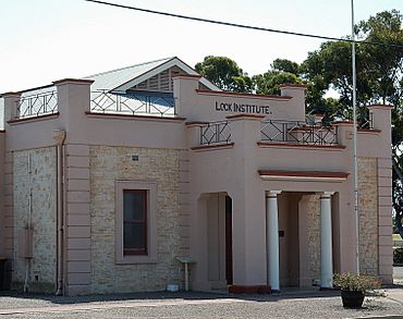
Lock Institute
|
|||||||||||||||
| Established | 1918 | ||||||||||||||
| Postcode(s) | 5633 | ||||||||||||||
| Elevation | 123 m (404 ft) | ||||||||||||||
| Location |
|
||||||||||||||
| LGA(s) | District Council of Elliston | ||||||||||||||
| State electorate(s) | Flinders | ||||||||||||||
| Federal Division(s) | Grey | ||||||||||||||
|
|||||||||||||||
|
|||||||||||||||
Lock is a town located in the middle of the Eyre Peninsula in South Australia. It is a very important place for storing grain. This is because many farms around Lock grow cereal crops. The town has a hotel, a caravan park, and a supermarket. You can also find a post office, police station, and a library. For fun, there's a sporting complex, golf club, and bowling club. There is also a school. In 2006, about 290 people lived in Lock.
Contents
Lock's Early History
Many towns along the coast were settled much earlier. But Lock was not started until the 1860s. This was because the area had low rainfall and tough conditions. Early settlers raised sheep on large areas of natural vegetation. They did this for very low costs. People began to settle the land in 1861. More settlements continued to grow further north in the following decades.
How Lock Got Its Name
A big change happened when the Port Lincoln railway line arrived in 1913. The area was first served by a train stop called Terre Siding. This name came from a local property. The town was officially named Lock in February 1918. It was named after Sergeant Albert Ernest Lock. He was a member of the South Australian Survey Department. Sergeant Lock was killed in Belgium during World War I in 1917.
Water Supply for Lock
People soon realized that wheat could be grown here. But the low rainfall made it hard to develop farming. Things changed when a pipeline from the Tod Reservoir was built. Two years later, a huge underground water source was found right under the town. This source could supply all the water Lock needed.
Lock Heritage Museum
The Lock Heritage Museum shows many old items. These include things from wartime, farming, and households. They were used in the area many years ago.
Where is Lock Located?
The town of Lock is in the exact geographic centre of the Eyre Peninsula. It is surrounded mostly by flat farming land. There are also some patches of original vegetation. Lock is at the meeting point of two main highways. The Tod Highway runs from the bottom to the top of the peninsula. The Birdseye Highway crosses the middle.
Lock is also close to some special natural areas. These include the Hambidge Wilderness Protection Area to the north. To the south are the Hincks Conservation Park and the Hincks Wilderness Protection Area. In these places, the area's original ecosystems are protected.
Lock's Community
In 2006, the Australian Bureau of Statistics counted the people in Lock. There were 290 people living in the town area. About 95.2% of the people were born in Australia. Other people came from New Zealand, the United States of America, and England.
What is Lock's Economy?
Agriculture is the main way people make money in Lock. This mostly means growing cereal crops. Some people also raise sheep. Tourism also brings in some money, especially during school holidays.
Mining in Lock
There is also a chance for mining in the area. Iron ore has been found about 20 kilometers southeast of Lock. This was discovered at Wilgerup by Centrex Metals. Another company, Iron Road, is also planning to mine magnetite north of Lock.
 | Shirley Ann Jackson |
 | Garett Morgan |
 | J. Ernest Wilkins Jr. |
 | Elijah McCoy |

