
Massac County, Illinois facts for kids
Quick facts for kids
Massac County
|
|
|---|---|

Massac County Courthouse in Metropolis
|
|

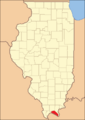
Location within the U.S. state of Illinois
|
|
 Illinois's location within the U.S. |
|
| Country | |
| State | |
| Founded | February 8, 1843 |
| Seat | Metropolis |
| Largest city | Metropolis |
| Area | |
| • Total | 242 sq mi (630 km2) |
| • Land | 237 sq mi (610 km2) |
| • Water | 4.6 sq mi (12 km2) 1.9% |
| Population
(2020)
|
|
| • Total | 14,169 |
| • Density | 59/sq mi (23/km2) |
| Time zone | UTC−6 (Central) |
| • Summer (DST) | UTC−5 (CDT) |
| Congressional district | 12th |
Massac County is a county in the state of Illinois. It was created in 1843 and is named after an old French fort from the 1700s. The main town, or county seat, is Metropolis.
In 2020, about 14,169 people lived in Massac County. It is part of the Paducah, KY-IL area. The county is located along the Ohio River, in a part of Illinois often called "Little Egypt".
Contents
History of Massac County
This area was home to different groups of indigenous peoples for thousands of years. Scientists have found signs of people living here since the Archaic Period (8000 to 2000 BCE). More advanced cultures, like the Adena culture, lived here during the Early Woodland period.
Ancient Mississippian Culture
The most complex Native American culture here was the Mississippian culture. These people built a large settlement between 1050 CE and 1450 CE. This place is now called the Kincaid Site.
The Mississippian people built 19 large earth mounds, including a special burial mound for important leaders. They also created a big plaza in the center of their town. This site is now a National Historic Landmark. The people left the site around 1500 CE, possibly because they ran out of wood or animals to hunt.
French Fort and County Naming
This land was once claimed by French explorers as part of the Illinois Country. In 1757, during a war against the British, the French built a fort here. They named it Fort Massac after a French naval minister, Claude Louis d'Espinchal, Marquis de Massiac. The county later got its name from this fort.
Settlement and Growth
After the American Revolution, people from the southern United States began to settle this area. They traveled along the Ohio River. This part of Illinois became known as "Little Egypt."
Massac County was officially formed on February 8, 1843. It was created from parts of Johnson and Pope counties. The area was mainly used for farming.
In the mid-1800s, many German immigrants moved to Illinois. They supported the Union and the Republican Party during the American Civil War. This was different from the people who came from the South, who often supported the Confederacy. Today, nearly one-third of Massac County's population has German roots.
-
Massac County when it was created in 1843

Geography of Massac County
The county covers about 242 square miles. Most of this area, 237 square miles, is land. The remaining 4.6 square miles (1.9%) is water.
Climate and Weather
| Weather chart for Metropolis, Illinois | |||||||||||||||||||||||||||||||||||||||||||||||
|---|---|---|---|---|---|---|---|---|---|---|---|---|---|---|---|---|---|---|---|---|---|---|---|---|---|---|---|---|---|---|---|---|---|---|---|---|---|---|---|---|---|---|---|---|---|---|---|
| J | F | M | A | M | J | J | A | S | O | N | D | ||||||||||||||||||||||||||||||||||||
|
3.5
42
25
|
3.9
48
29
|
4.4
58
38
|
4.7
69
47
|
4.8
77
56
|
4
86
64
|
4.3
90
68
|
3
88
66
|
3.3
82
59
|
3.2
71
47
|
4.5
58
38
|
4.4
47
29
|
||||||||||||||||||||||||||||||||||||
| temperatures in °F precipitation totals in inches source: The Weather Channel |
|||||||||||||||||||||||||||||||||||||||||||||||
|
Metric conversion
|
|||||||||||||||||||||||||||||||||||||||||||||||
In Metropolis, the county seat, temperatures usually range from 25°F in January to 90°F in July. The coldest temperature ever recorded was -21°F in January 1984. The hottest was 105°F in July 1999. The county gets about 3 to 4.76 inches of rain each month.
Major Roads
 Interstate 24
 U.S. Route 45
 Illinois Route 145
 Illinois Route 169
Neighboring Counties
- Pope County - to the north
- Livingston County, Kentucky - to the east
- McCracken County, Kentucky - to the south
- Pulaski County - to the west
- Johnson County - to the northwest
Protected Natural Areas
- Shawnee National Forest (part of it is in Massac County)
Population Information
| Historical population | |||
|---|---|---|---|
| Census | Pop. | %± | |
| 1850 | 4,092 | — | |
| 1860 | 6,213 | 51.8% | |
| 1870 | 9,581 | 54.2% | |
| 1880 | 10,443 | 9.0% | |
| 1890 | 11,313 | 8.3% | |
| 1900 | 13,110 | 15.9% | |
| 1910 | 14,200 | 8.3% | |
| 1920 | 13,559 | −4.5% | |
| 1930 | 14,081 | 3.8% | |
| 1940 | 14,937 | 6.1% | |
| 1950 | 13,594 | −9.0% | |
| 1960 | 14,341 | 5.5% | |
| 1970 | 13,889 | −3.2% | |
| 1980 | 14,990 | 7.9% | |
| 1990 | 14,752 | −1.6% | |
| 2000 | 15,161 | 2.8% | |
| 2010 | 15,429 | 1.8% | |
| 2020 | 14,169 | −8.2% | |
| 2023 (est.) | 13,661 | −11.5% | |
| U.S. Decennial Census 1790-1960 1900-1990 1990-2000 2010-2013 |
|||
Population in 2010
In 2010, Massac County had 15,429 people living there. The population density was about 65 people per square mile.
The people living in the county were mostly:
- 91.0% White
- 5.9% Black
- 0.4% Native American
- 0.3% Asian
- 2.0% Two or more races
- 1.9% Hispanic or Latino (of any race)
The average age of people in the county was 42.1 years old.
Communities in Massac County
Massac County has several towns and small communities.
Cities
Village
Unincorporated Communities
These are smaller places that are not officially organized as cities or villages:
Historic Forts
See also
 In Spanish: Condado de Massac para niños
