
Montrose, Pennsylvania facts for kids
Quick facts for kids
Montrose, Pennsylvania
|
|
|---|---|
|
Borough
|
|

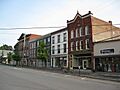
Downtown Montrose, Pennsylvania
|
|
| Nickname(s):
Quarry Town
|
|

Location of Montrose in Susquehanna County, Pennsylvania.
|
|

Montrose, Pennsylvania
Location in Pennsylvania

Montrose, Pennsylvania
Location in the United States
|
|
| Country | United States |
| State | Pennsylvania |
| County | Susquehanna |
| Settled | 1812 |
| Incorporated | 1824 |
| Government | |
| • Type | Borough Council |
| Area | |
| • Total | 1.29 sq mi (3.33 km2) |
| • Land | 1.29 sq mi (3.33 km2) |
| • Water | 0.00 sq mi (0.00 km2) |
| Elevation | 1,657 ft (505 m) |
| Population
(2020)
|
|
| • Total | 1,290 |
| • Density | 1,002.33/sq mi (387.03/km2) |
| Time zone | UTC-5 (Eastern (EST)) |
| • Summer (DST) | UTC-4 (EDT) |
| ZIP code |
18801
|
| Area code(s) | 570 |
| FIPS code | 42-50736 |
| GNIS feature ID | 1215614 |

Montrose is a small town, called a borough, located in Pennsylvania, United States. It's the main town, or county seat, of Susquehanna County. The town sits high up, about 1,400 feet (427 meters) above sea level. It's a quiet place with a rich history.
Contents
History of Montrose
Montrose was planned out in 1812. This area of Pennsylvania was once home to the Native American Susquehannock people. The first non-Native American settler arrived in 1800. He was Captain Bartlett Hinds, a soldier from the American Revolutionary War. He came from Long Island, New York, with his stepson, Isaac Post.
Captain Hinds liked the area's natural beauty and saw its potential. He went back to New York to bring his family to Pennsylvania. Other early settlers were descendants of Sir Peter Warren. He was a Knight Vice Admiral in England's Royal Fleet. He was given land here by American soldiers after he retired.
How Montrose Was Formed
The first courthouse in Montrose was built in 1813. Montrose officially became a borough on March 29, 1824. This happened when it separated from Bridgewater Township. Captain B. Hinds and Dr. Robert H. Rose were important citizens in the area. They worked together to name the town Montrose, after a town in Scotland.
Early Industries and Growth
In the past, Montrose was known for its creameries, which made dairy products. It also had factories that made cut glass, boxes, and sawing machinery. Lumber was another important product. The Montrose area is famous for its many quarry sites. A special type of rock found here is called bluestone. In 1900, about 1,827 people lived in Montrose. By 1910, the population grew to 1,914.
Settlers and New England Style
Families started moving to this area in the mid-1700s. They mostly came from places along the Connecticut River Valley. This includes western Connecticut, Massachusetts, and Vermont. The American Revolution changed a lot in New England. After the war, many people wanted affordable land. They found it in Pennsylvania.
When settlers arrived in what is now Susquehanna County, they saw rolling hills and clear lakes. There were also mountain streams and lots of natural resources. These included timber and bluestone. The first families quickly built Montrose to look like their New England hometowns. They built large colonial-style houses around churches. Both were centered on a main street. A town "green" next to the courthouse was a common area for community events.
Montrose and the Underground Railroad
Montrose played a big part in the Northern Trail of the Underground Railroad. This was a secret network that helped enslaved people escape to freedom. In the 1840s, people in Susquehanna County strongly opposed slavery.
Abolitionists, who wanted to end slavery, started helping enslaved people escape. They used the Underground Railroad. Out of 82 people known to be Underground Railroad agents, 21 were from Susquehanna County.
Changes in the Economy
Between the 1950s and 1990s, the coal industry and farming declined. Many residents moved away to find work. In the late 2000s, things changed. Natural gas exploration and drilling started. This included hydraulic fracturing, also known as "fracking." These activities greatly boosted the local economy.
Because of more money coming into town, the Montrose hospital was moved. It was the only major hospital in Susquehanna County. It moved from an old, small building downtown to a new, advanced facility just outside of town.
Historic Places in Montrose
Several buildings in Montrose are listed on the National Register of Historic Places. These include the Sylvanus Mulford House, the Silver Lake Bank, and the Susquehanna County Courthouse Complex. The entire Montrose Historic District was added in 2011.
Geography of Montrose
Montrose is located at coordinates 41°49′59″N 75°52′38″W.
The United States Census Bureau says the borough has a total area of 1.3 square miles (3.3 square kilometers). All of this area is land.
Population of Montrose
| Historical population | |||
|---|---|---|---|
| Census | Pop. | %± | |
| 1830 | 415 | — | |
| 1840 | 632 | 52.3% | |
| 1850 | 917 | 45.1% | |
| 1860 | 1,168 | 27.4% | |
| 1870 | 1,463 | 25.3% | |
| 1880 | 1,722 | 17.7% | |
| 1890 | 1,735 | 0.8% | |
| 1900 | 1,827 | 5.3% | |
| 1910 | 1,914 | 4.8% | |
| 1920 | 1,661 | −13.2% | |
| 1930 | 1,909 | 14.9% | |
| 1940 | 1,977 | 3.6% | |
| 1950 | 2,075 | 5.0% | |
| 1960 | 2,363 | 13.9% | |
| 1970 | 2,058 | −12.9% | |
| 1980 | 1,980 | −3.8% | |
| 1990 | 1,982 | 0.1% | |
| 2000 | 1,664 | −16.0% | |
| 2010 | 1,617 | −2.8% | |
| 2020 | 1,296 | −19.9% | |
| 2021 (est.) | 1,293 | −20.0% | |
| Sources: | |||
As of the census in 2010, Montrose had 1,617 people living there. There were 754 households. The population density was about 1,244 people per square mile (480 people per square kilometer).
About 21.5% of the population was under 18 years old. About 21.7% were 65 years or older. The average age in Montrose was 44.4 years.
Transportation in Montrose
Three Pennsylvania state highways meet in Montrose. These are Route 29, Route 167, and Route 706. A major highway, Interstate 81, is about 10 miles (16 km) to the east. You can get there using Route 706.
Montrose is also connected by road to nearby towns. These include Friendsville, Little Meadows, and South Montrose.
Airports and Railways
Husky Haven Airport is a small airport about three miles south of Montrose. It is used for general aviation, meaning private planes. The closest airports with commercial flights are Greater Binghamton Airport, about 30 miles (48 km) north, and Wilkes-Barre/Scranton International Airport, about 60 miles (97 km) south.
Montrose used to have three rail services. These included two railroads, the Lehigh Valley Railroad and the Lackawanna Railroad. There was also one trolley line, the Northern Electric. All of these have now been closed down.
Media in Montrose
WPEL AM 800 and 96.5 FM are radio stations that have served the Montrose area for over sixty years. Their studios are located at 251 High Street.
Notable People from Montrose
- Emily C. Blackman (1826-1907), a historian and schoolteacher.
- Charles Martin Crandall, a famous toymaker.
- Elisha Mulford, a religious minister and author.
- William Jessup, a judge and abolitionist (someone who wanted to end slavery).
- Edith May (Anne Drinker; 1827–1903), an American poet.
- J. Brewster McCollum, who was the Chief Justice of the Supreme Court of Pennsylvania from 1900 to 1903.
- Chris Snee, a former offensive guard for the New York Giants. He won two Super Bowls.
- Rich Thompson, an outfielder who played for the Tampa Bay Rays.
- Jonathan Jasper Wright, who lived in Montrose as a youth. He became the first African American to pass the Pennsylvania bar exam. After the Civil War, he worked with the American Missionary Association in the South. He led the Freedmen's Bureau in Beaufort, South Carolina. He was later elected as an associate justice of the South Carolina Supreme Court.
Images for kids
-
Downtown Montrose, Pennsylvania
-

Location of Montrose in Susquehanna County, Pennsylvania.
See also
 In Spanish: Montrose (Pensilvania) para niños
