National Register of Historic Places listings in Leelanau County, Michigan
Hey there! Welcome to a list of super cool historic places in Leelanau County, Michigan. These spots are so special that they're on the National Register of Historic Places. This means they are important parts of history in the United States.
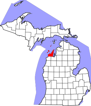
You'll find 24 amazing places on this list, and one of them is even a National Historic Landmark! That's like being extra, extra important. You can see where these places are on a map if you check out their coordinates.
Exploring Leelanau County's Historic Sites
| Name on the Register | Image | Date listed | Location | City or town | Description | |
|---|---|---|---|---|---|---|
| 1 | Bingham District No. 5 Schoolhouse |
(#91000353) |
Junction of County Roads 618 and 633 44°52′33″N 85°40′29″W / 44.875833°N 85.674722°W |
Bingham | This building was built in 1877. It replaced an older log schoolhouse from 1870. Kids from first to eighth grade learned here. It was used until school districts combined after World War II. Today, it serves as the Bingham Township Hall. | |
| 2 | Campbell-DeYoung Farm |
(#11000634) |
9510 E. Cherry Bend Rd. 44°48′32″N 85°39′18″W / 44.808889°N 85.655°W |
Elmwood Charter Township | Henry Campbell first settled this farm in 1855. He built the farmhouse around 1860. The Campbell family built most of the farm buildings. Louis DeYoung owned it from 1925 until 2004. Now, it's a fun place called the DeYoung Natural Area. The Leelanau Conservancy takes care of it. | |
| 3 | Empire School |
(#08000222) |
10017 W. Front St. 44°48′39″N 86°03′32″W / 44.810833°N 86.058889°W |
Empire | The Empire School was built in 1900-1901. It started as a four-room schoolhouse. A gym was added in 1932. The school served the community until 1968. | |
| 4 | Fountain Point |
(#03000623) |
990 South Lake Leelanau Dr. 44°58′02″N 85°42′22″W / 44.967222°N 85.706111°W |
Suttons Bay Township | The name "Fountain Point" comes from a sparkling artesian spring fountain. This fountain has been flowing since 1867! In 1889, Lydia Morrison started "The Fountain Point House." It was a beautiful Victorian-style mansion. Guests would arrive by steamboat and buggy for the summer. | |
| 5 | Glen Haven Village Historic District |
(#83000882) |
M-209 44°53′40″N 86°02′05″W / 44.894444°N 86.034722°W |
Glen Arbor Township | Glen Haven is a village that has been restored. It was once a logging village right on the shore of Lake Michigan. You can visit the restored General Store and Blacksmith Shop. There's also the old Glen Haven Canning Co. building. | |
| 6 | Grand Traverse Light Station |
(#84001799) |
Leelanau Peninsula 45°12′38″N 85°32′58″W / 45.210556°N 85.549444°W |
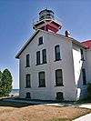
Northport | The Grand Traverse Light was built in 1858. It replaced an older round tower from 1852. This lighthouse is located inside Leelanau State Park. | |
| 7 | Grove Hill New Mission Church |
(#72000631) |
On M-22 45°03′27″N 85°35′10″W / 45.0575°N 85.586111°W |
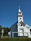
Omena | In 1852, Reverend Peter Dougherty moved his mission here. He built a school, and then this church in 1858. Since 1925, it's mostly used in the summer. It's still open as the Omena Presbyterian Church. | |
| 8 | Hutzler's Barn |
(#78000375) |
West of Leland on South Manitou Island 45°02′16″N 86°06′52″W / 45.037778°N 86.114444°W |
Glen Arbor Township | George Johann Hutzler built this barn in the 1870s. He was a German immigrant who claimed land on South Manitou Island in 1863. | |
| 9 | George Conrad Hutzler Farm |
(#91000466) |
South Manitou Island, Sleeping Bear Dunes National Seashore 45°01′22″N 86°07′36″W / 45.022778°N 86.126667°W |
Glen Arbor Township | The George Conrad Hutzler Farm started in 1870. George Conrad Hutzler Jr. was the son of the first owner. He was known for trying new things in farming. He was the first to mix different types of rye and pea beans. | |
| 10 | Lake Leelanau Narrows Bridge |
(#99001732) |
M-204 over Lake Leelanau Narrows 44°58′53″N 85°42′42″W / 44.981389°N 85.711667°W |
Leland Township | This bridge was built in 1939. It's the third bridge to cross this narrow part of Lake Leelanau. The bridge project helped create jobs during the Great Depression. It was part of a program that funded public building projects. | |
| 11 | Leelanau Transit Company Suttons Bay Depot |
(#97000929) |
101 S. Cedar St. 44°58′26″N 85°39′03″W / 44.973889°N 85.650833°W |
Suttons Bay | A railroad track came through Suttons Bay in 1903. It was meant to connect to a car ferry. But the railway didn't do well, and the ferry stopped by 1908. In 1919, a new company, the Leelanau Transit Company, took over. They built this depot in Suttons Bay for passengers and cargo. | |
| 12 | Leland Historic District |
(#75000951) |
Roughly bounded by the park, Main St., Ave. A, and the harbor 45°01′24″N 85°45′40″W / 45.023333°N 85.761111°W |
Leland Township | This area is also known as Fishtown. It includes Leland's harbor and the surrounding parts. The harbor has old fishing shanties, smokehouses, and docks. These were built for the commercial fishing business. Some are still used for fishing, while others help with tourism today. | |
| 13 | William and Margaret McFarland Core Farm |
(#04001579) |
5946 S. Center Hwy;5856 S. Lake Leelanau Dr. 44°53′40″N 85°41′02″W / 44.894444°N 85.683889°W |
Bingham Township | This farm was started in 1865. William Core and his family ran it for almost 150 years. Now, it's called the Ruby Ellen Farm. It's a working farm that you can visit. | |
| 14 | Morgan-Copp-Mervau Building |
(#00000219) |
101 N. Mill St. 45°07′47″N 85°36′57″W / 45.129722°N 85.615833°W |
Northport | This building was put together in three parts. The first part was a one-story building built in 1880. It was a grocery and dry goods store. A two-story part was added to the back in 1881-83 as a home. This two-story part was later extended and became a drugstore before 1905. A third section was built in 1927-28. It has cool cedar designs. | |
| 15 | North Manitou Island Lifesaving Station |
(#98001191) |
East Coast, North Manitou Island 45°07′16″N 85°58′39″W / 45.121111°N 85.9775°W |
Leland Township | The North Manitou Island Lifesaving Station is also known as the North Manitou Coast Guard Station. It's special because it was used during all three periods of lifesaving history. This includes the early volunteer days, the United States Life-Saving Service, and the United States Coast Guard. | |
| 16 | North Manitou Shoal Light Station |
(#05000981) |
Northeastern Lake Michigan, approximately 3 mi (4.8 km) southeast of North Manitou Island 45°01′12″N 85°57′24″W / 45.02°N 85.956667°W |
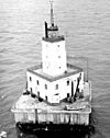
Leland Township | The North Manitou Shoal Light Station was built in 1935. It replaced an old lightship station. When it became automated in 1980, it was the last lighthouse in the Great Lakes that still had people living and working in it. | |
| 17 | Omena Historic District |
(#100000534) |
Generally along M-22 from Tatch Road to North Omena Point Road 45°03′22″N 85°35′14″W / 45.056036°N 85.587103°W |
Omena | This historic district in Omena includes buildings and areas along M-22. It shows how the town developed over time. | |
| 18 | Port Oneida Rural Historic District |
(#97000563) |
Roughly bounded by Lake Michigan, Shell Lake, Bass Lake, and Tucker Lake 44°56′14″N 85°56′11″W / 44.937222°N 85.936389°W |
Cleveland and Glen Arbor Townships | The Port Oneida Rural Historic District has many farms. These farms show what life was like for settlers from Northern Europe. They lived in the Midwestern United States in the late 1800s. This district is part of the Sleeping Bear Dunes National Lakeshore. | |
| 19 | Riverside Inn |
(#03000386) |
302 E. River St. 45°01′20″N 85°45′29″W / 45.022222°N 85.758056°W |
Leland Township | The first Riverside Inn was built in 1902 by Jacob Schwarz. After he passed away, his daughters Blanche and Anna took over. The inn burned down in 1924. So, Blanche and Anna rebuilt a nearby dancehall to create the current building. The Riverside Inn is still open for business today! | |
| 20 | Saint Joseph's Catholic Church |
(#91001997) |
5899 County Road 669 44°53′40″N 85°53′00″W / 44.894444°N 85.883333°W |
Cleveland Township | Saint Joseph's Catholic Church was built in 1884. Bohemian immigrants built it. The church was used by the Catholic community until 1970. Then, the Saint Joseph parish joined with another nearby church. | |
| 21 | Sleeping Bear Inn |
(#79000284) |
M-209 44°54′15″N 86°01′38″W / 44.904167°N 86.027222°W |
Glen Arbor Township | This inn was first called the "Sleeping Bear House." C.C. McCarthy built it in 1857. It worked as a boarding house and hotel for many years. It finally closed in 1973. The National Park Service bought it, along with the rest of Glen Haven. | |
| 22 | Sleeping Bear Point Life Saving Station |
(#79000285) |
North of Glen Haven 44°54′31″N 86°02′01″W / 44.908611°N 86.033611°W |
Glen Arbor Township | The Sleeping Bear Point Lifesaving Station is very important. When it was built in 1901, it was a new kind of building design. It's still almost exactly as it was back then. Now, it's a Maritime Museum. It's part of the Sleeping Bear Dunes National Lakeshore. | |
| 23 | South Manitou Island Lighthouse Complex and Life Saving Station Historical District |
(#83003782) |
Sandy Point 45°00′34″N 86°05′35″W / 45.009444°N 86.093056°W |
Glen Arbor Township | This lighthouse was built in 1872. It's the third one on the island. Earlier lighthouses from 1840 and 1858 weren't strong enough. This lighthouse stopped being used in 1958. Now, it's a museum you can visit. |

All content from Kiddle encyclopedia articles (including the article images and facts) can be freely used under Attribution-ShareAlike license, unless stated otherwise. Cite this article:
National Register of Historic Places listings in Leelanau County, Michigan Facts for Kids. Kiddle Encyclopedia.


