
Oberhasli facts for kids
Quick facts for kids
Oberhasli
|
||
|---|---|---|
|
Talschaft
|
||
|
||
 |
||
| Country | ||
| Canton | ||
| Region | Interlaken-Oberhasli | |
| Area | ||
| • Total | 551 km2 (213 sq mi) | |
| Population
(2007)
|
||
| • Total | 7,843 | |
| • Density | 14.234/km2 (36.87/sq mi) | |
| Time zone | UTC+1 (CET) | |
| • Summer (DST) | UTC+2 (CEST) | |
| Municipalities | 6 | |

Oberhasli is a special historical region in the Bernese Highlands of Switzerland. It's like a big valley area, also known as a Talschaft. This region borders several other Swiss areas called cantons, including Obwalden, Nidwalden, Uri, and Valais.
For many years, from 1833 to 2009, Oberhasli was its own district. It was the easternmost of the 26 districts in the canton of Bern. Since 2010, Oberhasli and the nearby Interlaken district have joined together. They now form one larger administrative area called Interlaken-Oberhasli. The people here speak a special kind of German called Highest Alemannic.
Oberhasli is quite large, covering about 551 square kilometers. This is bigger than some entire cantons in Switzerland! The region includes six smaller towns or villages called municipalities: Gadmen, Guttannen, Hasliberg, Innertkirchen, Meiringen, and Schattenhalb. About 8,000 people live here. Most of Oberhasli is made up of high mountains, which means many parts are not suitable for living.
The name Haslital refers to the whole region. But geographically, the "proper" Haslital is the main valley of the Aare river. It doesn't include the many smaller valleys that branch off, like Gadmertal or Reichenbachtal. The name Haslital was first used in 1234. The word Ober- (meaning "Upper") was added in the 1500s. This helped people tell it apart from another place called Hasle bei Burgdorf. The name Oberhasli became official in 1798. It likely comes from an old German word for "hazel" tree.
The upper parts of the Haslital are part of a special World Heritage Site. This site is called the Jungfrau–Aletsch–Bietschhorn and was recognized in 2007 for its amazing natural beauty.
Contents
Geography: Mountains, Valleys, and Passes
Oberhasli has always been very important because of its location in the middle of the Central Alps. It controls several mountain passes, which are like natural gateways through the mountains.
Important Mountain Passes
These passes connect Oberhasli to other regions:
- The Grimsel Pass: This pass goes south and connects to the Goms region in Upper Valais.
- The Susten Pass: This pass goes east and connects to the valley of the Reuss river. This river valley is part of the important St. Gotthard Route.
- The Joch Pass: This is a foot pass to the northeast. It connects to the canton of Nidwalden and leads to the resort town of Engelberg in the canton of Obwalden.
- The Brünig Pass: This lower pass to the north connects Meiringen and the Haslital with the upper canton of Obwalden. From there, you can reach other parts of Central Switzerland, like Lucerne.
- The Grosse Scheidegg: This pass in the southwest offers a direct connection to Grindelwald.
The Main Valley and Side Valleys
Besides the main valley, the Haslital, there are several smaller valleys that branch off. The Haslital includes the flat area around the Aare river between Meiringen and Lake Brienz.
- The proper Haslital begins near the Grimselpass and the Grimselsee lake. The upper part of the valley is narrow. It stretches to Innertkirchen, where the Aare river meets water from the Ürbachtal and the Gadmertal. The Aare then flows through the Aareschlucht (Aare Gorge). After the gorge, it opens up into a flat plain near Meiringen. The river then flows west and enters Lake Brienz.
- The Ürbachtal is a valley that joins the Haslital near Innertkirchen. It has a unique 'S' shape. Water from glaciers like the Gauligletscher flows into lakes like the Gaulisee and Mattenalpsee before becoming the Ürbachwasser, which then flows into the Aare.
- The Gadmertal starts from two places. One part is below the Titlis mountain, where the Wendengletscher glacier melts into the Wendenwasser. Another part is below the Sustenhorn mountain, where the Steingletscher glacier melts into the Steisee lake and then the Steinwasser. These waters combine to form the Gadmerwasser. This river also collects water from the Triftwasser and the Gentalwasser before flowing into the Aare at Innertkirchen.
- The Gental starts at the Engstlenalp area, below the Jochpass. The Gentalwasser flows from the Engstlensee lake and eventually joins the Gadmerwasser.
- The Reichenbachtal connects Meiringen with Grindelwald. The Reichenbach river flows through it. This river forms the famous Reichenbach Falls before joining the Aare at Meiringen.
History: A Story of Independence

Oberhasli has a strong history of being independent, even for Switzerland! It was mostly self-governing from when it was first settled in the early Middle Ages. This lasted until 1798, when it became part of the Helvetic Republic.
Oberhasli was officially part of the Holy Roman Empire until 1334. From 1334 to 1798, it was technically under the control of Bern. However, it still managed its own affairs. The only major change was when Bern made them accept the Reformation between 1528 and 1557.
In 1234, the area around Meiringen, which included all of Haslital, was recorded as being "free of imperial control." Hasli remained an imperial territory until Bern took it over in 1334. The church in Meiringen is built on top of older buildings, with the oldest parts possibly from the 9th or 10th century.
In 1275, Hasli made an alliance with the city of Bern. In 1311, Oberhasli was given to the Weissenburg family. After a rebellion in 1334, Oberhasli officially became part of Bern. But it kept most of its old special rights. Bern was smart and appointed local people from Hasli to manage the area and be judges.
Oberhasli was a strong military ally for Bern. In 1339, 300 men from Oberhasli fought in the Battle of Laupen. This arrangement, where Oberhasli was officially part of Bern but mostly ran itself, continued until 1528. That's when Bern forced the Protestant religion on Oberhasli.
About half of the people in Oberhasli rebelled against Bern. After this, Bern tried to take more control. But they faced so much resistance that in 1557, they signed a treaty. This treaty gave Oberhasli its old special rights back.
In the 1600s and 1700s, powerful local families, called the Ehrbarkeit, became important. Before 1709, all of Oberhasli had only one church in Meiringen. Later, churches were built in Gadmen (1808) and Guttannen (1816).
In 1558, there were 253 households in Oberhasli. By 1653, this number grew to 360. But in 1669, the population dropped to about 500 people because of a plague outbreak. Some parts of Haslital were also affected by a religious movement in the 1730s.
By 1764, there were 3,253 people. The population more than doubled over the next century, reaching 7,054 in 1850. During the time of the Helvetic Republic, Oberhasli was part of the Kanton Oberland.
Oberhasli was traditionally organized into fifteen groups of independent farms called Bäuerten. These groups together formed the Talschaft of Oberhasli. This system changed in 1834. It was replaced by the six municipalities that made up the Oberhasli district. From 1834 until 2009, Oberhasli was a district of the canton of Bern. The special local laws of Oberhasli became inactive in 1843.
Fast population growth in the 1800s led to poverty. Many people were forced to move away, mostly to America. Around 1880, the economy got better as Meiringen became a popular place for tourism.
However, the population still dropped from 7,574 in 1880 to 6,507 in 1920. This was due to fewer jobs in tourism during World War I. It started to rise again in the mid-to-late 1900s, reaching 7,878 in 1950 and 8,189 in 2000. It has slightly decreased since then.
While the total population has stayed about the same since the mid-1900s, where people live has changed. People used to live in spread-out settlements. Now, more people live in the main town of Meiringen. In 1764, Meiringen had 30% of Hasli's population. By 2016, it had 60%.
The Oberhasli district joined the Interlaken district in 2010. They now form the new Interlaken-Oberhasli district. The population of Gadmen dropped from 739 in 1850 to 250 in 2007. The municipality of Gadmen was merged into Innertkirchen in 2014.
Administrative Divisions: How Oberhasli is Organized

The Oberhasli district was the easternmost of the 26 districts in the canton of Bern. It existed from 1833 to 2009 and covered an area of 550 square kilometers. The main administrative town was Meiringen.
Since 1843, Oberhasli has had six municipalities. This number was reduced to five in 2014. This happened when Gadmen (which had 250 people in 2007) merged with Innertkirchen.
| municipality | population (2016) | area (km²) (2016) |
|---|---|---|
| 4,692 | 40.7 | |
| 1,193 | 41.7 | |
| 1,087 | 236.6 | |
| 585 | 31.5 | |
| 267 | 200.7 | |
| Total | 7,824 | 551 |
The black eagle on a gold background used to represent the entire Oberhasli region. This is the imperial coat of arms. The people of Hasli were given the right to use this eagle by Bern. This showed their special status. When towns got their own coats of arms, Meiringen kept the imperial eagle. Other towns used the eagle combined with other designs.
Economy and Infrastructure: How People Make a Living


In the Late Middle Ages, Oberhasli's economy was based on farming and moving animals like goats and sheep to different pastures (transhumance). Later, it shifted to raising livestock (cattle, horses) and making cheese.
Livestock and cheese were sold to Italy by crossing the Grimsel and Nufenen passes. In the 1700s, there were three yearly markets for livestock. There was also some iron mining, which started in the 1400s and ended after 1798. From the 1600s, people also searched for crystals. This became more popular with the rise of tourism in the 1800s.
The growth of tourism led to big investments in roads and railways. The Brünig road opened in 1857, and the Brünig railway in 1888. These connected Oberhasli to Lucerne and other major Swiss cities. The Grimsel road opened in 1894, and the Susten road in 1945. The number of hotels in Meiringen grew from two in 1831 to eighteen in 1900.
After 1973, more facilities were built, turning Hasliberg into a major skiing resort. By 2005, less than 20% of jobs were in farming. More than 65% of jobs were in the service sector, mostly tourism.
Another important industry is making hydroelectricity. The company Kraftwerke Oberhasli AG produces about 1.1 gigawatts of electricity. This is about 12% of all the electricity used in Switzerland! The Swiss Air Force also has an airbase in Unterbach, which is part of Meiringen.
Culture and Folklore: Traditions and Legends
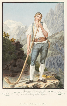
Oberhasli is a key area for Highest Alemannic Alpine culture. It has kept many traditions typical of Swiss folklore.
Oberhasli was affected by modern changes quite late, mostly in the second half of the 1800s when tourism grew. Because of this, it kept many rich folklore traditions well into the 1900s.
The main yearly festival in Oberhasli is the Ubersitz. This means "sitting out" the night drinking. It is the end of a week of Trychel (cowbell) marches in Meiringen.
In 1846, a traveler named Johann Georg Kohl visited Oberhasli. He wrote about its beautiful scenery and its people. Kohl recorded a story that said the people of Oberhasli came from Scandinavia. The legend tells of 6,000 Frisians and Swedes who were forced to leave their homes because of a famine. The leaders of these Swedish immigrants were said to be Restius and Hastus. Kohl also thought the architecture of the Meiringen church looked like buildings from North Frisia and Scandinavia. This legend was first written down by Petermann Etterlin in his 1507 Chronicle.
The Oberhasli legend became popular in Scandinavian Romantic nationalism. For example, the Danish poet Adam Oehlenschläger wrote a poem called Haslidalen in 1849.
A collection of folk tales was published in 1943 by Melchior Sooder. He was a teacher and from Schattenhalb. His book was called Zelleni us em Haslital. Dwarves are very important in these stories. There is a dwarf king named Muggestutz. The tales also tell how the dwarves disappeared after people in Oberhasli didn't appreciate their help. A book about the Hasli dialect (local language) was published in 1992 by Hans Dauwalder.
Images for kids
-
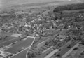
Aerial view (1964)
See also
 In Spanish: Distrito de Oberhasli para niños
- Highest Alemannic
- Walser
- Ubersitz
- History of the Alps
