Palms, Los Angeles facts for kids
Quick facts for kids
Palms
|
|
|---|---|
Palms Station, Los Angeles
|
|
Palms boundaries as shown on "Mapping L.A." project of the Los Angeles Times
|
|
| Country | United States |
| State | California |
| County | County of Los Angeles |
| City | City of Los Angeles |
| Area | |
| • Total | 1.9 sq mi (5 km2) |
| Population
(2000)
|
|
| • Total | 42,545 |
| • Density | 21,983/sq mi (8,488/km2) |
| ZIP Codes |
90034, 90232
|
| Area code(s) | 310/424 |
Palms is a neighborhood in the Westside area of Los Angeles, California. It was founded in 1886 and was the first neighborhood to become part of the city of Los Angeles in 1915. Palms was first planned as a farming and vacation spot. Today, it is mostly a place where people live, with many apartment buildings. There are also shopping areas and a part with single-family homes. In 2000, about 42,545 people lived in Palms.
Contents
History of Palms
Early Days Before 1887
Rancho La Ballona's Beginnings
Long ago, during Spanish and Mexican times, the land that is now Palms was part of a large area called Rancho La Ballona. In 1819, some families were given permission to use this land. They used about 14,000 acres (57 km2) for grazing their cattle and sheep.
The area was known for its open spaces. A general store was opened in 1871. It was also the first post office for the area. This store was a stop on the main road between Los Angeles and the ocean.
Land Rush and New Settlements
In the 1880s, many people moved to Southern California. This was because new railroad lines made it easier to travel across the country. The railroads also wanted to encourage people to buy land and build towns.
In 1882, some families from Iowa moved to the area. They started a church. Around this time, three people named Joseph Curtis, Edward H. Sweetser, and C.J. Harrison bought 500 acres (2 km2) of land. They divided the land into smaller pieces to sell. They planted 5,000 trees along new streets. They called their new development The Palms. They even brought in palm trees to plant near the train station. The official start date for Palms is December 26, 1886.
The Palms was located halfway between Los Angeles and Santa Monica. It was on a train line that is now the Expo line. Before Los Angeles grew very big, Palms was surrounded by farms and ranches.
Palms Since 1886
The people who developed The Palms gave land and money to the local church. The church building was finished in 1887. Over the years, the church grew and added more buildings.
Joining Los Angeles: Annexation
As more people moved to the area, there was a push for Palms to join the city of Los Angeles. This was important because Los Angeles had better water systems and flood control plans.
There were two votes for Palms to join Los Angeles. The first vote in April 1914 did not pass. People were worried about higher taxes. A new plan was quickly made, leaving out areas that voted no. Even though some people were still against it, the idea of joining Los Angeles was important for getting enough water.
On June 1, 1914, the second vote passed. On May 4, 1915, Los Angeles voters approved Palms joining the city. Palms officially became part of Los Angeles on May 22, 1915.
How Palms Got Its Name
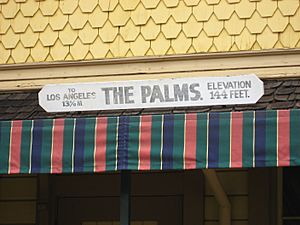
In the early 1900s, guidebooks mentioned that "The Palms" was named because of the many large palm trees near the train station. Over time, people stopped saying "The" in front of "Palms." By the 1920s, it was simply known as "Palms."
Geography of Palms
Palms' Boundaries
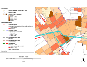
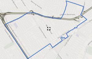
Palms does not have official borders. However, the "Mapping L.A." guide from the Los Angeles Times says it covers about 1.95 square miles. It is located northwest of Culver City. It is also south of Cheviot Hills and Beverlywood. To its west is Rancho Park. To the east is Mid-City, and to the northeast is Mar Vista.
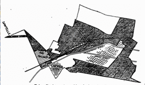
When Palms first joined Los Angeles in 1915, its borders were different. The area west of Overland Avenue did not join until 1927. A part of Palms called Westside Village was built before World War II. It has its own neighborhood signs and homeowners association.
Where is Palms?
Palms is surrounded by several other neighborhoods in Los Angeles.
 |
West Los Angeles | Cheviot Hills | La Cienega Heights & South Robertson |  |
| Mar Vista | Mid City & South Robertson | |||
| Mar Vista & Culver City | Culver City | Culver City & Baldwin Hills |
People in Palms
In 2000, the population of Palms was 42,545 people. By 2008, it was estimated to be 45,475. Palms is one of the most crowded neighborhoods in Los Angeles. It has about 21,983 people per square mile.
Palms is also a very diverse neighborhood. People from many different backgrounds live there. About 45.9% of adults in Palms have a four-year college degree. This is a high number for Los Angeles. Many young adults, aged 19 to 34, live in Palms. About 40.4% of residents were born outside the United States.
Housing in Palms
Before the 1960s, Palms mostly had single-family homes and small apartment buildings. These homes were often built in the Craftsman and Spanish Colonial styles.
Later, the city of Los Angeles changed the rules for building in Palms. This was to help create more affordable housing. Because of this, many older homes were replaced with larger apartment buildings. Now, Palms is one of the most crowded neighborhoods in Los Angeles. It has many affordable rental units.
Most homes in Palms are now apartments. About 92% of people living there rent their homes. The Westside Village area is one of the few places left with many owner-occupied single-family homes. Many people who live in Palms work in nearby Culver City. Culver City has many offices and businesses but fewer people living there.
These were the ten neighborhoods or cities in Los Angeles County with the highest population densities, according to the 2000 census, with the population per square mile:
- Koreatown, Los Angeles, 42,611
- Westlake, Los Angeles, 38,214
- East Hollywood, Los Angeles, 31,095
- Pico-Union, Los Angeles, 25,352
- Maywood, California, 23,638
- Harvard Heights, Los Angeles, 23,473
- Hollywood, Los Angeles, 22,193
- Walnut Park, California, 22,028
- Palms, Los Angeles, 21,870
- Adams-Normandie, Los Angeles, 21,848
Getting Around Palms
Highways for Travel
Palms is close to two major highways: the 405 (San Diego Freeway) and the 10 (Santa Monica Freeway). These highways help people travel to and from Palms.
Metro Rail Service
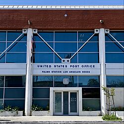
Palms is served by the Metro E Line. This train line brings back passenger service that used to exist from 1875 to 1953. The new service started in 2012. The E Line now runs between East Los Angeles and Santa Monica. There is a stop at the Palms station, which opened on May 20, 2016.
Bicycling in Palms
Palms is a good place for bicycling. Many people ride bikes because the neighborhood is busy, has a young population, and parking can be hard to find. Both Venice Boulevard and Motor Avenue, which are main streets, have special lanes for bikes. There is also a bike path next to the Metro E Line tracks called the Expo Bike Path. This path is great for getting to the Palms station and for fun rides.
Palms also has a new shared-ride service called LAnow. This service started in May 2019. Users can book a ride using a smartphone app, online, or by phone. You meet the shuttle at a special pick-up/drop-off spot, which is always close by.
Fun Places and Landmarks
Palms has many interesting places that show its diverse community. You can find religious sites like the International Society for Krishna Consciousness and the Iranian-American Muslim Association of North America (IMAN).
The neighborhood also has many restaurants and businesses from Indonesian, Indian, and Pakistani cultures. It is also a center for the Brazilian community in Los Angeles, with Brazilian restaurants and shops.
Palms is home to some unique places. These include the Museum of Jurassic Technology, which is an unusual museum. There is also a research center called the Center for Land Use Interpretation. For theater lovers, the Ivy Substation is a theater that is home to the Actors Gang. The Ivy Substation is located in Media Park.
Education in Palms
Many adults in Palms have earned a college degree. This is a high number compared to the rest of the city and county.
Here are some of the schools located in Palms:
- Redeemer Baptist Elementary School (private)
- Clover Avenue Elementary School (LAUSD)
- Le Lycée de Los Angeles (private)
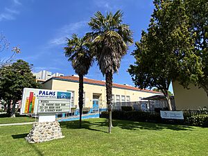
- Palms Elementary School (LAUSD)
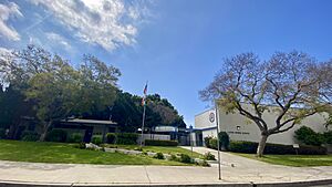
- Palms Middle School (LAUSD)
- Magnolia Science Academy No. 6 (charter school)
- Saint Augustine Elementary School (private)
- Charnock Road Elementary School (LAUSD)
- New World Montessori School (private)
The public high school for Palms is Alexander Hamilton High School (Los Angeles).
Parks and Recreation
Palms has its own parks for residents to enjoy. Palms Park and Palms Recreation Center are popular spots. The recreation center has an auditorium, places for barbecues, and lighted outdoor basketball courts. It also has a room for children to play and picnic tables. The Palms Park Child Care Center is next to the park and offers preschool for young children.
Woodbine Park is another park in Palms. It is a smaller park with picnic tables, a basketball court, and a play area for children.
|


