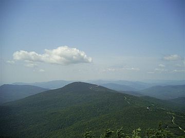
Pico Peak facts for kids
Quick facts for kids Pico Peak |
|
|---|---|

Pico Peak seen from Killington Peak
|
|
| Highest point | |
| Elevation | 3,967 ft (1,209 m) |
| Prominence | 590 ft (180 m) |
| Listing | #71 New England 100 Highest |
| Geography | |
| Location | Rutland County, Vermont |
| Parent range | Coolidge Range |
| Topo map | USGS Pico Peak Quad |
| Climbing | |
| Easiest route | maintained hiking trail |
Pico Peak is a mountain located in Rutland County, Vermont, United States. It is part of the famous Green Mountains. When you look at it from Sherburne Pass, the top of Pico Peak looks like a cone.
Pico Peak is surrounded by other interesting mountains. To its south, you'll find Ramshead Peak. To the north, it faces Deer Leap Mountain across Sherburne Pass.
Contents
About the Coolidge Range
Pico Peak is the mountain furthest north in the Coolidge Range. It is also the second tallest mountain in this range, right after Killington Peak.
In 1927, the state government decided to name this mountain range. They named it after Calvin Coolidge, who was born in Vermont. He later became a President of the United States. The Coolidge Range stretches from Pico Peak all the way to Plymouth, which is where Coolidge grew up.
How Pico Peak Got Its Name
The name 'Pico' might have a few different origins. One idea is that it comes from the Abenaki language. In Abenaki, it could mean "the pass" or "the opening."
Another idea is that the name comes from the Spanish or Portuguese word for "peak," which is Pico. The name "Pico Peak" has been used for a long time. It appears on old maps from the 1800s.
Where the Water Flows
Water from Pico Peak flows in different directions, eventually reaching large bodies of water.
- Northeast Side: Water from this side flows into Kent Brook. This brook then joins the Ottauquechee River, which flows into the Connecticut River. Finally, the water reaches Long Island Sound in Connecticut.
- Southeast Side: Water here drains into Roaring Brook. This brook also flows into the Ottauquechee River.
- Northwest Side: Water from this part of the mountain goes into Mendon Brook. Mendon Brook then flows into East Creek, and then into Otter Creek. Otter Creek empties into Lake Champlain. From Lake Champlain, the water travels through the Saint Lawrence River to the Gulf of St. Lawrence in Quebec, Canada.
- Southwest Side: Water here drains into Brewer's Brook, which then joins Mendon Brook.
Pico Mountain Ski Area
Pico Peak and about 1,000 acres (4 km2) of forest were given as a birthday gift to a person named Mortimer R. Proctor in 1910. He later sold the mountain to Pico Ski Inc. in 1948.
Today, the Pico Mountain ski area is located on the northwest side of Pico Peak. Its main lodge is right on U.S. Route 4. Pico Mountain first opened for skiing in 1937. It was also home to the very first T-bar lift in the United States, which was installed in 1940. Since December 1997, Pico Mountain has been part of the larger Killington Ski Resort.
Hiking Trails
Pico Peak is a popular spot for hikers, with several well-known trails nearby.
The Appalachian and Long Trails
The Appalachian Trail (AT) is a very long hiking path. It stretches for 2,170-mile (3,490 km) from Georgia to Maine. The Long Trail (LT) is another long path, 272-mile (438 km), that runs along the ridge of the Green Mountains from Massachusetts to Quebec. In this area, the Long Trail and Appalachian Trail used to follow the same path.
Before 1999, both the AT and LT passed about 0.3 mi (0.48 km) east of Pico Peak's summit. However, they were re-routed in 1999. Now, both trails go west of the mountain.
Sherburne Pass Trail
The old path that the AT and LT used to follow is now called the Sherburne Pass Trail. It is marked with blue blazes (paint marks on trees). Before the re-routing, this section was simply known as the Long Trail.
Reaching the Summit
To reach the very top of Pico Peak, hikers can use the 0.4 mi (0.64 km) Pico Link Trail. This trail was once part of a longer path called the Pico Loop Trail, which is no longer fully used.
The AT and LT used to split up about 2 miles (3 km) north of Pico Peak, on Deer Leap Mountain. Now, they separate at a spot called Long Trail Junction. This junction is just north of U.S. Route 4.
 | Roy Wilkins |
 | John Lewis |
 | Linda Carol Brown |

