Pilot Rock (Oregon) facts for kids
Quick facts for kids Pilot Rock |
|
|---|---|

Pilot Rock
|
|
| Highest point | |
| Elevation | 5,910 ft (1,800 m) |
| Prominence | 570 ft (170 m) |
| Geography | |
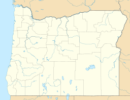
| Location | Jackson County, Oregon, United States |
| Parent range | Cascade Range |
| Topo map | USGS Siskiyou Pass |
| Geology | |
| Age of rock | 25.6 Ma |
| Mountain type | Volcanic plug |
| Volcanic arc/belt | Cascade Volcanic Arc |
| Climbing | |
| Easiest route | Scramble |
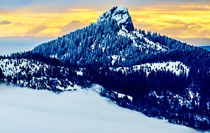
Pilot Rock is a tall, distinctive rock formation. It's a type of mountain feature called a volcanic plug. You can find it in the western Cascade Range in Oregon, close to Ashland.
This amazing rock stands out because it rises thousands of feet above the nearby Shasta and Rogue valleys. People can see it from over 40 miles (64 km) away! Pilot Rock is also very old, formed about 25.6 million years ago. It's one of the oldest parts of the Cascade Range.
Today, Pilot Rock is a protected area. It's part of the Cascade–Siskiyou National Monument and the Soda Mountain Wilderness. Many trails, including the famous Pacific Crest Trail, pass by this unique landmark.
Contents
How Pilot Rock Formed
Pilot Rock is one of the most noticeable features in the Cascade–Siskiyou National Monument. It rises 570 feet (174 m) above the hills around it.
This rock formed when hot, melted rock called magma pushed up from deep inside the Earth's crust. It found a weak spot and hardened there, creating a solid plug. Over millions of years, the softer rock around this plug slowly wore away due to erosion. This left Pilot Rock standing tall, just as we see it today. Other famous rocks formed this way include Devils Tower in Wyoming.
Scientists have studied Pilot Rock and found it is about 25.6 million years old. This makes it one of the oldest volcanic formations in the Cascade Mountains. However, the nearby Siskiyou Mountains are much older, at 425 million years old.
Rock Features
Pilot Rock has many unique cracks and patterns called columnar jointing. These formed when the hot magma cooled down and shrank. The cracks are tilted about 20 degrees to the east. This tilt happened because the Siskiyou Mountains to the west slowly lifted up over time.
The rock also has a lot of black hornblende crystals. These crystals tell us that there was a lot of water in the area when the rock first formed. At the base of Pilot Rock, you can see large piles of broken rock pieces called talus. The soil around the rock is sticky. It comes from the eroded remains of a type of volcanic rock called breccia.
History of Pilot Rock
The Takelma tribe of Native Americans were the first people to live near Pilot Rock. They called the rock Tan-ts'at-seniphtha, which means "stone standing up."
Later, early settlers called it Boundary Mountain. In 1841, a group of explorers from the United States Exploring Expedition passed through the area. They renamed the rock Emmons Peak, after Lieutenant George F. Emmons. He was a U.S. naval officer in their group. Emmons described the rock as "a singular, isolated rock, which stands like a tower on the top of the ridge."
James Clyman also wrote about the rock in 1845. The rock eventually became known as Pilot Rock. This is because it was a very important landmark for pioneers traveling north from California on the Applegate Trail. They could see it from far away, guiding their journey.
Pilot Rock is now protected. It became part of the Cascade–Siskiyou National Monument in 2000. Then, in 2009, it also became part of the Soda Mountain Wilderness.
Plants Around Pilot Rock
Pilot Rock is located in the eastern Klamath Mountains ecoregion. It is surrounded by a thick mixed coniferous forest.
In the spring and summer, many beautiful Wildflowers grow here. You might see wild strawberries, larkspur, columbine, lupine, and paintbrush. A very rare type of lily, called Gentner's fritillary, has also been found growing on and near the rock.
Trails to Pilot Rock
There are several trails that lead to Pilot Rock. You can reach them by driving on a forest road. This road ends at a parking lot about 1 mile (1.6 km) northwest of the rock.
The main trail is part of the famous Pacific Crest Trail. It goes southeast towards Pilot Rock for about 0.2 miles (0.3 km). Then, the trail splits into two paths.
- The left path is the northbound part of the Pacific Crest Trail.
- The right path is the trail that goes to the summit (top) of Pilot Rock.
The summit trail is about 1 mile (1.6 km) long and is quite steep. It climbs about 808 feet (246 m) in elevation. From the top of Pilot Rock, you can enjoy amazing views of other landmarks. These include Mount Shasta, the Trinity Alps, and Mount McLoughlin.
 | Kyle Baker |
 | Joseph Yoakum |
 | Laura Wheeler Waring |
 | Henry Ossawa Tanner |


