
Roermond facts for kids
Quick facts for kids
Roermond
Remunj / Remuunj (Limburgish)
|
|||
|---|---|---|---|
|
City and municipality
|
|||

Roermond in 2011
|
|||
|
|||
| Motto(s): | |||
.svg)
Location in Limburg
|
|||

Roermond
Location in Netherlands

Roermond
Location in Europe
|
|||
| Country | Netherlands | ||
| Province | Limburg | ||
| Government | |||
| • Body | Municipal council | ||
| Area | |||
| • Total | 71.10 km2 (27.45 sq mi) | ||
| • Land | 60.84 km2 (23.49 sq mi) | ||
| • Water | 10.26 km2 (3.96 sq mi) | ||
| Elevation | 22 m (72 ft) | ||
| Population
(May 2014)
|
|||
| • Total | 57,044 | ||
| • Density | 938/km2 (2,430/sq mi) | ||
| Demonym(s) | Roermondenaar | ||
| Time zone | UTC+1 (CET) | ||
| • Summer (DST) | UTC+2 (CEST) | ||
| Postcode |
6040–6049, 6070–6071
|
||
| Area code | 0475 | ||


Roermond is a city and municipality in the Limburg province of the Netherlands. It's an important historical town located on the east bank of the Meuse river, where the Roer river flows into it. Roermond became a city in 1231. Today, its city center is a special protected area.
For many centuries, Roermond was a busy trading hub and a main city in the Guelders region. Since 1559, it has been the home of the Roman Catholic Diocese of Roermond. The city's skyline is famous for the tall towers of its two main churches: St. Christopher's Cathedral and Roermond Minster (also called "Munsterkerk"). Besides these churches, the city center has many other important old buildings and monuments.
Contents
A Look at Roermond's Past
People called Celts lived in this area long ago, on both sides of the Roer river. Later, the Romans arrived and built a bridge. They also started the first town in Roermond, which is now a part of the city called Voorstad Sint Jacob.
Roermond in Guelders
From about 1180 to 1543, Roermond was part of the Duchy of Guelders. In 1213, the city was destroyed by Otto IV of Brunswick, a powerful German ruler. But by 1232, Roermond was rebuilt. It then gained important rights, like having its own seal, laws, and even its own money.
In 1309, a Franciscan monastery was first mentioned in the city. Roermond became the capital of the "Upper Quarter of Gelre" around 1350. In 1388, during the Hundred Years' War, French forces attacked the city. They destroyed some outer defenses and the old church.
Roermond joined the Hanseatic League in 1441. This was a powerful group of trading cities in Northern Europe. By 1472, Roermond was allowed to make its own coins.
Under Spanish Rule
Between 1543 and 1702, Roermond was part of the Spanish Netherlands. This period was known as Ruremunda in Spanish.
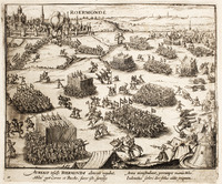
The Eighty Years' War began near Roermond in 1568. In 1572, William the Silent and his Dutch forces took control of Roermond. Sadly, on July 23, 1572, a tragic event occurred when 13 Catholic priests were killed by Dutch Calvinists. Spanish forces, led by Duke Fadrique Álvarez de Toledo, soon recaptured the city.
During Spanish rule, Roermond became a strong center for the Counter-Reformation. This was a movement to strengthen the Catholic Church. In 1613, a very sad event happened: 64 people accused of witchcraft were executed on Galgeberg hill. This was the largest witch trial in the Netherlands.
In 1632, the Dutch leader Frederik Hendrik captured Roermond. However, the local people, who were mostly Catholic, did not support the Dutch Calvinists.
Roermond was controlled by the Dutch Republic from 1632 to 1637, and again from 1702 to 1716. From 1716 to 1794, it was part of the Austrian Netherlands.
The French Era


During the French Revolutionary Wars, French forces took Roermond in December 1792. But by March 1793, the city was back under Austrian control. The French occupied it again in April 1794. From 1795 to 1814, Roermond was officially part of a French region called Meuse-Inférieure. In 1814, Russian forces freed Roermond.
Part of the Netherlands
,_REPRODUCTIE_VAN_DIA,_NUMMER_2235_-_Roermond_-_20297019_-_RCE.jpg)
After a treaty in 1814, Roermond became part of the new Kingdom of the Netherlands. The province it was in was named "Limburg" by King William.
When the Netherlands and Belgium separated in 1830, Limburg was divided. The eastern part, including Roermond, became part of the Netherlands.
During World War II, German forces occupied Roermond from 1940 to 1945. On March 1, 1945, American troops liberated the city. By that time, about 90% of all buildings in Roermond were damaged or destroyed. After the war, the city center was carefully rebuilt to its former beauty.
In 1988 and 1990, there were sad attacks in Roermond and nearby areas. These events caused great sorrow.
On April 13, 1992, a magnitude 5.4 earthquake happened near Roermond. It was the strongest earthquake in Western Europe since 1756. This event helped scientists learn more about the earth's movements in the area.
Roermond's Location

Roermond is in the middle of the Limburg province. The Meuse river forms its western border, and Germany is to its east.
Nearby Towns and Villages
The municipality of Roermond includes the main city and several other population centers:
- Roermond
- Asenray
- Asselt
- Boukoul
- Herten
- Leeuwen
- Maasniel
- Merum (Roermond)
- Ool
- Swalmen
Weather in Roermond
Roermond has a mild climate. Here are some facts about its weather:
| Climate data for Ell (extremes 1999–) | |||||||||||||
|---|---|---|---|---|---|---|---|---|---|---|---|---|---|
| Month | Jan | Feb | Mar | Apr | May | Jun | Jul | Aug | Sep | Oct | Nov | Dec | Year |
| Record high °C (°F) | 15.6 (60.1) |
17.4 (63.3) |
23.2 (73.8) |
28.9 (84.0) |
33.1 (91.6) |
34.6 (94.3) |
37.1 (98.8) |
37.0 (98.6) |
32.7 (90.9) |
25.9 (78.6) |
22.0 (71.6) |
16.0 (60.8) |
37.1 (98.8) |
| Daily mean °C (°F) | 3.1 (37.6) |
4.0 (39.2) |
6.4 (43.5) |
10.2 (50.4) |
14.2 (57.6) |
17.0 (62.6) |
18.4 (65.1) |
17.6 (63.7) |
14.9 (58.8) |
11.0 (51.8) |
7.1 (44.8) |
3.2 (37.8) |
10.6 (51.1) |
| Record low °C (°F) | −20.8 (−5.4) |
−16.2 (2.8) |
−13.3 (8.1) |
−4.6 (23.7) |
−0.2 (31.6) |
3.1 (37.6) |
4.5 (40.1) |
3.5 (38.3) |
0.4 (32.7) |
−6.4 (20.5) |
−6.7 (19.9) |
−15.0 (5.0) |
−20.8 (−5.4) |
| Source: Royal Netherlands Meteorological Institute (1971–2000 extremes) | |||||||||||||
Nature and Fun Activities
Roermond is surrounded by beautiful green areas, perfect for hiking and cycling. To the east, you'll find nature reserves like the Meinweg National Park. This area has forests, heathlands, and meadows. You might even spot a small group of vipers, which are the only venomous snakes in the Netherlands!
To the west, the Meuse river and its lake area, called "Maasplassen", are great for water sports and recreation.
Dealing with Floods
Because Roermond is located near the Meuse and Roer rivers, it sometimes faces floods. The most serious floods happened in 1993 and 1995. The city has built defenses to protect itself from high water.
| Year | Water level (mNAP) | At | Damage | Remarks |
|---|---|---|---|---|
| December 1643 | 49.7 | Maastricht | Highest level ever in Limburg | |
| December 1880 | 20.71 | Roermond | ||
| March 1910 | 46.1 | Maastricht | ||
| March 1920 | 20.6 | Roermond | ||
| January 1926 | 42.92 | Maastricht | 80 million Dutch guilders damage, 14,000 refugees | Largest flood disaster in Limburg, breakthrough of dikes |
| July 1980 | Roermond | |||
| 1984 | Roermond | |||
| December 1993 | 45.8 | Borgharen | 245 million guilders damage | |
| January 1995 | 45.71 | Borgharen | 500 million guilders damage, 210,000 people evacuated | Longest high water ever in Limburg |
Roermond's Economy
Roermond has grown steadily over the years. In the 21st century, its economy got a big boost. This was mainly because of the new A73 highway. This highway circles Roermond on the east side and includes the Roertunnel and the Swalmertunnel. These tunnels help traffic flow smoothly through and around the city. Another important road is the German autobahn A52, which connects Roermond directly to Düsseldorf.
Designer Outlet Roermond
Since 2001, Roermond has been home to a huge McArthurGlen Designer Outlet. This outlet has become one of the biggest and most popular in Europe. It attracts nearly six million visitors every year! This makes it one of the top tourist attractions in the Netherlands. By 2017, it had grown to include 200 shops. Many shoppers come from France, Germany, Belgium, and China to visit.
Culture and Events

Festivals and Celebrations
Roermond hosts several fun festivals. One important event is the Liberation Day festival on May 5th, which celebrates freedom. Another popular event is the Solar Weekend dance festival.
The City's Anthem
Roermond has its own special song, or anthem, since 1912. The words were written by A. F. van Beurden, and the music was composed by H. Tijssen. He also wrote the music for the Limburg Anthem. This anthem is a way for the people of Roermond to show their pride in their city.
Places to Visit

Roermond's old city center has many historical buildings and monuments worth seeing:
- Carolus Chapel
- Cuypershuis
- Kapel in 't Zand
- Kasteel Hattem
- Munsterkerk
- National Indiëmonument
- Rattentoren
- Roermond City Hall
- St. Christopher's Cathedral
Getting Around Roermond
Roermond has good roads that connect it to the Dutch and German highway systems. The A73 highway runs east of the city, with parts going through tunnels. To the east, the German A52 highway leads to Düsseldorf. To the west, the N280 road goes towards Weert and connects to the A2 highway, which leads to Eindhoven.

Roermond also has a busy train station. Fast trains run every 15 minutes to:
There are also local trains that run every half hour to:
- Northeast: Venlo-Nijmegen
- South: Sittard-Maastricht
The nearby town of Swalmen also has a train station for local trains. For getting around the region, there is a bus station with routes to nearby villages and towns.
Famous People from Roermond
Many interesting people have come from Roermond, including artists, athletes, and important public figures.
Public Service and Thinkers

- Denis the Carthusian (1402–1471), a Catholic thinker and mystic.
- Pierre Cuypers (1827–1921), a famous architect who designed many buildings.
- Charles Ruijs de Beerenbrouck (1873–1936), who served as Prime Minister of the Netherlands.
- Louis Beel (1902–1977), another Prime Minister of the Netherlands.
- Jo Cals (1914–1971), also a Prime Minister of the Netherlands.
Artists and Performers
.jpg)
- Jan Frans van Douven (1656–1727), a painter.
- Louis Raemaekers (1869–1956), a painter and cartoonist.
- Marleen Gorris (born 1948), a writer and film director.
- Stefanie Joosten (born 1988), a model, singer, and actress.
- Timor Steffens (born 1987), a dancer and choreographer.
Sports Stars

- Anna Wood (born 1966), an Olympic sprint canoeist who won bronze medals.
- Rogier Wassen (born 1976), a tennis player.
- Harrie Gommans (born 1983), a footballer.
Online Personalities
- Jelle van Vucht (born 1996), a popular YouTuber with millions of followers.
|
See also
 In Spanish: Roermond para niños
