
Saharanpur facts for kids
Quick facts for kids
Saharanpur
|
|
|---|---|
|
Shakumbari Devi Temple; Saharanpur Junction railway station
|
|

Saharanpur
Location in Uttar Pradesh

Saharanpur
Location in India
|
|
| Country | |
| State | Uttar Pradesh |
| District | Saharanpur |
| Government | |
| • Type | Municipal Corporation |
| • Body | Saharanpur Municipal Corporation |
| Population
(2011)
|
|
| • Total | 705,478 |
| Languages | |
| • Official | Hindi, Urdu, Khariboli |
| Time zone | UTC+5:30 (IST) |
| PIN |
247001/02
|
| Telephone code | 0132 |
| Vehicle registration | UP-11 |
| Airport | Sarsawa Airport |
| Sex ratio | 1000/898 ♂/♀ |

Saharanpur is a city and a municipal corporation in Uttar Pradesh, India. It is also the main office for the Saharanpur district. The city got its name from a Sufi saint named Shah Haroon Chishti.
Saharanpur is one of the 100 "Smart Cities" chosen by the Indian government. This is part of a plan to make cities better and more modern.
Contents
Explore Saharanpur: A City in India
Saharanpur's Rich History
Early History: Medieval Times
During the time of Sultan Iltutmish (1211–1236), this area became part of the Delhi Sultanate. Back then, it was mostly covered with forests and swamps. Rivers like Paondhoi flowed through it.
Later, Sultan Muhammad bin Tughluq (1325–1351) visited the area. He heard about a wise saint living by the Paondhoi River. After meeting the saint, he decided the region would be called 'Shah-Haroonpur' after him. You can still find the saint's tomb in the oldest part of Saharanpur city.
By the late 1300s, the Delhi Sultanate was weaker. A ruler named Timur from Central Asia attacked India in 1399. He marched through Saharanpur on his way to Delhi. The people of Saharanpur tried to fight his army but were not successful.
Mughal Empire's Influence
In the 16th century, Babur, a ruler from Central Asia, started the Mughal Empire in India. During the Mughal period, Akbar (1542–1605) made Saharanpur an important administrative area.
Akbar gave the land of Saharanpur to his treasurer, Sah Ranveer Singh. He was an Aggarwal Jain. Sah Ranveer Singh started building the city we know today. Saharanpur used to be a walled city with four gates. You can still see parts of his old fort in the Chaudharian area of Saharanpur. He also built a large Jain temple there.
Sayyids and Rohillas Take Over
Later Mughal emperors gave control of the Sarwat area to Muslim Sayyid families. In 1633, one of these families founded a city called Muzaffarnagar.
After 1739, the area became chaotic. Different groups took control. The Rohillas eventually gained power over the region. Ahmad Shah Durrani, an Afghan ruler, gave Saharanpur to a Rohilla chief named Nawab Najib ad-Dawlah in 1754. He tried to make friends with the Hindu Gurjar chief Manohar Singh to protect his land.
Maratha Rule in Saharanpur
In 1757, the Maratha army took over Saharanpur. This meant Nawab Najeeb-ud-Daula lost control. The fighting between the Rohillas and Marathas ended in 1788. Ghulam Qadir, a Rohilla leader, was defeated by the Maratha general Mahadaji Shinde. Ghulam Qadir built the Nawab Ganj area and the Ahmedabadi fortress in Saharanpur.
After Ghulam Qadir's defeat, Saharanpur became the northernmost part of the Maratha Empire. During Maratha rule, the Bhuteshwar Temple and Bagheshwar Temple were built in Saharanpur. In 1803, the British East India Company defeated the Maratha Empire. This made Saharanpur part of British India.
British Era and New Schools
In 1857, people in India rebelled against British rule. Saharanpur was part of this uprising. After the rebellion, the British took strong actions.
Later, two important Islamic schools were founded. Muhammad Qasim Nanautawi and Rashid Ahmad Gangohi started a school in Deoband in 1867. This school, called the Darul Uloom Deoband, became very famous worldwide. Its goal was to teach Muslims about their faith and culture. It also aimed to promote unity among Hindus and Muslims in India. Muslim scholars in Saharanpur supported this idea. They started another school, Mazahir Uloom, six months later.
Where is Saharanpur? (Geography)

Saharanpur is located at about 29.97°N latitude and 77.55°E longitude. It is about 130 kilometers (81 miles) southeast of Chandigarh. It is also about 170 kilometers (106 miles) northeast of Delhi.
The city is part of a geographical area called a "doab," which means land between two rivers. Saharanpur district is special because it touches the borders of four different states: Himachal Pradesh, Uttar Pradesh, Uttarakhand, and Haryana.
Weather in Saharanpur
Saharanpur has a varied climate.
- In January, the average high temperature is 20°C (68°F).
- In June, the average high temperature can reach 46°C (115°F).
- The city gets most of its rain during July and August.
- The average yearly rainfall is about 830 millimeters (32.7 inches).
People and Languages (Demographics)
How Many People Live Here?
According to the 2011 Indian census, Saharanpur had a population of 705,478 people. About 12.5% of these people were under six years old. The city covers an area of about 46.74 square kilometers (18.05 sq mi).
For every 1,000 males, there were about 891 females in the city. The average literacy rate, which means how many people can read and write, was 76.32%. About 33% of the city's population lives in slum areas.
Different Religions and Languages
About half of the people in Saharanpur are Hindus. Muslims make up about 45% of the population. There are also smaller numbers of Sikhs and Jains.
The most common language spoken in Saharanpur is Hindi. Urdu is also widely spoken. Both Hindi and Urdu are official languages in Uttar Pradesh. You will also find many people who speak Punjabi. The local dialect of Hindi spoken here is called Khari Boli.
Fun Places to Visit (Culture)
Famous Gardens: Company Garden
The Saharanpur Botanical Gardens, also known as the Company Garden, is one of India's oldest gardens. It was created before 1750. It was first a pleasure garden for a local chief. In 1817, the British East India Company took it over.
This garden is famous for bringing the tea plant from China to India. This helped start the tea trade in the Himalaya mountains and Assam. Today, the garden is full of green plants and many beautiful flowers.
Ancient Temple: Shakumbhari Devi
The Siddhpeeth Shri Shakumbhari Devi Temple is an important and very old Hindu temple. It is located in the Shivalik hills, about 40 kilometers (25 miles) from Saharanpur. Many people visit this temple every year. Shakumbhari Devi is a famous Shaktipeeth, which is a special shrine dedicated to Maa Durga.
Amazing Wood Carvings
Saharanpur is known as the "Wood Carving City." It is a center for art and culture in India. The city is famous for its beautiful wooden items that are carved by hand.
Oldest Settlements: Hulas Site
About 40 kilometers (25 miles) south of Saharanpur, there is an archaeological site called Hulas. This site shows evidence of a very old settlement from the late Harappan period, dating back to 2000 BC. It is one of the important Harappan sites in Western Uttar Pradesh.
Getting Around (Transport)

Roads and Highways
Two main National Highways pass through Saharanpur: NH 709B and NH 344.
- NH 709B starts in Saharanpur and connects it to Delhi.
- NH 344 connects Saharanpur with Ambala, Yamunanagar, and Roorkee.
- Uttar Pradesh State Highway 57 also goes through the city.
- A new expressway, the Delhi–Saharanpur–Dehradun Expressway, is planned to be ready by March 2024.
Train Travel
Saharanpur Junction is the main train station in the city. It is a busy hub where several train lines meet.
- Saharanpur was first connected by train in 1870. This line connected Amritsar to Delhi.
- Another line connecting Saharanpur with Moradabad was finished in 1886.
- A narrow-gauge railway connecting Shahdara (in Delhi) with Saharanpur opened in 1907. This railway was later closed in 1970 and rebuilt as a wider track in the late 1970s.
- Saharanpur is also on the route of the planned Eastern Dedicated Freight Corridor project, which will help move goods by train more efficiently.
Images for kids
-

Shakumbari Devi Temple
-
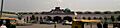
Saharanpur Junction railway station

See also
 In Spanish: Saharanpur para niños
