Sandwich Mountain facts for kids
Quick facts for kids Sandwich Mountain |
|
|---|---|

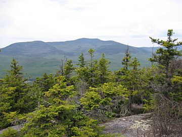
View from Mount Israel
|
|
| Highest point | |
| Elevation | 3,983 ft (1,214 m) |
| Prominence | 1,200 ft (370 m) |
| Listing | #68 New England 100 Highest |
| Geography | |
| Location | Carroll / Grafton counties, New Hampshire, U.S. |
| Parent range | Sandwich Range |
| Topo map | USGS Mount Tripyramid |
| Climbing | |
| Easiest route | maintained hiking trail |
Sandwich Mountain, also known as Sandwich Dome, is a tall mountain in New Hampshire. It stands about 3,983 feet (1,214 meters) high. This mountain is located right on the edge of Carroll and Grafton counties. It is part of the beautiful Sandwich Range, which is a section of the larger White Mountains.
Contents
About Sandwich Mountain
Sandwich Mountain is a well-known peak in New Hampshire. It is one of the highest mountains in the Sandwich Range. The mountain is popular for hiking and offers great views.
Location and Neighbors
Sandwich Mountain sits between two counties, Carroll and Grafton. It also touches parts of the towns of Sandwich and Waterville Valley.
Other mountains are close by. To its northeast, you'll find Mount Tripyramid. To its southwest, across a place called Sandwich Notch, is Mount Weetamoo.
Hiking Trails
If you like to explore, you'll be happy to know that there are several hiking trails on Sandwich Mountain. These trails are kept in good condition. They lead right over the mountain's top, making it a great spot for adventurers.
Water Flow from the Mountain
Rain and melting snow on Sandwich Mountain flow into different rivers. This water eventually makes its way to the ocean.
North and West Sides
Water from the north side of the mountain flows into Drakes Brook. This brook then joins the Mad River. The Mad River flows into the Pemigewasset River. From there, the water goes into the Merrimack River. Finally, it reaches the Gulf of Maine near Newburyport, Massachusetts.
The west side of Sandwich Mountain also drains into Smarts Brook, which then flows into the Mad River.
Southwest Side
Water from the southwest part of the mountain flows into the Beebe River. This river also joins the Pemigewasset River.
South and East Sides
The south side of Sandwich Mountain drains into the Cold River. This river then flows into the Bearcamp River, then the Ossipee River, and finally the Saco River. The Saco River reaches the Gulf of Maine at Saco, Maine.
Water from the east side of the mountain flows into Pond Brook, which also joins the Cold River.
 | Jackie Robinson |
 | Jack Johnson |
 | Althea Gibson |
 | Arthur Ashe |
 | Muhammad Ali |

