Sausalito, California facts for kids
Quick facts for kids
Sausalito, California
|
||
|---|---|---|
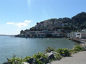
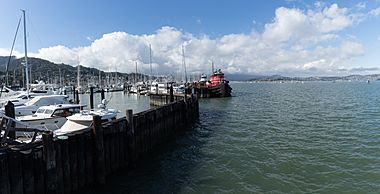
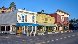
Sausalito combines hillside with shoreline, as seen in this view from Bridgeway, the city's central street.
|
||
|
||
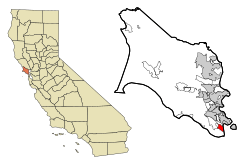
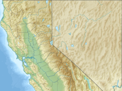
Location in Marin County and the state of California
|
||
| Country | United States | |
| State | California | |
| County | Marin | |
| Incorporated | September 4, 1893 | |
| Area | ||
| • Total | 2.26 sq mi (5.9 km2) | |
| • Land | 1.76 sq mi (4.6 km2) | |
| • Water | 0.49 sq mi (1.3 km2) 21.54% | |
| Elevation | 10 ft (3 m) | |
| Population
(2020)
|
||
| • Total | 7,269 | |
| • Density | 4,120.74/sq mi (1,591.03/km2) | |
| Time zone | UTC−8 (PST) | |
| • Summer (DST) | UTC−7 (PDT) | |
| ZIP codes |
94965, 94966
|
|
| Area codes | 415/628 | |
| FIPS code | 06-70364 | |
| GNIS feature IDs | 277597, 2411834 | |
Sausalito is a city in Marin County, California, United States. Its name comes from the Spanish word sauzalito, which means "small willow grove."
The city is located just 1.5 miles (2.4 kilometers) southeast of Marin City. It is also about 4 miles (6 km) north of San Francisco, right across the Golden Gate Bridge.
In 2020, Sausalito had a population of 7,269 people. It is known for being close to the northern end of the Golden Gate Bridge. Before the bridge was built, it was a major stop for trains, cars, and ferries.
During World War II, Sausalito quickly grew as a place for building ships. After the war, it became known as a beautiful and artistic town. Many people live in houseboats here. It is also a popular place for tourists to visit. The city is surrounded by the Golden Gate National Recreation Area and the San Francisco Bay.
Contents
- What's in a Name? Sausalito's Meaning
- Exploring Sausalito's Geography
- Sausalito's History: A Journey Through Time
- Sausalito's Population: Demographics
- Global Connections: Sausalito's Sister Cities
- Sausalito in the Media
- Learning in Sausalito: Education
- Fun in Sausalito: Parks and Recreation
- Living on the Water: Sausalito's Houseboats
- Famous Faces: Notable People from Sausalito
- Sausalito's Businesses and Industries
- Images for kids
- See also
What's in a Name? Sausalito's Meaning
The name Sausalito comes from the Spanish word sauzalito. This means "small willow grove." It comes from sauce, meaning "willow," and -ito, which means "small."
Long ago, people used different spellings for the name. Some of these were Saucelito, San Salita, and Sousolito.
Exploring Sausalito's Geography
Sausalito is located at 37°51′33″N 122°29′07″W / 37.85917°N 122.48528°W. It has both steep, wooded hillsides and flat areas along the shoreline. The city covers about 2.2 square miles (5.7 km2) in total.
Most of this area is land, about 1.8 square miles (4.7 km2). But a large part, about 21.54% (or 0.5 square miles), is covered by water. This has been true since the city was founded in 1868. Important water areas near Sausalito include Richardson Bay and Pine Point.
When Sausalito was first planned, people thought they might add more land by filling in parts of the shoreline. This was done in nearby San Francisco. Because of this, some old street names like Pescadero and Eureka are actually under the water of Richardson Bay. This has caused some discussions, especially because some houseboats float right above these "underwater streets."
Sausalito's Climate
Sausalito has a Mediterranean climate. This means it has mild, wet winters and warm, dry summers. However, because it is right next to the San Francisco Bay, it gets cool breezes. This makes the temperatures lower than you might expect.
| Climate data for Sausalito, California | |||||||||||||
|---|---|---|---|---|---|---|---|---|---|---|---|---|---|
| Month | Jan | Feb | Mar | Apr | May | Jun | Jul | Aug | Sep | Oct | Nov | Dec | Year |
| Mean daily maximum °F (°C) | 57 (14) |
60 (16) |
62 (17) |
63 (17) |
64 (18) |
67 (19) |
67 (19) |
68 (20) |
70 (21) |
69 (21) |
63 (17) |
57 (14) |
64 (18) |
| Mean daily minimum °F (°C) | 46 (8) |
48 (9) |
49 (9) |
49 (9) |
51 (11) |
53 (12) |
54 (12) |
55 (13) |
55 (13) |
54 (12) |
50 (10) |
46 (8) |
51 (11) |
| Average precipitation inches (mm) | 4.50 (114) |
3.61 (92) |
3.26 (83) |
1.46 (37) |
.70 (18) |
.16 (4.1) |
0 (0) |
.06 (1.5) |
.21 (5.3) |
1.12 (28) |
3.16 (80) |
4.56 (116) |
22.80 (579) |
| Source: Weather Channel | |||||||||||||
Sausalito's History: A Journey Through Time
Early Inhabitants: The Coast Miwok People
Long ago, Sausalito was home to a Coast Miwok village called Liwanelowa. The people living here were known as the Huimen. Early explorers described them as very friendly. Sadly, over time, the culture of the Coast Miwok people disappeared due to European settlement.
European Arrival and Early Settlement
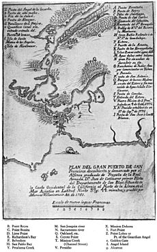
The first European to visit Sausalito was Don José de Cañizares in 1775. His group found friendly native people and many animals like deer and sea lions. They also found lots of large trees, which were useful for building ships.
Even with these good reports, the Spanish government did not build much in Sausalito. They built a military base (Presidio of San Francisco) and a mission (Mission Dolores) on the other side of the bay. This left Sausalito as mostly wilderness for many years.
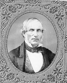
The area began to develop when William A. Richardson arrived in 1822. He was an English sailor who spoke Spanish. He became an important person in the Mexican territory. In 1825, he became a Mexican citizen and married the daughter of a military leader.
Richardson wanted his own land. He asked for a large piece of land across the bay from the Presidio, which he called "Rancho Saucelito." The name likely referred to a small group of willow trees, showing there was a freshwater spring.
Before he even owned the land, Richardson used the spring to sell fresh water to ships. After many years, he officially received the title to his large ranch in 1838.
From Fishing Village to Transit Hub
After the California Gold Rush, Sausalito's unique location became very important. It was close to San Francisco but hard to reach by land. This meant that commercial fishermen and wealthy yacht owners, who both used boats, were the main groups of people living there.
In the 1870s, a manganese mine was found in the hills west of town. A plant was built to process the ore. However, Sausalito did not become a major mining center.
The first post office opened in 1870. In the 1870s, the North Pacific Coast Railroad extended its tracks to Sausalito. A train yard and a ferry service to San Francisco were set up. Sausalito became a busy transportation center.
By 1926, a large car ferry service started from the Sausalito Ferry Terminal to San Francisco. This ferry was part of old U.S. Highway 101. Many cars would line up, making traffic a big part of the town. Train service also grew to handle the increased traffic.
This busy era ended in May 1937 when the Golden Gate Bridge opened. The bridge made the large ferry operations unnecessary. Since Highway 101 now bypassed Sausalito, traffic in town greatly decreased. Car ferry service stopped in 1941. However, passenger ferry service still runs today, connecting Sausalito to San Francisco.
Sausalito During World War II
When the United States entered World War II, military bases like Fort Barry and Fort Baker became very active. Many soldiers were housed there.
A large shipyard called Marinship was built along Sausalito's shoreline by the Bechtel Corporation. Thousands of workers lived in a nearby community called Marin City. This area was created by using soil dredged from Richardson Bay. A part of this area became known as Schoonmaker Point.
A ship named USS Sausalito (PF-4) was named in honor of the city's help in the war. This ship was built in Richmond, California, not Sausalito.
The Marinship Shipyards were important for the civil rights movement. In 1944, a court case called James v. Marinship ruled that African Americans could not be kept from jobs because of their race. This was a big step forward for equal rights.
After the War: Houseboats and Open Spaces
After World War II, a lively community grew in the abandoned shipyards. By the late 1960s, many houseboat communities were along Sausalito's waterfront. In the 1970s, there were conflicts between houseboat residents and developers. These were called the "Houseboat Wars."
Today, three houseboat communities still exist: Galilee Harbor, Waldo Point Harbor, and the Gates Cooperative.
In 1965, the City of Sausalito sued Marin County to stop a plan to build a new city called Marincello next to Sausalito. Sausalito won the lawsuit in 1970. The land was then made into open space as part of the Golden Gate National Recreation Area.
Sausalito's Population: Demographics
| Historical population | |||
|---|---|---|---|
| Census | Pop. | %± | |
| 1880 | 476 | — | |
| 1890 | 1,334 | 180.3% | |
| 1900 | 1,628 | 22.0% | |
| 1910 | 2,383 | 46.4% | |
| 1920 | 2,790 | 17.1% | |
| 1930 | 3,667 | 31.4% | |
| 1940 | 3,540 | −3.5% | |
| 1950 | 4,828 | 36.4% | |
| 1960 | 5,331 | 10.4% | |
| 1970 | 6,158 | 15.5% | |
| 1980 | 7,338 | 19.2% | |
| 1990 | 7,152 | −2.5% | |
| 2000 | 7,330 | 2.5% | |
| 2010 | 7,061 | −3.7% | |
| 2020 | 7,269 | 2.9% | |
| U.S. Decennial Census | |||
Sausalito in 2010
In 2010, Sausalito had a population of 7,061 people. Most residents (90.6%) were White. About 4.8% were Asian, and 4.1% were Hispanic or Latino.
There were 4,112 households. About 10.2% of these had children under 18. The average household size was 1.71 people. Many households (46.9%) were made up of individuals living alone.
The population included 8.7% under 18 years old and 21.2% who were 65 or older. The average age was 51.1 years.
Sausalito in 2000
In 2000, Sausalito had 7,330 people. There were 4,254 households. About 8.8% of households had children under 18. The average household size was 1.72 people.
The population was spread out, with 7.4% under 18 and 12.3% aged 65 or older. The average age was 45 years.
The median income for a household in the city was $87,469. For a family, it was $123,467.
Global Connections: Sausalito's Sister Cities
Sausalito has "sister city" relationships with other cities around the world. These connections help people from different places learn about each other's cultures.
 Viña del Mar, Chile
 Sakaide, Kagawa, Japan
 Cascais, Portugal
Sakaide, Japan, became a sister city in 1988. They have a program for young people to exchange cultures.
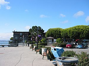
Viña del Mar, Chile, became a sister city in 1960. Sausalito has a main plaza named Viña del Mar. They also have a program to help women in Chile with business training.
Cascais, Portugal, is the newest sister city, established in 2013.
Sausalito in the Media
For many years, Sausalito had a local newspaper called the MarinScope. It stopped publishing in 2018.
Sausalito also has a small radio station, Radio Sausalito 1610 AM. This station also works as the city's Emergency Broadcasting System.
You can find information about Sausalito on its official city website, the Chamber of Commerce website, and other local guides.
Learning in Sausalito: Education
Sausalito is part of the Sausalito Marin City School District for elementary school. For high school, it is part of the Tamalpais Union High School District.
As of 2021, the main public school for younger students is Martin Luther King Jr. Academy. It has preschool and middle school in Marin City and elementary school in Sausalito.
There are also two private elementary schools: The New Village School (K-12) and a campus of the Lycée Français de San Francisco (PreK-5). Headlands Preparatory School helps middle and high school students with personalized learning. Public high school students usually go to Tamalpais High School in Mill Valley.
The Sausalito Public Library is located in the Sausalito City Hall.
Fun in Sausalito: Parks and Recreation
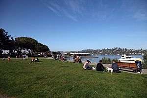
Sausalito has many public parks where you can play and relax. These include Cazneau Playground, Cloud View Park, Dunphy Park, and Gabrielson Park. There are also Martin Luther King Park and Dog Park, and Robin Sweeny Park.
The city has public beaches like Schoonmaker Beach and Swede's Beach. You can also visit the municipal fishing pier or use the Turney Street Boat Ramp. Inside the city hall, there is a club house/game room and an exercise room.
Living on the Water: Sausalito's Houseboats
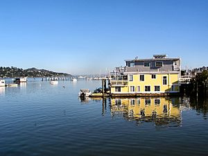
Sausalito is famous for its houseboat community. There are over 400 houseboats of different shapes and sizes. They are located at the north end of town, about two miles from downtown. Even if some are just outside the city limits, they are seen as a big part of Sausalito.
The houseboat community started after World War II. People began using abandoned boats and materials from the Marinship shipyards. Over time, rules were made for the area. Most boats moved to special docks. Today, the Gates Co-op Houseboat Community still exists.
Sometimes, a fish called the humming toadfish makes mating noises underwater. This can keep some houseboat residents awake at night!
Famous Faces: Notable People from Sausalito
Many interesting people have lived in Sausalito, both in the past and today.
Past Residents
- Leon Adams, a writer about wine.
- Etel Adnan, an artist, poet, and writer.
- Phil Frank, a cartoonist.
- Sterling Hayden, a film actor and sailor.
- William Randolph Hearst, a famous newspaper publisher.
- Janis Joplin, a well-known singer. She lived on Bridgeway.
- Baby Face Nelson, a gangster from the 1920s.
- Otis Redding, a musician who wrote "(Sittin' On) The Dock of the Bay" while staying on a houseboat in Sausalito in 1967.
- Shel Silverstein, a poet.
- Sally Stanford, who was a Sausalito City Council member and mayor.
- Alan Watts, a philosopher. The Sausalito Library has recordings of his talks.
Current Residents
- Isabelle Allende, an author.
- Dave Eggers, an author and helper of good causes.
- Vijay Mallya, an Indian business leader.
- Amy Tan, an author.
- Chase Utley, a Major League Baseball player.
Sausalito's Businesses and Industries
- Heath Ceramics, a company that makes pottery, has been in Sausalito since 1948.
- From 1972 to 2008, the Record Plant recording studio was on the Sausalito waterfront. Many famous albums were recorded there, like Fleetwood Mac's Rumours and Stevie Wonder's Songs in the Key of Life.
- Sausalito has a long history of building boats. Many boatyards have existed here, building fishing boats, government boats, and yachts.
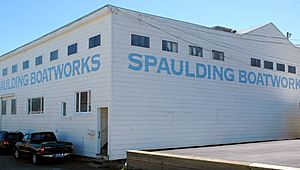
- The Spaulding Boatworks was started in 1951. It is one of the last places on the West Coast that still builds wooden boats. Today, the Spaulding Wooden Boat Center is a museum. It helps restore old wooden boats and teaches people about boat building.
- Mason's Distillery, which made whiskey, was destroyed by fire in 1963. Now, condominiums called "Whiskey Springs" are on that site.
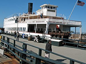
- The Southern Pacific ferryboat Berkeley was docked in Sausalito for several years in the 1960s. It is now a tourist attraction in San Diego.
- The bakery Pepperidge Farm has a cookie named "Sausalito" (milk chocolate/macadamia-nut). It is not made in the city.
Images for kids
See also
 In Spanish: Sausalito (California) para niños


