The Sleepers (New Hampshire) facts for kids
Quick facts for kids East Sleeper |
|
|---|---|

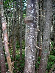
Summit sign on East Sleeper
|
|
| Highest point | |
| Elevation | 3,855 ft (1,175 m) |
| Prominence | 344 ft (105 m) |
| Listing | #86 New England 100 Highest |
| Climbing | |
| Easiest route | unofficial path |
| West Sleeper | |
|---|---|

Summit of West Sleeper
|
|
| Highest point | |
| Elevation | 3,881 ft (1,183 m) |
| Prominence | 180 ft (55 m) |
| Geography | |
| Location | Grafton County, New Hampshire |
| Parent range | Sandwich Range |
| Topo map | USGS Mount Tripyramid |
| Climbing | |
| Easiest route | bushwhack |
The Sleepers are two mountain peaks, East Sleeper (about 3,855 feet or 1,175 meters tall) and West Sleeper (about 3,881 feet or 1,183 meters tall). They are found in the Sandwich Range Wilderness in Grafton County, New Hampshire. These mountains are part of the Sandwich Range, which is a section of the larger White Mountains. Nearby mountains include Mount Tripyramid to the northwest, Mount Passaconaway to the northeast, and Mount Whiteface to the southeast. A hiking path called the Kate Sleeper Trail goes very close to both peaks.
Where Does the Water Go?
Water from the Sleepers flows in different directions. On the southwest side, water goes into Slide Brook and Cascade Brook. These then join Avalanche Brook, which flows into the Mad River. The Mad River then joins the Pemigewasset River, then the Merrimack River, and finally reaches the Gulf of Maine near Newburyport, Massachusetts.
On the northeast side, water flows into Sabbaday Brook and Downes Brook. These join the Swift River, which then flows into the Saco River. The Saco River also reaches the Gulf of Maine, but further north, near Saco, Maine.
The south end of East Sleeper sends its water into the Whiteface River. This river joins the Cold River, then the Bearcamp River, and the Ossipee River, before finally connecting with the Saco River.
The Hundred Highest List
East Sleeper is on a special list created by the Appalachian Mountain Club. This list, called the "Hundred Highest", includes the tallest peaks in New England. Even though West Sleeper is a bit taller than East Sleeper, it's not on the list. This is because West Sleeper is connected to the peaks of Mount Tripyramid by a high ridge. To be on the "Hundred Highest" list, a mountain needs to rise at least 200 feet (about 61 meters) above the land connecting it to any higher peaks. West Sleeper doesn't quite meet this requirement.
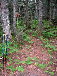
A well-kept trail passes near the top of East Sleeper. From this trail, a clear side path leads right to the summit.
Who Was Kate Sleeper?
The Sleepers mountains are named after a remarkable woman named Katherine "Kate" Sleeper (1862 – 1949). She was an innkeeper in the area and played a huge role in creating and improving hiking trails.
Kate Sleeper Walden was born in 1862. In 1890, she bought an old farm called Caleb Brown farm. She fixed it up and opened it as the Wonalancet Farm in 1892, and it was an instant success! She later married Arthur Walden. Kate was involved in many important projects in the area. She helped restore the Wonalancet Chapel, started the Wonalancet Out Door Club, and even helped bring the telephone to the area. She was also the first postmaster for the Wonalancet Post Office. Kate strongly believed in protecting large areas of land, and her efforts helped create parts of the White Mountain National Forest. She passed away in 1949.
You can find more information about Kate Sleeper in the book "Forest and Crag" by Laura and Guy Waterman, which is about the White Mountains.
 | Sharif Bey |
 | Hale Woodruff |
 | Richmond Barthé |
 | Purvis Young |

