The Triad (mountain) facts for kids
Quick facts for kids The Triad |
|
|---|---|

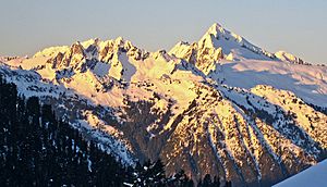
The Triad seen from Eldorado Peak
|
|
| Highest point | |
| Elevation | 7,520+ ft (2,290+ m) |
| Prominence | 760 ft (230 m) |
| Parent peak | Eldorado Peak 8,868 ft |
| Geography | |
| Parent range | North Cascades |
| Topo map | USGS Eldorado Peak |
| Geology | |
| Age of rock | Cretaceous |
| Type of rock | Orthogneiss |
| Climbing | |
| First ascent | 1949 Dick Eilertsen, Dick Lowery, Dick Scales, Don Wilde |
| Easiest route | Scrambling class 4 |
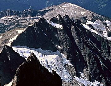
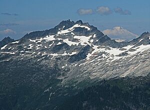
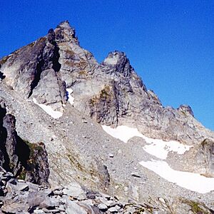
The Triad is a cool mountain in Washington state. It has three main peaks and is located in the North Cascades mountain range, specifically in Skagit County. You can find it inside North Cascades National Park, about 12 miles east of the town of Marblemount.
The tallest of The Triad's peaks is about 7,520 feet high. The west peak is around 7,440 feet, and the east peak is also about 7,520 feet tall. A popular spot for hikers, Hidden Lake Peak Lookout, is three miles to the southwest. The nearest higher mountain, Eldorado Peak, is two miles to the northeast and is a favorite for climbers.
Rain and snow that fall on The Triad flow into the Cascade River. This river then joins the larger Skagit River. The first people to climb The Triad were Dick Eilertsen, Dick Lowery, Dick Scales, and Don Wilde in 1949. They originally called it The Three Dicks because three of them had the same first name! But later, they changed it to The Triad because "triad" means a group of three, which was a more fitting and polite name.
Mountain Weather
The Triad is in a "marine west coast" climate zone. This means it gets a lot of rain and snow because it's close to the Pacific Ocean. Most weather systems come from the Pacific Ocean and move towards the Cascade Mountains. As these weather systems hit the tall peaks of the North Cascades, they are forced upwards. This causes them to drop their moisture as rain or snow.
Because of this, the western side of the North Cascades gets a lot of precipitation. This is especially true during the winter months, when most of it falls as snow. In winter, the weather is often cloudy. However, during summer, high-pressure systems over the Pacific Ocean usually bring clear skies.
Since the ocean influences the weather, the snow tends to be wet and heavy. This can lead to a high risk of avalanches. The mountain's climate also supports a small, unnamed glacier. This glacier is found on the north slope, beneath the steep rock faces.
How the Mountain Formed
The North Cascades area has some of the most rugged land in the Cascade Range. You can see jagged peaks, sharp ridges, deep valleys carved by glaciers, and tall, pointed rock formations made of granite. These amazing landscapes and big changes in height were created by geological events that happened millions of years ago.
The Cascade Mountains began forming millions of years ago, during the late Eocene Epoch. At that time, the North American Plate was slowly moving over the Pacific Plate. This movement caused many periods of volcanic activity. Also, small pieces of the Earth's crust, called terranes, helped create the North Cascades about 50 million years ago.
During the Pleistocene period, which started over two million years ago, glaciers repeatedly moved across the land. As they advanced and retreated, they scraped away the landscape. They left behind piles of rock debris. The "U"-shaped valleys you see today were formed by these glaciers. The lifting up of the land and cracks in the Earth's crust, combined with the action of glaciers, have shaped the tall peaks and deep valleys of the North Cascades.
Getting to The Triad
To reach The Triad, you can use the Hidden Lake Trail #745. The start of this trail is at the end of Forest Service Road #1540. This road is about five miles long and connects to the Cascade River Road 9.5 miles from Marblemount.
The trail starts steeply in a forest. Then, it opens up into beautiful meadows filled with wildflowers. After that, it climbs higher into areas with heather plants and rocky gardens. From this point, you leave the main trail and head east. You climb up to the top of the ridge, where you'll find a smaller path to follow.

 | Anna J. Cooper |
 | Mary McLeod Bethune |
 | Lillie Mae Bradford |


