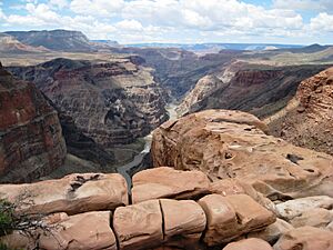
Toroweap Fault facts for kids
The Toroweap Fault is a large crack in the Earth's crust found in northwest Arizona and southwest Utah. It's a key part of the fault system in the western Grand Canyon area, affecting the edges of the Coconino Plateau and Colorado Plateau.
Imagine two giant cracks meeting! The Hurricane Fault actually starts from the Toroweap Fault near the Colorado River. The Toroweap Fault runs north from the Colorado River, going into southern Utah. The Hurricane Fault then heads north-northwest, following the western side of the Uinkaret Mountains, which form the western edge of Toroweap Valley. Both the Hurricane Fault and the Hurricane Cliffs extend into southwest Utah, marking the western and southwestern boundary of the Colorado Plateau. These Hurricane Cliffs are made of a strong rock called Kaibab Limestone, which is very resistant to erosion and forms tall cliffs.

(with small (dk black)-volcano on South Rim, adjacent rim edge)
The meeting point of these two faults created the Uinkaret volcanic field. You can see examples of this volcanic activity in landforms like Vulcan's Throne and Lava Falls. Both of these are located west of Toroweap Point, on the North Rim of the Grand Canyon, right along the faults. There's even a small volcano on the South Rim, right above the fault line!
This two-fault system is part of the western edge of the Colorado Plateau, an area known as the High Plateaus Section.
How the Fault Shapes the Grand Canyon
In the Grand Canyon, the Toroweap-Hurricane Fault system causes a noticeable change in the types of rocks you see on the South Rim. For example, the Esplanade Sandstone, a tough rock layer from the Supai Group, forms a wide, flat area called The Esplanade. This platform is located upstream on the Colorado River, on the South Rim, directly across from Toroweap Point. The Toroweap Fault and the Aubrey Cliffs mark the western edge of The Esplanade.
The Aubrey Cliffs form the western boundary of the Coconino Plateau. They stretch from the Colorado River south towards Prospect Valley. They then continue through some mountains north of Aubrey Valley, forming the eastern and southeastern edge of that valley. Their southern end, Chino Point, is just west of Seligman, Arizona, near Interstate 40. This southern end of the Aubrey Cliffs is also close to where the Chino Valley (Arizona) begins, which is part of the starting point for the Verde River watershed.
The Aubrey Cliffs are made up of several layers of rock. At the top, you'll find Permian rocks like Kaibab Limestone, Toroweap Formation, and Coconino Sandstone. Below these are the Hermit Formation and parts of the Supai Group, including the Esplanade Sandstone at lower elevations in the Grand Canyon. In the southern part, near Aubrey Valley, the Coconino Sandstone layer becomes much thinner compared to its impressive 300-foot cliffs in other parts of the Grand Canyon.
In Aubrey Valley, at the southern end of the Aubrey Cliffs, the cliffs have been eroded back from the Coconino Plateau. The Toroweap Fault in this area is actually hidden beneath layers of gravel, closer to the center of the valley, west of the north-trending cliffs.
Aubrey Valley: A Corner of the Colorado Plateau
Aubrey Valley is a special type of basin where water collects but doesn't flow out to the ocean; it's called an endorheic basin. This valley is connected to the Seventyfour Plains to its southwest. This area acts as a water divide between the Verde River watershed (which includes the Big Chino Wash) to the east and southeast, and smaller streams that flow west into the Bill Williams River, which eventually joins the Colorado River.
The Toroweap Fault is part of a larger geological picture that defines the southwestern border of the Colorado Plateau. This region includes areas like Sycamore Canyon and Oak Creek Canyon. The faults in this area, like those at the Aquarius Cliffs, are "high angle normal faults." This means they are steep cracks where one side of the Earth has dropped down compared to the other. This explains why you see the Aquarius Cliffs, the Big Sandy River & Valley, and the Hualapai Mountains in this region. It's where the Colorado Plateau meets the classic Basin and Range province, a landscape of alternating mountains and valleys.
 | William L. Dawson |
 | W. E. B. Du Bois |
 | Harry Belafonte |

