Tregony, Queensland facts for kids
Quick facts for kids TregonyQueensland |
|||||||||||||||
|---|---|---|---|---|---|---|---|---|---|---|---|---|---|---|---|

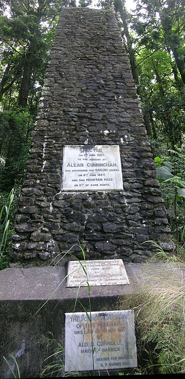
Allan Cunningham monument, Cunningham's Gap, 2009
|
|||||||||||||||
| Population | 36 (2021 census) | ||||||||||||||
| • Density | 0.625/km2 (1.62/sq mi) | ||||||||||||||
| Postcode(s) | 4370 | ||||||||||||||
| Area | 57.6 km2 (22.2 sq mi) | ||||||||||||||
| Time zone | AEST (UTC+10:00) | ||||||||||||||
| Location | |||||||||||||||
| LGA(s) | Southern Downs Region | ||||||||||||||
| State electorate(s) | Southern Downs | ||||||||||||||
| Federal Division(s) | Maranoa | ||||||||||||||
|
|||||||||||||||
Tregony is a small area, or 'locality', in the Southern Downs Region of Queensland, Australia. It's known as an important entry point to the Darling Downs region from the coast of Queensland. In 2021, only 36 people lived there.
Contents
Tregony's Location and Landscape
The eastern part of Tregony is home to the Main Range National Park. This area sits on the western side of the Great Dividing Range, where mountains can reach up to 1160 meters high. A stream called Gap Creek starts here and flows west. It eventually joins Glengallan Creek, then the Condamine River, and finally the huge Murray-Darling River system.
The Cunningham Highway passes through Tregony. It crosses the mountain range at a spot called Cunninghams Gap, which is about 790 meters high. The highway then runs from east to west through Tregony, generally following Gap Creek. As it goes west, the land becomes flatter and is used for farming.
A Look Back at Tregony's History
Even before it was called Tregony, this area was very important to early explorers. The Darling Downs region had great potential for farming. However, getting goods to and from the coast was hard. The first way was a long trip through inland New South Wales, which took too much time and money.
Finding a Faster Route
People needed a quicker way to the coast, especially to the growing towns of Ipswich and Brisbane. These towns were connected by rivers to Moreton Bay, which led to the sea. But the Great Dividing Range stood in the way.
On June 11, 1827, an explorer named Allan Cunningham was exploring from the Darling Downs side. He found a possible route for drays (horse-drawn carts) across the range. This route later became known as Spicer's Gap.
A year later, on August 21, 1828, Cunningham found another pass while traveling from Ipswich. This pass is now called Cunningham's Gap. He thought it was the same one he found in 1827, but it was actually about 4 kilometers north of Spicer's Gap. Cunningham told the government that the route should go through Cunningham's Gap.
The Importance of Spicer's Gap
As more people settled the Darling Downs, finding a good dray route became even more important. The route through Cunningham's Gap was too steep for carts. It wasn't until April 1847 that Henry Alphen rediscovered Spicer's Gap.
In August 1847, two drays successfully traveled through Spicer's Gap to Ipswich. This led to the creation of Spicers Gap Road over the range. In 1861, a telegraph line was built along this road. It connected the first telegraph station at Fassifern Reserve with the station at Tregony.
New Roads and Railways
Spicers Gap Road needed a lot of money to keep it in good condition. Then, in 1871, the Southern railway line opened. This line connected Warwick (a major town on the Darling Downs) to Toowoomba and then to Brisbane. Train travel was much better than drays, so Spicers Gap Road was mostly abandoned.
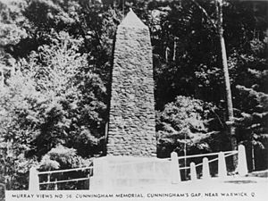
As cars became more common, building a road through Cunningham's Gap became possible. This road was built between 1925 and 1927. On June 11, 1927, exactly 100 years after Allan Cunningham found Spicer's Gap, the road was officially opened. The Acting Queensland Premier, William Forgan Smith, also unveiled a monument to Cunningham. The monument's plaque says Cunningham found Cunningham's Gap in 1927, which was a bit confusing because of Cunningham's own mix-up between the two gaps.
In 1935, the road was improved and named the Cunningham Highway. It became the most direct way to travel between Brisbane and Warwick.
Tregony's Population
In 2016, Tregony had 34 people living there. By 2021, the population had grown slightly to 36 people.
Historic Places in Tregony
Tregony has one important heritage-listed site:
- Spicers Gap Road: This was the old road that crossed the Great Dividing Range before the Cunningham Highway was built.
Schools Near Tregony
There are no schools directly in Tregony.
 | Georgia Louise Harris Brown |
 | Julian Abele |
 | Norma Merrick Sklarek |
 | William Sidney Pittman |


