Tulancingo facts for kids
Quick facts for kids
Tulancingo
|
||
|---|---|---|
|
Municipality and city
|
||
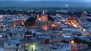
An evening view of Tulancingo, from the Cerro del Tezontle
|
||
|
||
| Country | ||
| State | Hidalgo | |
| Municipality | Tulancingo | |
| Area | ||
| • Total | 290.4 km2 (112.1 sq mi) | |
| Elevation | 2,181 m (7,156 ft) | |
| Population
(2010)
|
||
| • Total | 151,582 | |
| • Density | 352.64/km2 (913.3/sq mi) | |
| Website | http://www.tulancingo.gob.mx | |
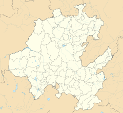
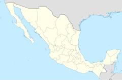
Tulancingo (officially Tulancingo de Bravo) is the second-largest city in the Mexican state of Hidalgo. It is located in the southeastern part of the state. Tulancingo is also one of the 84 municipalities of Hidalgo.
The city is about 93 kilometers (58 miles) from Mexico City. It is famous for making wool textiles. Tulancingo was home to El Santo, Mexico's most famous lucha libre wrestler. It was also the home of Gabriel Vargas (cartoonist), who created the popular cartoon La Familia Burrón.
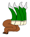
You can find the Huapalcalco archeological site here. This ancient site was important before the Teotihuacan civilization. The name "Tulancingo" comes from Nahuatl words meaning "in or behind the reeds." This meaning is shown in its Aztec symbol.
Contents
Exploring Tulancingo's Past
The Tulancingo area has some of the oldest settlements in Latin America. These include places like Huapalcalco and El Pedregal. Early groups like the Olmecs and Xicalancas lived here.
Ancient Civilizations and Trade
A city called Tolancingo was started in 645 BCE by the Toltecs. It was part of their empire, which was based in Tula. During this time, Tulancingo had schools and temples. A special calendar stone was carved here. A temple called Mitlancalco was built for important people. The Toltec Empire ended after 1116 CE, and the city was left empty.
Around 1000 CE, Tulancingo was a busy trading center. Otomi-Tepehua and Totonaca people traded goods here. Traders came from areas that are now the states of Hidalgo, Puebla, and Veracruz. Even today, a traditional market called a "tianguis" is held every Thursday.
Chichimecas and Aztec Rule
The Chichimecas took control around 1120 under their leader Xolotl. They rebuilt the city with the remaining Toltecs. More people arrived, including the Tlaxcaltecas. In 1324, King Quinantzin made Tulancingo the main city of a province. Later, in the early 15th century, the city was conquered by Texcoco. This made Tulancingo part of the Aztec Empire.
Spanish Arrival and New Beginnings
During the Spanish Conquest, a prince named Ixtlilxochitl gathered an army here. They joined Hernán Cortés to conquer Tenochtitlan. Spanish rule officially began in 1525. Soon after, Christian missionaries arrived.
Franciscans came from Texcoco and built a small church in the Zapotlan area. This church later became the main cathedral. It was dedicated to John the Baptist. The new European city was built, and at first, only Europeans were allowed to live there. Indigenous people who worked in the city had to live outside it, at the base of the Cerro del Tezontle mountain. This area is now part of the city and is called Colonia Francisco I. Madero.
The Tulancingo Valley was given to Spanish settlers. Its rich soil and warm weather attracted many, especially older soldiers. It became known as the "Retiring place of Old Conquistadors."
Independence and French Influence
During the Mexican War of Independence, the city was attacked several times. But royalist forces held it until Nicolás Bravo and Guadalupe Victoria took it in 1821. This was near the end of the war. Nicolás Bravo stayed in Tulancingo for a while. He started a newspaper and built a gunpowder factory. Because of him, "de Bravo" was added to the city's name in 1858.
After Agustín de Iturbide became emperor in 1822, he lived in Tulancingo. When he was removed from power, he left Mexico City and came to Tulancingo on his way to exile.
Under the 1824 Constitution, Tulancingo was the head of a large district. This district included areas that are now parts of the states of Mexico, Hidalgo, Morelos, and Guerrero.
During the French Intervention in Mexico, the large State of Mexico was divided. Tulancingo became part of a new military district, which later became the state of Hidalgo. French troops entered Tulancingo in 1863. Emperor Maximilian I also stayed in the same house that Iturbide had used.
In 1863, Tulancingo became the head of a diocese (a church district). This diocese was under the archbishopric of Mexico City. When the state of Hidalgo was created, Tulancingo was considered for the capital, but Pachuca was chosen instead.
Modern Challenges
During the Mexican Revolution, forces loyal to Francisco I. Madero took Tulancingo in 1910. Madero himself visited in 1912. Later, forces loyal to Venustiano Carranza took the city in 1915.
The area has many small rivers and mountains, which can cause flooding. Major floods happened in 1999 and 2007. In 1999, heavy rains caused rivers to overflow, and over 500 houses were left empty. In 2007, Hurricane Dean caused more flooding. Many homes were destroyed or flooded with sewage.
Tulancingo's Geography
Climate and Weather
The climate in Tulancingo is mild to cool. The average yearly temperature is 14°C (57°F). It rains about 500 to 550 mm (20-22 inches) each year. Most of the rain falls from June to October.
| Climate data for Tulancingo (Tulancingo Observatory), elevation: 2,181 m or 7,156 ft, 1951–1980 normals, extremes 1951–2024 | |||||||||||||
|---|---|---|---|---|---|---|---|---|---|---|---|---|---|
| Month | Jan | Feb | Mar | Apr | May | Jun | Jul | Aug | Sep | Oct | Nov | Dec | Year |
| Record high °C (°F) | 29.6 (85.3) |
32.0 (89.6) |
35.0 (95.0) |
35.0 (95.0) |
35.5 (95.9) |
33.0 (91.4) |
29.8 (85.6) |
29.4 (84.9) |
29.0 (84.2) |
37.0 (98.6) |
30.6 (87.1) |
30.2 (86.4) |
37.0 (98.6) |
| Mean daily maximum °C (°F) | 21.3 (70.3) |
22.8 (73.0) |
25.8 (78.4) |
26.5 (79.7) |
26.0 (78.8) |
23.8 (74.8) |
22.5 (72.5) |
22.9 (73.2) |
21.6 (70.9) |
21.1 (70.0) |
21.4 (70.5) |
20.7 (69.3) |
23.0 (73.4) |
| Daily mean °C (°F) | 12.2 (54.0) |
12.9 (55.2) |
15.7 (60.3) |
16.8 (62.2) |
17.2 (63.0) |
16.5 (61.7) |
15.4 (59.7) |
15.6 (60.1) |
15.1 (59.2) |
13.8 (56.8) |
12.8 (55.0) |
11.9 (53.4) |
14.7 (58.5) |
| Mean daily minimum °C (°F) | 2.8 (37.0) |
3.0 (37.4) |
5.7 (42.3) |
7.2 (45.0) |
7.9 (46.2) |
8.3 (46.9) |
7.3 (45.1) |
7.1 (44.8) |
7.5 (45.5) |
5.4 (41.7) |
4.2 (39.6) |
3.1 (37.6) |
5.8 (42.4) |
| Record low °C (°F) | −10.6 (12.9) |
−13.8 (7.2) |
−7.0 (19.4) |
−6.5 (20.3) |
−4.0 (24.8) |
−3.0 (26.6) |
−2.2 (28.0) |
−1.7 (28.9) |
−5.8 (21.6) |
−5.5 (22.1) |
−10.0 (14.0) |
−8.6 (16.5) |
−13.8 (7.2) |
| Average precipitation mm (inches) | 9.7 (0.38) |
5.2 (0.20) |
11.9 (0.47) |
32.4 (1.28) |
49.4 (1.94) |
94.8 (3.73) |
67.4 (2.65) |
65.8 (2.59) |
114.9 (4.52) |
54.3 (2.14) |
21.6 (0.85) |
7.0 (0.28) |
534.4 (21.04) |
| Average precipitation days (≥ 0.1 mm) | 3.07 | 2.40 | 3.44 | 7.03 | 9.14 | 13.46 | 14.74 | 13.96 | 16.24 | 10.18 | 5.40 | 3.03 | 102.09 |
| Average relative humidity (%) | 67 | 64 | 61 | 63 | 66 | 76 | 80 | 78 | 81 | 79 | 74 | 71 | 72 |
| Mean monthly sunshine hours | 221.8 | 218.5 | 227.1 | 212.7 | 227.0 | 192.6 | 183.4 | 200.4 | 150.5 | 187.0 | 201.2 | 199.6 | 2,421.8 |
| Source 1: Colegio de Postgraduados | |||||||||||||
| Source 2: SMN | |||||||||||||
| Climate data for Tulancingo (La Espereranza), elevation: 2,210 m or 7,250 ft, extremes 1951–2017 | |||||||||||||
|---|---|---|---|---|---|---|---|---|---|---|---|---|---|
| Month | Jan | Feb | Mar | Apr | May | Jun | Jul | Aug | Sep | Oct | Nov | Dec | Year |
| Record high °C (°F) | 31.0 (87.8) |
32.0 (89.6) |
35.0 (95.0) |
35.0 (95.0) |
37.0 (98.6) |
34.0 (93.2) |
33.0 (91.4) |
30.0 (86.0) |
29.0 (84.2) |
29.0 (84.2) |
30.0 (86.0) |
31.0 (87.8) |
37.0 (98.6) |
| Record low °C (°F) | −9.0 (15.8) |
−7.0 (19.4) |
−8.0 (17.6) |
−3.0 (26.6) |
0.0 (32.0) |
1.0 (33.8) |
0.0 (32.0) |
0.1 (32.2) |
0.0 (32.0) |
−2.0 (28.4) |
−6.0 (21.2) |
−7.0 (19.4) |
−9.0 (15.8) |
| Source: SMN | |||||||||||||
Discovering the City of Tulancingo
Tulancingo is the second-largest and second-most important city in Hidalgo state. It sits at the base of the Cerro del Tezontle mountain. From the top of this mountain, you can see great views of the city and the valley. There's also a restaurant, playground, and sports areas up there.
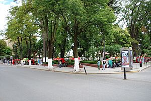
The city's center is around its cathedral and the Jardin Floresta (Floresta Garden).
The Cathedral and Its History
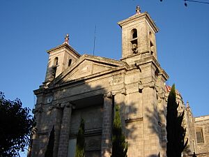
The cathedral started as a Franciscan monastery in 1528. It was first a church dedicated to Francis of Assisi. In 1788, it was rebuilt and dedicated to John the Baptist, who is the city's patron saint. The old monastery's cloister (a covered walkway) was kept.
In 1862, this church became the main church for the diocese (a church region) of Tulancingo, making it a cathedral. In 2007, Tulancingo became an archdiocese, which is an even larger church region. The bishop lives in the old cloister building.
The cathedral is 56.6 meters (186 feet) tall. It is made of gray sandstone and has a simple, classic design. Inside, you can find a holy water font made of stone. There is also a wooden pulpit with carvings. The organ has over 16,000 pipes!
Floresta Garden and Other Churches
The Floresta Garden is made of two parts: Plaza de la Constitución and Parque Juárez. This area was originally the city's founding block and the monastery's courtyard. Today, you can find leather goods, cider, hats, and wool items for sale here.
Tulancingo has several other important churches. The La Expiración Chapel was built in 1527. It is one of the oldest chapels in the region. The Iglesia de los Angeles (Church of the Angels) is dedicated to an image of the Virgin Mary. This church was started in 1878. Most major religious parades in the city start here and end at the cathedral. The La Merced Temple was built in 1892.
Museums and Famous People
The Railroad Museum (Museo del Ferrocarril) is in the old train station. It has old photos and items from the late 1800s and early 1900s. This building was the city's second train station, built in 1893. It shows how Tulancingo was a big transportation center. Nearby, the Vagón del Ferrocarril (Railroad Car) cafeteria sells crafts.
Near the Railroad Museum, you'll find a statue of Rodolfo Guzmán Huerta. He is better known as El Santo or The Silver Mask. He was Mexico's most famous lucha libre wrestler. El Santo was born here in 1917 and is also buried here. The highway nearby is named Boulevard Rodolfo Guzman Huerta, El Santo, in his honor.
The Museo de Datos Históricos (Museum of Historical Facts) is in the city's first train station. This museum tells the story of Tulancingo from ancient times to today. It has two rooms: one with photos and another with old artifacts.
The Sor Juana Inés de la Cruz Library is in a 19th-century building. It used to be part of the cathedral's cemetery. The library has been open since 1984. The Jardin del Arte (Art Garden) and Ricardo Garibay Cultural Center host art, music, and theater events.
Markets and Historic Homes
The Municipal Market is built where the Plaza of the Count of Orizaba used to be. The current market was built in 1948. There are also five "tianguis" (traditional markets), including one for fake products.
The city has many historic homes, mostly from the 1800s. The Casa de los Emperadores (House of the Emperors) was used by both Emperor Agustín de Iturbide and Emperor Maximiliano I. The Casa de los Huesitos de Chabacano (House of the Little Apricot Pits) is a beautiful 19th-century building. The Exquitlán Hacienda was built in the late 1800s using materials from France.
Zoo and Satellite Dishes
The Municipal Zoo has 180 different kinds of animals, with a total of 390 animals. You can see lions, tigers, deer, and a hippopotamus, which is the zoo's mascot!
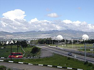
You might notice large satellite dishes overlooking the city. They were built in the 1960s to show the 1968 Summer Olympics on TV. These dishes gave Tulancingo the nickname "City of the Satellites." Today, they provide various services. The two largest dishes are 32 meters (105 feet) wide and weigh 330 tons each. They provide international service. These are the largest and most important satellite dishes in Mexico.
Unique Neighborhoods
Colonia Francisco I. Madero is a special neighborhood. It started as an indigenous settlement outside the Spanish city. As the city grew, it became part of Tulancingo. Because indigenous people lived separately for a while, they kept many of their old traditions.
The annual Feria de Tulancingo [1] is the city's main event. It shows off the area's farming, industry, and businesses.
Tulancingo Municipality
The city of Tulancingo is the main governing center for over one hundred smaller communities. These communities cover an area of 290.4 square kilometers (112 square miles). About 75% of the municipality's population lives in the city itself. Other important communities include Jaltepec, Santa Ana Hueytlalpan, and Javier Rojo Gómez.
Landscape and Nature
The municipality is located in the Trans-Mexican Volcanic Belt. It has mostly valley floor with some mountains. The land is made of light volcanic rock with ravines, small canyons, and hills. The highest point is the Cerro del Tezontle mountain. Other high points include Cerro Viejo, Napateco, and Las Navajas.
The main river is the Tulancingo River. There are also four small lakes: Los Alamos, Otontepec, San Alejo, and La Ciénega.
Forests here have trees like pine, ocotea, oyamel, cedar, and walnut. You can find small animals like rabbits and squirrels. Birds like hummingbirds, doves, and woodpeckers also live here.
Huapalcalco Archeological Site
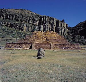
In the Tulancingo Valley, some of Mexico's oldest human remains were found in Tecolote Cave. But the most important site is Huapalcalco. This site is about three kilometers (1.8 miles) from modern Tulancingo. It has an ancient pyramid and cave paintings.
The cliffs of Huapalcalco have fifty groups of cave paintings. Some of these paintings are as old as 10,000 BCE. The ancient site was first studied in the 1950s. Objects found here date back to 1,100 BCE. In the 7th century, a ruler named Quetzalcoatl lived here before he left to start Teotihuacan.
The main part of the site is a five-level pyramid. It is twelve meters (39 feet) wide at its base and eight meters (26 feet) high. This site was used for ceremonies. At the top of the pyramid, there is a stone altar where offerings were likely placed. The name "Huapalcalco" means "House of Green Wood."
Cemeteries and Traditions
Most people know the San Miguel Municipal Cemetery in the city. But the area has other important cemeteries. Cemeteries were brought by the Spanish. Before that, indigenous people buried their dead under their homes.
The cemetery at Santa Ana Hueytlalpan shows Otomi traditions. You can see Mexican marigolds and offerings of fruit, mole, sweets, and alcohol. The Santa María Cemetery also has indigenous touches, but with Nahua influence.
Los Ermitanos is a nature preserve. It has two deep ravines and many cool rock formations. The area is often cold and foggy.
Tulancingo's Economy
The economy of Tulancingo municipality has three main parts: farming, manufacturing/industry, and trade. Farming employs about 5.9% of the people. Manufacturing and industry employ 30.5%. Trade and services employ the most people, at 63.6%.
Farming and Livestock
The soil is fertile but a bit dry. Over 60% of the land is used for farming, pastures, and forests. Farmers grow crops like corn, barley, beans, and wheat. Some crops are grown all year round using irrigation, like cactus fruit (tunas), alfalfa, and hay.
Farmers also raise animals like cattle, pigs, goats, sheep, horses, and chickens. Pine and other trees are harvested for wood, but this is carefully controlled. Tulancingo is also known for its dairy products and cider, which is made from local apples.
Textile Industry
Tulancingo is famous for its wool textiles. It makes wool thread, yarn, cashmeres, blankets, and embroidered clothes. In ancient times, this area made cotton textiles. These were given as tribute to the Aztecs. Textile making continued when the Spanish arrived.
Over time, wool became the main fabric. In the late 1800s and early 1900s, the textile industry became modern. The first train station helped ship products. Today, Tulancingo produces about 21% of Mexico's wool fabric.
Other Industries and Crafts
Other industries include food processing, bottling, tobacco products, leather goods, wood products, and chemicals. The most important for jobs are food processing, tobacco, and textiles.
Local crafts include pottery, like jars, cups, and plates. Leather goods like sandals and gloves are also made. Wool items like sarapes (shawls) and rebozos (long scarves) are popular. A unique craft is a type of "God's eye" called a "tenango."
Education and Transportation
The municipality offers public education from preschool to university. There are many schools at all levels, with over a thousand teachers. There are also ten high schools and six universities. These include the Universidad Tecnologica de Tulancingo and the Universidad Politecnica de Tulancingo.
Tulancingo has 42.4 kilometers (26 miles) of major roads. There is a small airport with a 1,000-meter (3,280-foot) runway. Most public transportation is by bus. There are two bus stations with routes to Mexico City, Tampico, Tuxpan, and other nearby towns. The city also has satellite stations for television and three local radio stations.
Sister Cities
- Pleasanton, California, United States
Tulancingo also has a community exchange program with New York City, New York, USA. This is because many people from Tulancingo have moved to New York City for work.
Notable People
- El Santo (1917-1984) - Famous Mexican wrestler.
- Gabriel Vargas (1915-2010) - Mexican cartoonist, creator of La Familia Burrón.
- Alfonso Zayas (1941-2021) - Well-known film and television actor, born here.
- Jorge Poza
See also
 In Spanish: Municipio de Tulancingo de Bravo para niños
 | Lonnie Johnson |
 | Granville Woods |
 | Lewis Howard Latimer |
 | James West |


