
Tyler State Park (Pennsylvania) facts for kids
Quick facts for kids Tyler State Park |
|
|---|---|
|
IUCN Category III (Natural Monument)
|
|

Schofield Ford Covered Bridge
|
|

Tyler State Park
Location in Pennsylvania
|
|
| Location | Bucks, Pennsylvania, United States |
| Area | 1,711 acres (6.92 km2) |
| Elevation | 236 ft (72 m) |
| Established | 1974 |
| Named for | Mr. and Mrs. George F. Tyler |
| Governing body | Pennsylvania Department of Conservation and Natural Resources |
| Website | Tyler State Park |
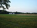
Tyler State Park is a state park in Pennsylvania. It covers about 1,711 acres (692 ha) in Newtown and Northampton Townships in Bucks County.
The park has roads, trails, and buildings that fit right into the old farms and woods. A creek called Neshaminy Creek winds through the park, splitting it into different parts.
Before it was a park, the land belonged to Mr. and Mrs. George F. Tyler. They bought it between 1919 and 1928. Their first purchase was Solly Farm, which is now used by Hostelling International at the park's north end. The Solly House was their country home until they built the George F. Tyler Mansion. This mansion is now the main building for Bucks County Community College.
The Tylers raised Ayrshire cows for dairy. They also had chickens, sheep, pigs, and about 25 horses for riding. The farm fields were mostly used to grow food for their animals.
You can still see old stone houses in the park. These are great examples of early farm homes from the 1700s. One house by the bike trail has a stone with the date "1775" on it. Ten of these old farm houses are currently rented out as private homes.
The land for the park was bought in 1964 as part of a special land program. Tyler State Park officially opened on May 25, 1974.
Tyler State Park has a 36-hole disc golf course. It also has a former landfill area. This area is now mostly used by students from Council Rock School District for archaeological digs, where they dig to find old things.
The park is home to many different kinds of birds. In the creek, you might see water snakes, turtles, and eels. In the quieter parts of the park, you could find foxes, deer, beavers, wild turkeys, rabbits, and even black bears.
One of the most popular spots in the park is the Schofield Ford Covered Bridge. It was first built in 1874. Sadly, the bridge burned down in 1991. But people raised money, and it was rebuilt. The new bridge opened on September 7, 1997.
Weather at Tyler State Park
The weather at Tyler State Park changes a lot throughout the year. It has hot summers and cold winters. Rain and snow fall all year round.
Even though summers are usually a bit humid, it can get very hot and sticky sometimes. The hottest temperature recorded since 1981 was 102.8 °F (39 °C) on July 22, 2011.
Winters can be very cold and windy. The coldest temperature recorded since 1981 was −10.5 °F (−24 °C) on January 22, 1984. The park usually gets between 24 and 30 inches (61 to 76 cm) of snow each year, from November to April. Big snowstorms, with 12 inches (30 cm) or more of snow, happen every few years, especially from December to February.
The wettest month on average is July, which is when the most thunderstorms happen. The most rain in one day since 1981 was 6.46 inches (164 mm) on August 27, 2011.
| Climate data for Tyler State Park. Elevation: 223 ft (68 m). 1981-2010 Averages (1981-2018 Records). | |||||||||||||
|---|---|---|---|---|---|---|---|---|---|---|---|---|---|
| Month | Jan | Feb | Mar | Apr | May | Jun | Jul | Aug | Sep | Oct | Nov | Dec | Year |
| Record high °F (°C) | 71.3 (21.8) |
77.6 (25.3) |
87.3 (30.7) |
94.1 (34.5) |
95.0 (35.0) |
96.1 (35.6) |
102.8 (39.3) |
100.2 (37.9) |
97.9 (36.6) |
89.0 (31.7) |
80.8 (27.1) |
75.5 (24.2) |
102.8 (39.3) |
| Mean daily maximum °F (°C) | 40.1 (4.5) |
43.2 (6.2) |
51.5 (10.8) |
63.6 (17.6) |
73.2 (22.9) |
82.3 (27.9) |
86.6 (30.3) |
84.9 (29.4) |
78.0 (25.6) |
66.7 (19.3) |
55.6 (13.1) |
44.4 (6.9) |
64.3 (17.9) |
| Daily mean °F (°C) | 31.7 (−0.2) |
34.4 (1.3) |
41.8 (5.4) |
52.5 (11.4) |
62.0 (16.7) |
71.5 (21.9) |
76.1 (24.5) |
74.6 (23.7) |
67.4 (19.7) |
55.7 (13.2) |
46.0 (7.8) |
36.2 (2.3) |
54.3 (12.4) |
| Mean daily minimum °F (°C) | 23.3 (−4.8) |
25.5 (−3.6) |
32.1 (0.1) |
41.5 (5.3) |
50.8 (10.4) |
60.7 (15.9) |
65.7 (18.7) |
64.2 (17.9) |
56.8 (13.8) |
44.7 (7.1) |
36.5 (2.5) |
28.0 (−2.2) |
44.2 (6.8) |
| Record low °F (°C) | −10.5 (−23.6) |
−2.7 (−19.3) |
3.4 (−15.9) |
17.8 (−7.9) |
34.2 (1.2) |
42.1 (5.6) |
48.3 (9.1) |
42.9 (6.1) |
35.9 (2.2) |
25.1 (−3.8) |
12.1 (−11.1) |
−0.8 (−18.2) |
−10.5 (−23.6) |
| Average precipitation inches (mm) | 3.55 (90) |
2.77 (70) |
4.12 (105) |
3.97 (101) |
4.33 (110) |
4.35 (110) |
5.24 (133) |
4.37 (111) |
4.43 (113) |
3.80 (97) |
3.65 (93) |
4.05 (103) |
48.63 (1,235) |
| Average relative humidity (%) | 65.6 | 62.2 | 57.8 | 57.2 | 61.5 | 65.4 | 66.0 | 68.1 | 69.3 | 68.5 | 67.4 | 67.3 | 64.7 |
| Average dew point °F (°C) | 21.5 (−5.8) |
22.8 (−5.1) |
28.0 (−2.2) |
37.8 (3.2) |
48.6 (9.2) |
59.3 (15.2) |
63.9 (17.7) |
63.4 (17.4) |
57.0 (13.9) |
45.5 (7.5) |
35.8 (2.1) |
26.4 (−3.1) |
42.6 (5.9) |
| Source: PRISM | |||||||||||||
Trees and Plants
Tyler State Park is mostly covered by hardwood forests. You will find many types of Oak trees here.
Nearby Parks to Explore

There are many other state parks within 30 miles (48 km) of Tyler State Park. Here are some of them:
- Benjamin Rush State Park (Philadelphia County)
- Bull's Island Recreation Area (Hunterdon County, New Jersey)
- Delaware and Raritan Canal State Park (New Jersey)
- Delaware Canal State Park (Bucks and Northampton Counties)
- Evansburg State Park (Montgomery County)
- Fort Washington State Park (Montgomery County)
- Neshaminy State Park (Bucks County)
- Nockamixon State Park (Bucks County)
- Norristown Farm Park (Montgomery County)
- Ralph Stover State Park (Bucks County)
- Rancocas State Park (Burlington County, New Jersey)
- Round Valley State Park (Hunterdon County, New Jersey)
- Spruce Run State Park (Hunterdon County, New Jersey)
- Washington Crossing State Park (Mercer County, New Jersey)
Images for kids
-
The Guild of Craftsmen building, which is also a secondary park entrance.

