
Delaware Canal State Park facts for kids
Quick facts for kids Delaware Canal State Park |
|
|---|---|
|
IUCN Category III (Natural Monument)
|
|

Part of the trail that follows the Delaware Canal
|
|

Location of Delaware Canal State Park in Pennsylvania
|
|
| Location | Pennsylvania, United States |
| Area | 830 acres (340 ha) |
| Elevation | 127 ft (39 m) |
| Established | 1931 |
| Named for | Delaware Canal |
| Governing body | Pennsylvania Department of Conservation and Natural Resources |
| Website | Delaware Canal State Park |
Delaware Canal State Park is a large park in Pennsylvania, covering about 830-acre (336 ha). It stretches across Bucks and Northampton Counties. The main feature of the park is the Delaware Canal. This canal runs right next to the Delaware River for a long distance. It goes from Easton all the way to Bristol.
The Delaware River is special because it's the longest river east of the Mississippi River that flows freely. This means it doesn't have many dams blocking its path. It's a very important route for fish like American shad and many kinds of waterfowl (birds that live near water). You can find a visitor's center for the park in New Hope. The park office is in Upper Black Eddy.
Inside the park, there are two special natural areas: Nockamixon Cliffs and River Islands. These areas are protected to keep nature wild. The park offers lots of fun things to do. You can go hiking, biking, or even cross-country skiing on the path next to the canal. People also enjoy fishing in the canal and the river. Sometimes, you can even take a ride on a canal boat!
The Pennsylvania Department of Conservation and Natural Resources (DCNR) chose Delaware Canal State Park as one of the "25 Must-See Pennsylvania State Parks." This shows how important and beautiful it is. However, the park often experiences floods. The canal path was fixed recently, but floods in April 2011 washed it out again. Interestingly, the canal paths on the New Jersey side of the Delaware River, part of the Delaware and Raritan Canal, haven't had as much damage from flooding.
Contents
Exploring the Delaware Canal's Path

The Delaware Canal starts near the Lehigh River in Easton. It then follows the Delaware River south towards Bristol. The land along the canal is a mix of private properties and state park areas. The state park covers about 830 acres (336 ha) along the canal's 60 miles (97 km) length.
As you travel along the canal, you'll see it pass through different towns and townships. It starts in Northampton County, then crosses into Bucks County. The canal generally follows the Delaware River's path. However, near Morrisville, the canal and park turn southwest earlier than the river. This creates a shortcut, cutting off a bend in the river. The canal continues through various areas before finally ending in the borough of Bristol.
A Look Back: History of the Canal
The Delaware Canal was built a long time ago, in the mid-1800s. It was used to transport important goods like coal. This coal came from places like Mauch Chunk (now Jim Thorpe) and was moved to big industrial areas near Philadelphia. The canal helped power factories and homes.
The last time the canal was used for commercial shipping was on October 17, 1931. That same year, the state bought about 40 miles (64 km) of the canal. They bought the rest of it, another 20 miles (32 km), in 1940.
In the early 1950s, the Delaware Division of the Pennsylvania Canal and its towpath became Theodore Roosevelt State Park. The banks of the canal were fixed, and water was put back into it. In 1989, the park was renamed Delaware Canal State Park. The U.S. Congress has recognized the Delaware Canal as a special National Historic Landmark. Its towpath is also a National Recreation Trail, which means it's great for outdoor activities.
For many years, from the mid-1950s until 2006, visitors could ride on mule-drawn canal boats. These boats operated from a spot in New Hope. It was a unique way to experience the canal's history. Sadly, due to a lack of maintenance and damage from floods, the boat rides had to stop.
Special Natural Areas to Explore
Pennsylvania state parks often have "natural areas." These are special spots kept wild, where nature can thrive without much human interference. Delaware Canal State Park has two such areas: River Islands and Nockamixon Cliffs. These places let scientists study natural ecosystems. They also protect unique plants, animal habitats, and beautiful natural scenery.
River Islands: Nature's Floating Homes
There are eleven islands in the Delaware River that are protected. These islands hold clues to the past, like archeological finds. They are also important homes for migrating waterfowl and songbirds. For people, they offer a wild place to go fishing or canoeing.
Some islands were once part of the riverbank but were separated by erosion or human activity. Other islands formed naturally in the river. They started as silt (fine dirt) deposits that caught seeds. These seeds grew into plants and trees. The roots of these plants helped more silt and dirt build up, forming the islands. While most islands are stable, strong floods or river erosion can still change them.
Nockamixon Cliffs: Ancient Rock Formations
The cliffs along the Delaware River, called Nockamixon Cliffs, look like they rise from the land. But they are actually made of very hard stone that eroded much slower than the land around them. These cliffs are made of a tough rock called hornfel. It formed at the end of the Triassic Period when hot magma (melted rock from deep inside the Earth) pushed into layers of sedimentary rock. The cliffs "rose" during the Jurassic Period as the softer surrounding sandstone and shale wore away from wind and water.
The Nockamixon Cliffs face north in Pennsylvania. This means they get very little direct sunlight, so they stay cooler than usual. This cool environment supports special plants that normally grow in cold, alpine-Arctic regions. This is very unusual for this part of Pennsylvania! On the other side of the river in New Jersey, the south-facing cliffs at Delaware and Raritan Canal State Park are almost the opposite. They get a lot of sunshine, making them warmer and drier. This creates a home for plants that usually live in much drier places.
American Shad: A Fishy Comeback Story
The Delaware River is a vital place for American shad during their spawning run. These fish are the biggest members of the herring family. They are anadromous, which means they are born and lay their eggs in fresh water. But they spend most of their lives in the salty Atlantic Ocean. After living at sea for three to six years, the shad return to the fresh waters where they were born to lay their eggs. Unlike salmon, not all shad die after spawning; some survive and go back to the ocean.
American shad have been an important food source for people living along the Delaware River for a very long time. The Lenape (or Delaware) tribe relied on the shad migration as a main part of their diet. They caught the fish and prepared them in different ways. Some were grilled quickly, while others were smoked or air-dried to save for later. Early European settlers, like the Moravians, also depended on shad for food.
Over time, as more people moved to the Delaware River area, especially in cities like Philadelphia, Easton, Camden, and Trenton, the river became very polluted. Sewage and industrial waste, along with too much fishing, almost wiped out the shad population. The pollution was so bad after World War II that nearly 20 miles (32 km) of the river had no oxygen. This "dead zone" stopped the shad from migrating. Also, Dams built during the canal era to provide water for the canals blocked the shad's path. These problems together almost made the shad leave the Delaware River completely.
But in the late 1960s, people started working to bring the American Shad population back. Pollution levels dropped a lot. Fish ladders were built to help the shad get past the dams. These efforts have been successful, and the American Shad are now returning to the Delaware River.
Fun Activities and Recreation

The Delaware Canal towpath runs for 60 miles (97 km) from Easton to Bristol. This path was once used by teams of mules to pull barges along the canal. Today, it's a National Recreation Trail that's perfect for walkers, joggers, cyclists, bird watchers, and cross-country skiers. Five bridges cross the Delaware River, connecting the paths in Delaware Canal State Park with similar paths in New Jersey at the Delaware and Raritan Canal State Park.
Both the Delaware River and the Delaware Canal are great places for fishing. They are known as warm water fisheries. You can catch fish like American shad, striped bass, walleye, and smallmouth bass. The river is also popular for people who like to explore it in canoes and other small boats without motors. If you want to launch a boat, you need a permit from Pennsylvania or New Jersey, or a current registration from any state.
Nearby Parks to Visit
Here are some other state parks you can find within 30 miles (48 km) of Delaware Canal State Park:
- Beltzville State Park (Carbon County)
- Benjamin Rush State Park (Philadelphia County)
- Big Pocono State Park (Monroe County)
- Bull's Island State Park (New Jersey)
- Delaware and Raritan Canal State Park (New Jersey)
- Evansburg State Park (Montgomery County)
- Fort Washington State Park (Montgomery County)
- Hacklebarney State Park (New Jersey)
- Jacobsburg Environmental Education Center (Northampton County)
- Neshaminy State Park (Bucks County)
- Nockamixon State Park (Bucks County)
- Norristown Farm Park (Montgomery County)
- Ralph Stover State Park (Bucks County)
- Rancocas State Park (New Jersey)
- Ridley Creek State Park (Delaware County)
- Round Valley State Park (New Jersey)
- Tyler State Park (Bucks County)
- Voorhees State Park (New Jersey)
- Washington Crossing State Park (New Jersey)
- Washington Rock State Park (New Jersey)
Images for kids
-
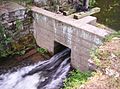
A lock on the Delaware Canal near Yardley, Pennsylvania, August 2007
