
U.S. Route 166 facts for kids
Quick facts for kids
|
|
|---|---|
|
US 166 highlighted in red
|
|
| Route information | |
| Auxiliary route of US 66 | |
| Maintained by KDOT and MoDOT | |
| Length | 164.159 mi (264.188 km) |
| Existed | 1926–present |
| Major junctions | |
| West end | |
|
|
| East end | |
| Location | |
| States: | Kansas, Missouri |
| Counties: | KS: Sumner, Cowley, Chautauqua, Montgomery, Labette, Cherokee MO: Newton |
| Highway system | |
| United States Numbered Highways List • Bannered • Divided • Replaced |
|

U.S. Route 166 (US 166) is a special highway in the United States. It stretches about 164 miles (264 kilometers) from west to east. This road is one of the last two parts of the famous historic U.S. Route 66, which was a very important road in the past. US-166 was officially created in 1926.
US-166 connects with the old path of US-66 in Baxter Springs, Kansas. This town is in the very southeast corner of Kansas. Today, that part of the old US-66 is called US-69 Alternate.
Contents
Exploring U.S. Route 166
US-166 travels through two states: Kansas and Missouri. It starts in South Haven, Kansas, and ends near Joplin, Missouri. Along its journey, it passes through several counties in Kansas, like Sumner, Cowley, and Cherokee. In Missouri, it only goes through a small part of Newton County.
Starting the Journey in Kansas
The western end of US-166 is in South Haven, Kansas. Here, it meets US-81. Not far from South Haven, you'll find an important highway called I-35. This is a major road that can take you to bigger cities like Wichita or Oklahoma City.
As you travel east, US-166 goes through Arkansas City. In this town, it briefly shares the road with US-77. This is called a "concurrency" when two highways use the same road for a short distance.
Through Towns and Countryside
The highway continues its path through the Kansas countryside. It passes near towns like Sedan and Caney. In these areas, you might see farms and open fields. US-166 also crosses paths with other U.S. Highways, such as US-75 and US-169. Sometimes, these crossings are simple intersections, and other times they are more complex interchanges, like a "trumpet interchange" which helps cars get on and off the highway smoothly.
One notable stop is Coffeyville, a larger town along the route. Further east, in Chetopa, US-166 again shares a road, this time with US-59.
Reaching the Missouri Border
As US-166 gets closer to the Missouri border, it goes through Baxter Springs. This town is special because it's where US-166 meets the old path of U.S. Route 66. This part of the road is now known as U.S. Route 69 Alternate. It's a cool spot for people interested in the history of American roads!
Near the very end of its journey in Kansas, US-166 also connects with US-400. They travel together for a short distance.
Ending the Journey in Missouri
After crossing the state line from Kansas into Missouri, US-166 only travels a short distance. It quickly reaches its eastern end near Joplin. Here, it connects with I-44, which is another major interstate highway. This is where both US-166 and US-400 finish their routes.
Images for kids
-
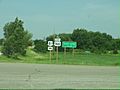
US-166's western starting point in South Haven, Kansas
-
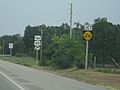
US-166 and US-400 meeting K-26


