
Greenburgh, New York facts for kids
Quick facts for kids
Greenburgh, New York
|
||
|---|---|---|
| Town of Greenburgh | ||

Greenburgh Town Hall
|
||
|
||

Location of Greenburgh, New York
|
||
| Country | United States | |
| State | New York | |
| County | Westchester | |
| Founded | 1788 | |
| Government | ||
| • Type | Civil township | |
| Area | ||
| • Total | 36.11 sq mi (93.54 km2) | |
| • Land | 30.31 sq mi (78.50 km2) | |
| • Water | 5.80 sq mi (15.03 km2) | |
| Elevation | 171 ft (52 m) | |
| Population
(2020)
|
||
| • Total | 95,397 | |
| • Density | 3,147.38/sq mi (1,215.25/km2) | |
| Time zone | UTC-5 (Eastern (EST)) | |
| • Summer (DST) | UTC-4 (EDT) | |
| ZIP code |
10603, 10607, 10530, others
|
|
| Area code(s) | 914 | |
| FIPS code | 36-30367 | |
| GNIS feature ID | 0979017 | |

Greenburgh is a vibrant town located in the western part of Westchester County, New York. It's a place where many families live, and it had about 95,397 residents when the last count was taken in 2020. Greenburgh is special because it includes six smaller villages and some other areas that are not part of any village.
Contents
Exploring Greenburgh's Past
Greenburgh grew up along the Hudson River, which was a very important way to travel and move goods a long time ago. Early settlers were mostly from Europe, especially from the Netherlands and England. People living here played a part in the American Revolutionary War, helping to shape the country we know today.
The Romer-Van Tassel House was Greenburgh's very first town hall, starting in 1793. It's now a historic landmark! Other important historical places include the Church of St. Joseph of Arimathea and Odell House. There's also a special monument in Mount Hope Cemetery for soldiers from the Spanish American War. These places are all recognized for their historical importance.
Greenburgh's Location and Landscape
Greenburgh is surrounded by other towns and cities. To the south, you'll find Yonkers. To the north is Mount Pleasant. On the east, it borders White Plains and Scarsdale. The beautiful Hudson River forms its western edge. The famous Tappan Zee Bridge connects Tarrytown (which is in Greenburgh) to South Nyack across the river.
The total area of Greenburgh is about 93.5 square kilometers (or 36.1 square miles). Most of this is land, about 78.5 square kilometers (30.3 square miles), and the rest, about 15 square kilometers (5.8 square miles), is water, mainly from the Hudson River.
Who Lives in Greenburgh?
| Historical population | |||
|---|---|---|---|
| Census | Pop. | %± | |
| 1790 | 1,450 | — | |
| 1820 | 2,064 | — | |
| 1830 | 2,195 | 6.3% | |
| 1840 | 3,361 | 53.1% | |
| 1850 | 4,291 | 27.7% | |
| 1860 | 8,929 | 108.1% | |
| 1870 | 10,790 | 20.8% | |
| 1880 | 8,934 | −17.2% | |
| 1890 | 11,613 | 30.0% | |
| 1900 | 15,564 | 34.0% | |
| 1910 | 21,148 | 35.9% | |
| 1920 | 23,881 | 12.9% | |
| 1930 | 35,821 | 50.0% | |
| 1940 | 40,145 | 12.1% | |
| 1950 | 47,527 | 18.4% | |
| 1960 | 76,213 | 60.4% | |
| 1970 | 85,827 | 12.6% | |
| 1980 | 82,881 | −3.4% | |
| 1990 | 83,816 | 1.1% | |
| 2000 | 86,764 | 3.5% | |
| 2010 | 88,400 | 1.9% | |
| 2020 | 95,397 | 7.9% | |
| U.S. Decennial Census | |||
Greenburgh has grown quite a bit over the years! In 1790, there were about 1,450 people, and by 2020, the population had grown to over 95,000. This shows how the town has developed and welcomed many new residents. People from many different backgrounds live in Greenburgh, making it a diverse and interesting community.
Many different types of families and individuals call Greenburgh home. You'll find households with children, married couples, and single people, all contributing to the town's vibrant community. The people in Greenburgh are of all ages, from young children to seniors. This mix of ages helps create a lively and supportive community for everyone.
Many families in Greenburgh have good jobs, and the town has a strong economy. This helps support local schools and services.
Exploring Greenburgh's Neighborhoods
Roughly half of Greenburgh's population lives within its six incorporated villages. The rest live in the unincorporated areas of the town, outside any villages.
Villages to Discover
Greenburgh contains six villages:
Unincorporated Areas
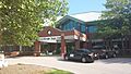
The unincorporated areas of Greenburgh are the parts of the town that are not part of any village. These areas often have their own names, like hamlets, even though they are not separate towns. Many properties in these areas are grouped into three main zones, called census-designated places.
Other unincorporated areas in Greenburgh include the neighborhoods of:
- East Irvington
- North Elmsford
- South Ardsley
Getting Around Greenburgh
Getting around Greenburgh is easy thanks to several major roads. Important highways like Interstate 87 (also known as the New York State Thruway) and the Cross Westchester Expressway run through the town. There are also scenic parkways and U.S. and State routes that help people travel.
For those who prefer trains, the Metro-North Railroad has two lines that serve Greenburgh. The Hudson Line runs along the western side with several stations, and the Harlem Line has a station in Hartsdale on the eastern side.
Local buses, part of the Bee-Line Bus System, help people get around town. There's even a special bus service, the HudsonLink, that crosses the Governor Mario M. Cuomo Bridge to connect Greenburgh with Rockland County.
Greenburgh's Economy and Resources
Greenburgh is home to the main office of the Westchester Library System, located in Elmsford. This means easy access to books and learning resources for everyone! The town has a strong economy, providing many job opportunities for its residents.
Famous Faces from Greenburgh
Many talented people have lived in Greenburgh, including:
- Freddie Blassie, a professional wrestler
- Cab Calloway, a famous jazz musician
- Gordon Parks, a renowned photographer
- Moms Mabley, a popular comedian
- Donovan Mitchell, an NBA basketball player
- Dana Reeve, an actress and wife of Christopher Reeve
- Biff Henderson, a television personality
- Adam Clayton Powell Jr., a Baptist pastor and politician
- Adam Clayton Powell III, a journalist and media executive
- Hazel Scott, a jazz vocalist
- Roy Campanella, a professional baseball player
Images for kids
-
Greenburgh Town Hall
-
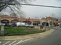
Hartsdale, an unincorporated hamlet in the town of Greenburgh
-

Greenburgh Public Library


See also
 In Spanish: Greenburgh para niños
