
Wythe County, Virginia facts for kids
Quick facts for kids
Wythe County
|
||
|---|---|---|

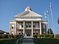
Wythe County Courthouse in Wytheville
|
||
|
||

Location within the U.S. state of Virginia
|
||
 Virginia's location within the U.S. |
||
| Country | ||
| State | ||
| Founded | 1790 | |
| Named for | George Wythe | |
| Seat | Wytheville | |
| Largest town | Wytheville | |
| Area | ||
| • Total | 465 sq mi (1,200 km2) | |
| • Land | 462 sq mi (1,200 km2) | |
| • Water | 2.8 sq mi (7 km2) 0.6% | |
| Population
(2020)
|
||
| • Total | 28,290 | |
| • Density | 60.84/sq mi (23.490/km2) | |
| Time zone | UTC−5 (Eastern) | |
| • Summer (DST) | UTC−4 (EDT) | |
| Congressional district | 9th | |

Wythe County is a cool place located in the southwestern part of Virginia, a state in the United States. It's like a big neighborhood with its own government. In 2020, about 28,290 people lived here. The main town, or county seat, where the county government is, is called Wytheville.
Contents
History of Wythe County
Wythe County was created in 1790 from a larger area called Montgomery County. It was named after George Wythe, a very important person from Virginia. He was the first person from Virginia to sign the Declaration of Independence, which was a big step for the United States becoming its own country.
During the Civil War, a battle called the Battle of Cove Mountain happened in Wythe County.
Before Wythe County was formed, a place called Austinville in what is now Wythe County was the main town for a huge area called Fincastle County. This old county was enormous, stretching all the way from Roanoke, Virginia, to the Mississippi River! That's about half the size of Texas!
Lead Mining in Austinville
The Austinville community was started by brothers Stephen and Moses Austin. Moses Austin was the father of the famous Stephen F. Austin, who helped settle Texas. In the 1790s, the Austin brothers took over mines that dug up lead and zinc. The town was named Austinville after their family.
Lead was a very important metal back then. It was used to make things like lead shot for hunting and defense. The lead from these mines was sent all over the new country.
Near Fosters Falls, you can still see the Jackson Ferry Shot Tower. This tower is a reminder of how lead shot was made. Workers would hoist lead to the top of the tower using ropes and oxen. The lead was melted and then poured through a special screen at the top. As the melted lead drops fell 150 feet, they would become perfectly round. The shot would land in a kettle of water at the bottom. Workers, often enslaved people, would go through a 110-foot tunnel from the New River bank to get the shot from the kettle.
The lead mines in Wythe County closed in 1982. This happened because of new rules to protect the environment and because there wasn't as much demand for lead anymore. The mines are now filled with water, and the main shaft went down more than 1100 feet!
Fort Chiswell and Modern Growth
Another important area in the county is Fort Chiswell. It's named after a fort built during the French and Indian War. This fort and its buildings used to be the county seat before Wytheville was established about 10 miles west. The old fort eventually fell apart. Its remains were covered up when the big highways I-77 and I-81 were built in the 1970s. Today, a pyramid marker shows where the fort used to be. Fort Chiswell was named after Colonel John Chiswell, who helped start the lead mines in 1757, even before the Austin brothers bought them.
Wythe County is a great spot because it's where two major highways, I-81 and I-77, meet. This has helped the county grow with new businesses and tourism. Big companies like Gatorade and Pepsi have built factories here because it's easy to get to and is a central spot on the East Coast.
There are also many places for travelers, like hotels, truck stops, and restaurants. Tourism in Wythe County offers lots of outdoor activities, including trails, campgrounds, and parks. The county also has wineries, with the first one opening in 2006. There's even a dinner theater in Wytheville, where you can watch a show while you eat!
Geography and Nature
Wythe County covers about 465 square miles. Most of this area, about 462 square miles, is land, and a small part, about 2.8 square miles, is water. The New River flows through the county.
The land in Wythe County is mostly a high, flat area. It's located between Iron Mountain to the south and Walker's Mountain to the northwest. The soil is generally good for farming. The county has many natural resources like iron ore, lead, coal, limestone, and gypsum. People have even found small amounts of silver in the old lead mines!
Neighboring Counties
Wythe County shares its borders with these other counties:
- Bland County - to the north
- Smyth County - to the west
- Grayson County - to the south
- Carroll County - to the southeast
- Pulaski County - to the east
Protected Natural Areas
Parts of these national protected areas are in Wythe County:
- Jefferson National Forest
- Mount Rogers National Recreation Area
Main Roads and Highways
These are some of the major roads that go through Wythe County:
Population of Wythe County
| Historical population | |||
|---|---|---|---|
| Census | Pop. | %± | |
| 1800 | 6,380 | — | |
| 1810 | 8,356 | 31.0% | |
| 1820 | 9,692 | 16.0% | |
| 1830 | 12,163 | 25.5% | |
| 1840 | 9,375 | −22.9% | |
| 1850 | 12,024 | 28.3% | |
| 1860 | 12,305 | 2.3% | |
| 1870 | 11,611 | −5.6% | |
| 1880 | 14,318 | 23.3% | |
| 1890 | 18,019 | 25.8% | |
| 1900 | 20,437 | 13.4% | |
| 1910 | 20,372 | −0.3% | |
| 1920 | 20,217 | −0.8% | |
| 1930 | 20,704 | 2.4% | |
| 1940 | 22,721 | 9.7% | |
| 1950 | 23,327 | 2.7% | |
| 1960 | 21,975 | −5.8% | |
| 1970 | 22,139 | 0.7% | |
| 1980 | 25,522 | 15.3% | |
| 1990 | 25,466 | −0.2% | |
| 2000 | 27,599 | 8.4% | |
| 2010 | 29,235 | 5.9% | |
| 2020 | 28,290 | −3.2% | |
| U.S. Decennial Census 1790-1960 1900-1990 1990-2000 2010 2020 |
|||
The population of Wythe County has changed over the years. In 2020, the census counted 28,290 people living here.
Education in Wythe County
Wythe County has several schools and colleges.
Colleges
- Breckbill Bible College, Grahams Forge
- Blueridge College of Evangelism, Wytheville
- Wytheville Community College, Wytheville
Public High Schools
- Fort Chiswell High School, Fort Chiswell
- George Wythe High School, Wytheville
- Rural Retreat High School, Rural Retreat
Private Schools
- The Baptist Academy of Rural Retreat, Rural Retreat
- Granite Christian Academy, Wytheville
- Appalachian Christian Academy, Rural Retreat
- Grace Christian Academy, Max Meadows
- United Christian Academy, Austinville
Communities in Wythe County
Wythe County has several towns and other communities.
Towns
Census-Designated Places
These are areas that are like towns but are not officially incorporated as towns:
Other Communities
These are other smaller communities in the county:
Images for kids
-
Wythe County Courthouse in Wytheville
See also
 In Spanish: Condado de Wythe para niños
