
Yvonand facts for kids
Quick facts for kids
Yvonand
|
||
|---|---|---|
 |
||
|
||

Yvonand
Location in Switzerland

Yvonand
Location in Canton of Vaud
|
||
| Country | Switzerland | |
| Canton | Vaud | |
| District | Jura-Nord Vaudois | |
| Area | ||
| • Total | 13.4 km2 (5.2 sq mi) | |
| Elevation | 438 m (1,437 ft) | |
| Highest elevation
(Roche de la Baume)
|
658 m (2,159 ft) | |
| Lowest elevation | 430 m (1,410 ft) | |
| Population
(Dec 2020 )
|
||
| • Total | 3,470 | |
| • Density | 259.0/km2 (671/sq mi) | |
| Postal code |
1462
|
|
| Surrounded by | Cheseaux-Noréaz, Cheyres (FR), Concise, Corcelles-près-Concise, Cronay, Cuarny, Donneloye, Molondin, Onnens, Rovray, Villars-Epeney | |

Yvonand is a town in Switzerland. It is located in the Vaud area, right by the beautiful Lake Neuchâtel.
This village is on the southwest side of Lake Neuchâtel. About 2,500 people live here. In summer, the population can grow to 7,000! This is because of the sandy beaches that slowly slope into the lake.
Contents
A Look at Yvonand's History

Yvonand has a very long history of people living there. About 6,000 years ago, people used the caves in the Vallon of Vaux as their first homes. Some cave paintings from that time can still be seen. Later, during the Bronze Age, people built settlements using wooden stakes in Yvonand bay.
The area around Yvonand was also settled during the Roman times. It was on the road between two Roman towns, Eburodunum (now Yverdon) and Aventicum (now Avenches). West of the Mentue River, the old walls of a Roman villa were found. This villa was built around 100 AD. There were also signs of a settlement with a Gallo-Roman temple, which was likely used around 400 AD.
Yvonand was first mentioned in official records in 1010. Back then, it was called Evonant. Later, names like Ivonant (1100) and Eyvonant (1437) appeared. The name Yvonand comes from a German family name, Evo, and the word 'nant', which means a small river or a valley.
During the Burgundian Wars in 1476, Yvonand became part of the area controlled by Grandson. This region was ruled by both Bern and Fribourg. Yvonand had its own local court. In 1531, the town joined the Protestant Reformation, which was a big change in religion.
After the old system of government ended, during the time of Napoleon (1798 to 1803), Yvonand had to join the Canton of Léman. This area later became the Canton Vaud. In 1798, Yvonand was placed in the Yverdon district.
Understanding Yvonand's Geography
Yvonand covers an area of about 13.4 square kilometers (5.2 square miles). A large part of this land, about 52.3%, is used for farming. Forests cover about 31.9% of the area. The rest of the land, about 12.9%, has buildings or roads. A small part (0.6%) is rivers or lakes, and 2.1% is land that cannot be used for farming or building.
Most of the built-up area is for homes and other buildings (5.3%). Roads and transport take up 5.5%. All the forested land is covered with thick forests. For farming, 42.0% is used for growing crops, and 8.9% is for pastures where animals graze. A small part (1.4%) is used for fruit trees or vineyards. All the water in the town comes from flowing rivers.
Yvonand is located 438 meters (1,437 feet) above sea level. It is about 8 kilometers (5 miles) east-northeast of Yverdon-les-Bains. The village is near where the River Mentue flows into Lake Neuchâtel. The land around Yvonand is gently rolling, between Lake Neuchâtel and the Broye area.
The main part of the area has the delta of the River Mentue, where it empties into Lake Neuchâtel. The lakeshore near Yvonand is flat, with reeds and forests. In the southeast, the land rises to its highest point in the town, at 675 meters (2,215 feet) above sea level. This area borders a high plateau near Rovray. The southern part of Yvonand includes the valley of the Mentue, which can be up to 1 kilometer (0.6 miles) wide. The River Vaux has also created a deep valley over millions of years.
Yvonand is surrounded by several other towns. These include Cheseaux-Noréaz, Villars-Epeney, Cuarny, Cronay, Donneloye, Molondin, and Rovray in Canton Vaud. It also borders Cheyres in Canton Fribourg.
People and Population
Yvonand has a population of about 2,600 people. About 11.1% of the people living here are foreign nationals. Over the last 10 years, the population has grown by about 13.2%. Most of this growth is due to people moving into the town.
Most people in Yvonand (91.9%) speak French as their main language. German is the second most common language (4.3%), followed by Portuguese (1.1%).
The age groups in Yvonand are:
- Children (0-9 years old): 10.5%
- Teenagers (10-19 years old): 16.0%
- Young adults (20-29 years old): 9.7%
- Adults (30-39 years old): 12.1%
- Adults (40-49 years old): 16.9%
- Adults (50-59 years old): 12.6%
- Seniors (60-69 years old): 11.0%
- Seniors (70-79 years old): 5.7%
- Seniors (80-89 years old): 4.6%
- Seniors (90 and older): 0.9%
In 2000, there were 862 private homes in Yvonand, with an average of 2.5 people per home. About 27% of homes had only one person living in them. There were also many married couples, with and without children, and single parents.
The chart below shows how the population of Yvonand has changed over time:

Yvonand's Economy
In 2010, Yvonand had an unemployment rate of 3.1%. This means a small percentage of people looking for work could not find a job.
The town's economy is divided into three main parts:
- Primary sector: This includes jobs like farming and fishing. In 2008, 44 people worked in this sector, with 17 businesses.
- Secondary sector: This involves manufacturing and construction. There were 234 people employed here, with 33 businesses. Most of these jobs (72.7%) were in manufacturing, and 27.3% were in construction.
- Tertiary sector: This covers services like sales, transport, hotels, education, and healthcare. This was the largest sector, with 464 people employed and 58 businesses. For example, 28.9% worked in sales, and 35.1% worked in healthcare.
Many people who live in Yvonand travel to other towns for work. In 2000, 653 people left Yvonand to work elsewhere, while 484 people came into Yvonand for work. Most people (63.9%) used a private car to get to work, while 11.7% used public transport.
Getting Around Yvonand
Yvonand has good transport links. A main road connects Yverdon to Estavayer-le-Lac and runs through the village. Since 2001, a new motorway, the A1 motorway, helps traffic bypass the village center. This motorway has two impressive bridges, over 100 meters (328 feet) high, that cross deep valleys.
The closest motorway exits are Yverdon Ouest (10 km or 6 miles away) and Estavayer-le-Lac (14 km or 9 miles away).
Yvonand also has a train station. The Yverdon railway line was extended to Payerne in 1877, and Yvonand got its own station. There is also a Post Bus service that connects Yvonand to nearby villages.
The new motorway has made it easier for people to travel to and from Yvonand. This has made the town more appealing to commuters who work further away but enjoy living by the lake.
Religious Buildings
In Yvonand, there has been a church since the town was first named. The main church, which is a Swiss Reformed Church, was rebuilt in 1749. Its tower was updated in 1906 and again in 2006. There is also a Catholic chapel that was built in 1959.
Interesting Places to Visit
The ancient settlement at Le Marais is a very special place. It is part of the Prehistoric Pile dwellings around the Alps, which is a UNESCO World Heritage Site. This means it is recognized as important to the world's history and culture.
Local Groups
- Yvonand Youth Club: www.jeunesse-yvonand.net
- Parti socialiste d'Yvonand (Socialist political party): www.ps-yvonand.ch
Images for kids
-
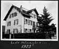
Ecole Ménagère in 1923

See also
 In Spanish: Yvonand para niños
