Águas de São Pedro facts for kids
Quick facts for kids
Águas de São Pedro
|
|||||
|---|---|---|---|---|---|
|
Municipality
|
|||||
| Municipality of the Hydromineral Spa of Águas de São Pedro Município da Estância Hidromineral de Águas de São Pedro |
|||||
|
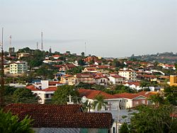
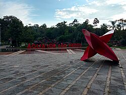
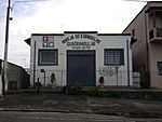
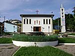
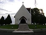
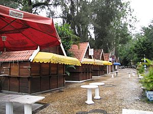
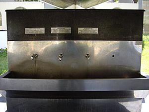
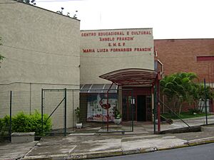
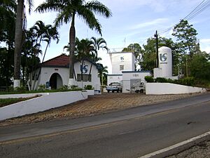
From the top, going left to right: Midtown and Jardim Iporanga neighborhood, Grande Hotel São Pedro, the municipal bath house, the municipal fountain, the main street of the municipality, and the Octavio Moura Andrade Square
|
|||||
|
|||||
| Nickname(s):
Águas
|
|||||
| Motto(s):
Omnibus Pax et Sanitas (Latin for Peace and Health for Everyone)
|
|||||
| Anthem: Hino a Águas de São Pedro | |||||
| Country | |||||
| Region | Southeast | ||||
| State | |||||
| Founded | 25 July 1940 | ||||
| Incorporated | 24 December 1948 | ||||
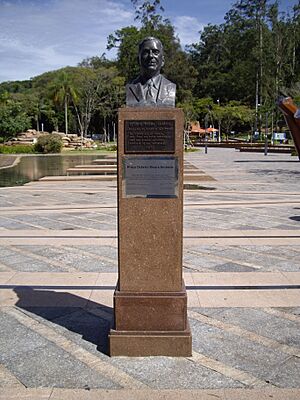
| Founded by | Octavio Moura Andrade | ||||
| Named for | Saint Peter and São Pedro | ||||
| Area | |||||
| • Municipality | 3.612 km2 (1.395 sq mi) | ||||
| • Urban | 3.612 km2 (1.395 sq mi) | ||||
| Elevation | 515.24 m (1,690.42 ft) | ||||
| Population
(2010)
|
|||||
| • Municipality | 2,707 | ||||
| • Estimate
(2020)
|
3,521 | ||||
| • Rank | 5,199th, Brazil | ||||
| • Density | 749.45/km2 (1,941.1/sq mi) | ||||
| Demonym(s) | água-pedrense | ||||
| Ethnicity | |||||
| • White | 87.22% (2,361 inhabitants) | ||||
| • Multiracial | 10.31% (279 inhabitants) | ||||
| • Black | 1.51% (41 inhabitants) | ||||
| • Asian | 0.96% (26 inhabitants) | ||||
| Time zone | UTC−3 (BRT) | ||||
| Postal codes |
13525-001–13529-999
|
||||
| Area code(s) | 19 | ||||
| HDI (2010) | 0.854 – very high | ||||
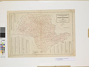
Águas de São Pedro is a small city in the state of São Paulo, Brazil. It is about 184 kilometers (114 miles) from the state capital. The city is known for its special mineral springs. Its name means "Waters of Saint Peter," because of these waters and its location near the city of São Pedro.
Águas de São Pedro is one of the smallest cities in Brazil. It covers only 3.61 square kilometers (1.39 square miles). In 2020, about 3,521 people lived there. The city is entirely urban, meaning it has no rural areas.
The average temperature in Águas de São Pedro is 22.4°C (72.3°F). Most of the city's green spaces are reforested areas. The city has a very high Human Development Index (HDI) of 0.854. This is one of the highest in Brazil and in the state of São Paulo.
The city was officially created in the 1940s. It is famous for its mineral waters, which are believed to have healing properties. These natural springs are popular tourist spots. One spring, called Fonte Juventude (Youth Fountain), has the second most sulfurous water in the world. The city also has two large parks, Dr. Octavio Moura Andrade Park and Parque das Águas "José Benedito Zani." These parks are important green areas for the city.
Águas de São Pedro is a planned city. It was designed from the start to be a tourist destination. It is located in the Itaqueri Ridge region, which means "lying stone" in the old Tupí–Guaraní language.
Contents
History of Águas de São Pedro
How the City Started
Long ago, before 1800, the area where Águas de São Pedro is now was a thick forest. The first people to explore this region were called bandeirantes. They were explorers looking for valuable stones like gold. They created many paths through the dense forest. One of these paths was called Caminho do Picadão, or "Way of the Forest Trail."
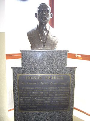
Over the years, many farms were built in the region. In 1883, the nearby city of São Pedro became independent from Piracicaba. The main business at that time was growing coffee. Many Italian families came to work on these farms. One of them was Angelo Franzin, who arrived in 1887. After working hard for many years, he bought land with his brother. They planned to grow coffee.
Finding Water, Not Oil
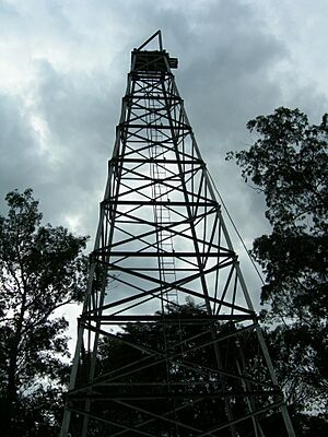
In the 1920s, the governor of São Paulo, Júlio Prestes, started looking for oil in the São Pedro area. They didn't find any oil. Instead, the drilling equipment brought up mineral water. Other attempts to find oil also failed, but the water kept flowing. One old oil rig structure, called the Torre de Petróleo Engenheiro Ângelo Balloni, still stands today.
Years later, in 1934, Angelo Franzin built a simple bath house at one of the springs. The water there smelled like sulfur. A year later, a group of people bought land around this bath house. They built a small health resort with twelve bathtubs. In the same year, Octavio Moura Andrade decided to build a bigger spa there. He named it Caldas de São Pedro.
Experts from the University of São Paulo studied these waters for four years. They wanted to make sure the water was safe for bathing and had good properties. In 1940, they announced that the waters were good for bathing and had medicinal benefits.
City Foundation and Growth
Because the mineral springs were so important, the São Paulo State Government officially created the "Hydromineral and Climatic Spa of Águas de São Pedro" on June 19, 1940. However, the city celebrates its birthday on July 25. This was the day in 1940 when the first big building, the Grande Hotel, was opened. Águas de São Pedro became an official city on December 24, 1948.
Octavio Moura Andrade planned the city to be a spa town. It was designed for people seeking health treatments and for tourists looking for fun. An urban planner named Jorge de Macedo Vieira helped design the city. He made sure the buildings and spaces worked well with the natural springs, land, and climate.
As part of this plan, many buildings were constructed. This included a large luxury hotel for tourists. A sanitation system was also built. Roads were improved, including an 8-kilometer (5-mile) road connecting São Pedro to the springs. An airport was also built. The city's energy system was also made better.
Modern Times
After the spa opened, tourism grew quickly. The city became part of the "Touristic Region of the Itaqueri Ridge." This region includes twelve cities. With more tourists, the city needed better shops. The main shopping street, Rua do Comércio, was renovated and became a pedestrian street.
In 2013, a group of companies planned to make Águas de São Pedro the first "digital city" in Brazil. They replaced old telephone wires with optical fiber. They also installed 4G internet antennas and security cameras. Students received tablets, and smart parking and street lighting systems were put in place. However, many residents later complained that most of these promised services stopped working.
Geography of Águas de São Pedro
{{wide image|Aguas de Sao Pedro Landscape 00.jpg|880px|View of Águas de São Pedro city center.]] Águas de São Pedro is a very small city, covering only 3.61 square kilometers (1.39 square miles). It is the second-smallest city in Brazil. The city has only urban areas, with no rural parts.
The city is divided into four main neighborhoods:
- Jardim Jerubiaçaba (meaning "loyalty" in Tupí–Guaraní) in the northeast.
- Jardim Iporanga (meaning "beautiful river" in Tupí–Guaraní) in the east.
- Centro (Center).
- Jardim Porangaba (meaning "nice view" in Tupí–Guaraní) in the south.
Águas de São Pedro is located at 22°35'50.422" south and 47°53'02.309" west. It is about 184 kilometers (114 miles) northwest of the state capital, São Paulo. The city is surrounded entirely by the municipality of São Pedro. This makes it one of Brazil's four enclaves.
Land and Water
The land in Águas de São Pedro has low, gentle hills separated by valleys. The city is about 515 meters (1,690 feet) above sea level.
The city is located in an area where ancient sediments from temporary rivers are found. These sediments are mostly reddish sandstones.
Águas de São Pedro is near the Araquá River. Araquá means "hole of the world" in Tupí–Guaraní. The city also has the Limoeiro and Das Palmeiras lakes. All these waters are part of the watershed of the Piracicaba River.
Climate and Weather
| Weather chart for Águas de São Pedro | |||||||||||||||||||||||||||||||||||||||||||||||
|---|---|---|---|---|---|---|---|---|---|---|---|---|---|---|---|---|---|---|---|---|---|---|---|---|---|---|---|---|---|---|---|---|---|---|---|---|---|---|---|---|---|---|---|---|---|---|---|
| J | F | M | A | M | J | J | A | S | O | N | D | ||||||||||||||||||||||||||||||||||||
|
222
31
19
|
191
31
20
|
149
31
19
|
72
29
16
|
62
27
13
|
44
26
12
|
27
26
11
|
27
28
13
|
64
29
15
|
124
30
17
|
134
30
17
|
192
30
19
|
||||||||||||||||||||||||||||||||||||
| temperatures in °C precipitation totals in mm source: Center for Meteorological and Climatic Researches Applied to Agriculture |
|||||||||||||||||||||||||||||||||||||||||||||||
|
Imperial conversion
|
|||||||||||||||||||||||||||||||||||||||||||||||
Águas de São Pedro has a tropical savanna climate. This means it has dry, mild winters and rainy, hot summers. The average yearly temperature is 22.4°C (72.3°F).
February is the hottest month, with an average temperature of 25.2°C (77.4°F). July is the coldest month, with an average temperature of 18.7°C (65.7°F).
The city gets about 1307.5 millimeters (51.5 inches) of rain each year. July is the driest month, and January is the wettest. In recent years, winters have become hotter and drier. This can lead to smoke from nearby sugarcane fields and scrubland.
| Climate data for Águas de São Pedro | |||||||||||||
|---|---|---|---|---|---|---|---|---|---|---|---|---|---|
| Month | Jan | Feb | Mar | Apr | May | Jun | Jul | Aug | Sep | Oct | Nov | Dec | Year |
| Mean daily maximum °F (°C) | 87.4 (30.8) |
87.6 (30.9) |
87.1 (30.6) |
84.0 (28.9) |
80.2 (26.8) |
78.3 (25.7) |
78.6 (25.9) |
82.6 (28.1) |
84 (29) |
85.3 (29.6) |
86.4 (30.2) |
86.2 (30.1) |
84.0 (28.9) |
| Daily mean °F (°C) | 77 (25) |
77.4 (25.2) |
76.5 (24.7) |
72.5 (22.5) |
68.2 (20.1) |
65.8 (18.8) |
65.7 (18.7) |
68.9 (20.5) |
71.4 (21.9) |
73 (23) |
74.8 (23.8) |
75.9 (24.4) |
72.3 (22.4) |
| Mean daily minimum °F (°C) | 66.7 (19.3) |
67.1 (19.5) |
65.8 (18.8) |
61.0 (16.1) |
56.1 (13.4) |
54 (12) |
52.5 (11.4) |
55.0 (12.8) |
58.6 (14.8) |
61.7 (16.5) |
63.3 (17.4) |
65.7 (18.7) |
60.6 (15.9) |
| Average precipitation inches (mm) | 8.72 (221.5) |
7.53 (191.2) |
5.87 (149.2) |
2.83 (71.8) |
2.45 (62.3) |
1.74 (44.1) |
1.05 (26.7) |
1.07 (27.1) |
2.53 (64.3) |
4.9 (124) |
5.26 (133.5) |
7.55 (191.8) |
51.48 (1,307.5) |
| Source: Center for Meteorological and Climatic Researches Applied to Agriculture | |||||||||||||
Nature and Environment
The original plants in Águas de São Pedro were part of the cerrado ecosystem. This area had trees that were 3 to 6 meters (10 to 20 feet) tall, with grasses and smaller plants below. The trees often had twisted branches and thick bark.
Today, much of this natural plant life has been replaced. The city now has many reforested areas, covering about 69.58 hectares (171.9 acres). Most of these are in Dr. Octavio Moura Andrade Park. There are also smaller areas of floodplain plants along the Araquá River.
People of Águas de São Pedro
| Population pyramid 2010 | ||||
| % | Males | Age | Females | % |
| 0.967 | 85+ | 1.414 | ||
| 0.967 | 80–84 | 1.525 | ||
| 1.637 | 75–79 | 1.9 | ||
| 2.121 | 70–74 | 2.568 | ||
| 2.27 | 65–69 | 3.35 | ||
| 2.791 | 60–64 | 3.535 | ||
| 2.57 | 55–59 | 3.163 | ||
| 2.605 | 50–54 | 3.647 | ||
| 3.24 | 45–49 | 4.056 | ||
| 2.98 | 40–44 | 4.205 | ||
| 3.312 | 35–39 | 3.423 | ||
| 3.61 | 30–34 | 3.312 | ||
| 3.275 | 25–29 | 3.163 | ||
| 2.791 | 20–24 | 2.791 | ||
| 3.684 | 15–19 | 3.796 | ||
| 3.35 | 10–14 | 3.35 | ||
| 2.493 | 5–9 | 2.567 | ||
| 1.935 | 0–4 | 1.637 | ||
In 2010, the city had a population of 2,707 people. Most residents were White (87.22%). About 10.31% were multiracial, 1.51% Black, and 0.96% Asian. The city has about 749 people per square kilometer.
| Historical population | ||
|---|---|---|
| Year | Pop. | ±% |
| 1970 | 830 | — |
| 1980 | 1,091 | +31.4% |
| 1991 | 1,697 | +55.5% |
| 1996 | 1,664 | −1.9% |
| 2000 | 1,883 | +13.2% |
| 2007 | 2,340 | +24.3% |
| 2010 | 2,707 | +15.7% |
| Source: Brazilian Institute of Geography and Statistics | ||
Many homes in Águas de São Pedro (over 50%) are owned by people who visit for vacations. They use these homes on weekends and holidays.
The city's Human Development Index (HDI) is 0.854. This is considered very high. It is the second highest HDI in Brazil. This means the city ranks well in areas like education, health, and income.
Religions in the City
Águas de São Pedro has many different religions. In 2010, most people were Roman Catholic (67.81%). About 16.07% were Evangelics, and 8.41% said they had no religion. There were also Spiritists, Jews, and other Christian groups.
Catholic Churches
The history of the Catholic Church in Águas de São Pedro began when the city founder's mother asked him to build a "House of God." The highest point in the city was chosen for it.
In 1946, a chapel was finished. It was named after Our Lady of the Immaculate Conception. In 1954, Águas de São Pedro got its own Catholic parish. The current Immaculate Conception Parish was founded that year.
Later, a new church was planned, but it was not completed. The city's parochial hall was then turned into the main church, called the Mother Church. The old chapel is now dedicated to Our Lady of the Immaculate Conception of the Apparition.
Protestant Churches
Many different Protestant churches are in the city. These include the Assemblies of God in Brazil and the Christian Congregation in Brazil. These churches are growing in popularity across Brazil.
Economy of Águas de São Pedro
In 2016, the city's total economic output (GDP) was about R$132.6 million. The average income per person was R$41,378. The city had 225 local businesses and 1,569 employed people.
Águas de São Pedro does not have rural areas, so farming is not a part of its economy. The city also does not rely on large industries.
Most of the city's economy comes from services, especially tourism. The city is part of the Itaqueri Ridge Tourism Region. Its main attraction is its medicinal mineral waters. Tourists help boost the city's shops and businesses. The busiest shopping areas are Carlos Mauro Avenue and Trade Street.
The city's exports in 2016 were very small, totaling only US$838. These exports included imitation jewelry and woven baskets.
Holidays bring more money to the city. For example, during the 2016 Carnival, tourism brought in about R$5 million. Several programs have been created to attract more tourists and improve local businesses.
Media and Communication
The city has one local newspaper, Jornal Águas News, which started in 2016. Regional newspapers also cover news from Águas de São Pedro.
The city has one radio station, 92 FM, which began broadcasting in 1987.
For phone and internet services, the city is served by Vivo. This company took over from previous phone companies over the years.
Culture and Fun
{{wide image|Panorâmica 3.jpg|880px|Fountain in Octavio Moura Andrade Square.]]
Tourism in Águas
On weekends, the number of tourists in Águas de São Pedro can be twice the number of people who live there. During long holidays, up to 30,000 tourists can visit.
Águas de São Pedro is one of eleven cities in São Paulo state known as "hydromineral spas." This means they have special mineral springs. This recognition helps these cities get more money from the state to invest in tourism. It also allows the city to use the title "hydromineral spa" in its name.
The city has several green areas for visitors:
- Mini Horto (Mini Garden): A place with a plant nursery and a pond.
- Dr. Octavio Moura Andrade Park: This park is over one million square meters (about 10.7 million square feet). It has 16 hiking trails that are 6,500 meters (4 miles) long. You can find many local animals and plants here, including about 250 types of birds and 40 coatis.
- Parque das Águas "José Benedito Zani" (Waters Park "José Benedito Zani"): This park is 6,400 square meters (68,889 square feet). It has a jogging track, an outdoor gym, a skate ramp, and a bikeway.
The city used to have the "Museum of Telecommunications," also known as the Radio Museum. It had a collection of old radios and other communication devices. The museum is currently closed.
Águas de São Pedro celebrates two local holidays: the city's anniversary on July 25 and Immaculate Conception Day on December 8.
Special Mineral Springs
Águas de São Pedro is famous for its mineral waters. There are three main fountains: Fonte Juventude (Youth Fountain), Fonte Gioconda (Gioconda Fountain), and Fonte Almeida Salles (Almeida Salles Fountain). These waters have more minerals than most other Brazilian springs.
- The water from Fonte Juventude comes from deep underground. It has the most sulfur in Brazil and the Americas, and the second most in the world. It is used for baths and to help with skin diseases.
- Fonte Gioconda water has a lot of sodium sulfate. It is used to help with stomach diseases.
- Fonte Almeida Salles water has sodium bicarbonate. It is used for stomach and liver problems.
You can drink the water from the Fontanário Municipal (Municipal Fountain). For baths, there is the Spa Thermal Dr. Octavio Moura Andrade, which is the city's public bath house.
Caminho do Sol (Way of the Sun)
| Caminho do Sol | |
|---|---|
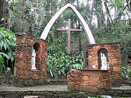
Casa de Santiago
|
|
| Length | 241 kilometres (150 mi) |
| Location | São Paulo, Brazil |
| Use | Hiking and biking |
The Caminho do Sol (Way of the Sun) is a special path that ends in Águas de São Pedro. It is a practice route for the famous Way of St. James in Spain. Many people hike or bike this 241-kilometer (150-mile) path each year. They come to the city for religious reasons or for tourism. The path goes through 12 different cities.
Arts and Crafts
The city also has a lively arts and crafts scene. You can find many handmade items made from local materials. These crafts show the local culture and way of life. Artisans sell their work at bazaars, fairs, and craft stores.
Sports and Games
In 1941, the Grande Hotel hosted Brazil's first major chess competition.
More recently, Águas de São Pedro has sent teams to participate in the Senior Regional Games (JORI) and Senior Open Games (JAI). These are sports competitions for older adults. In 2018, 56 athletes from Águas de São Pedro took part in the JORI games.
Education in Águas de São Pedro
Águas de São Pedro has three public schools:
- Escola Municipal de Educação Infantil "Vida" (EMEI Vida): A pre-school.
- Escola Municipal de Ensino Fundamental de Águas de São Pedro "Maria Luiza Fornasier Franzin" I, II e III (EMEFASP "Maria Luiza Fornasier Franzin" I, II and III): An elementary school with three different buildings for different grades.
- Escola Estadual Angelo Franzin (E. E. "Angelo Franzin"): A high school.
The city also has a higher education institution. The Centro Universitário Senac – Campus Águas de São Pedro (Senac University Center) opened in 1995. It is a private university that offers various courses.
In 2017, there were 686 students in the city's schools. There were 51 teachers. In 2010, only 1.71% of people over 18 could not read or write. This shows a high level of education in the city.
City Services
In 2010, Águas de São Pedro had 990 homes. Most of these homes (654) were owned by the residents.
Getting Around
An old railway station used to connect to São Pedro, which helped people reach Águas de São Pedro. This station closed in the late 1960s.
Today, the main highway that passes through the city is the SP-304, also known as Rodovia Geraldo de Barros. It connects Águas de São Pedro to São Pedro (8 kilometers or 5 miles away) and Piracicaba (29 kilometers or 18 miles away). This highway was recently improved and widened.
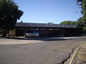
The city is also near the São Pedro Airport, which opened in 1938. It has a dirt runway. The city's bus station was also updated in 2008 to better serve passengers.
In 2016, the city had 2,491 vehicles. This means there was about one vehicle for every 1.29 people. This can sometimes cause traffic problems, especially in the city center on weekends.
Utilities and Services
Electricity in the city is provided by the Companhia Paulista de Força e Luz (São Paulo State Power and Light Company).
Water services are provided by the Basic Sanitation Company of the State of São Paulo (Sabesp). They provide tap water to all homes. However, not all homes have sewage collection. For a long time, the city did not have a sewage treatment plant, so untreated sewage flowed into the Araquá River. This caused complaints from residents. After talks, a sewage treatment plant was built and finished in 2016.
Telephone and cable Internet services are offered by Vivo.
Public Safety
Águas de São Pedro is a very safe city. There has been only one murder case recorded since the city was founded.
The city has a police station and is patrolled by the Military Police and the Municipal Civil Guard. The city does not have its own Fire Department. Fire services are provided by the nearby city of São Pedro.
Sister Cities
 Cubatão, Brazil (since 1991)
 Molinaseca, Spain (since 2012)
See Also
 In Spanish: Águas de São Pedro para niños


