Alabama Hills facts for kids
Quick facts for kids Alabama Hills |
|
|---|---|
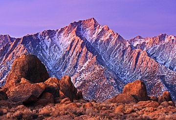
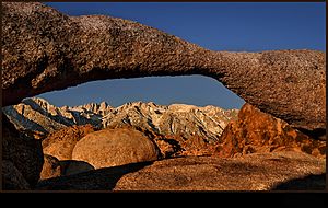
Rocks of the Alabama Hills with the Sierra Nevada in the background, winter dawn
|
|
| Highest point | |
| Elevation | 5,354 ft (1,632 m) |
| Geography | |
| Country | United States |
| State | California |
| District | Inyo County |
| Range coordinates | 36°36′53″N 118°05′45″W / 36.6146556°N 118.0959218°W |
| Topo map | USGS Lone Pine, Union Wash |
The Alabama Hills are a special area of hills and cool rock formations. You can find them in California, near the eastern side of the Sierra Nevada mountains. They are located in the Owens Valley, just west of a town called Lone Pine. Even though they look separate, the Alabama Hills are actually part of the same big rock structure as the Sierra Nevada.
Contents
Alabama Hills: A Special Protected Area
The U.S. Bureau of Land Management (BLM) takes care of the Alabama Hills. They manage it as the Alabama Hills Recreation Area. Their goal is to protect the natural habitat and make sure people can enjoy the area. In March 2019, the U.S. Congress gave the area a new, important name: the Alabama Hills National Scenic Area. This means it's now a specially protected place for everyone to enjoy its beauty.
Camping Rules in Alabama Hills
Many people love to visit the Alabama Hills, especially those who enjoy dispersed camping (camping outside of official campgrounds). This area is a popular gateway to Mount Whitney and the Eastern Sierra Nevada Mountains. However, because more and more visitors are coming, the natural environment is facing challenges.
The Bureau of Land Management (BLM) now asks visitors to camp in official campgrounds. This helps keep the beautiful views clear and reduces the number of vehicles in the hills. If you need to use a restroom, please use facilities in town or at nearby campgrounds. If that's not possible, you should bury human waste properly. Dig a hole 6 inches deep and make sure it's 200 feet away from water, trails, and other camps. There are no restrooms directly in the hills. Following these rules helps protect the amazing scenery and outdoor activities for everyone. You can find the latest rules and fire restrictions on the BLM's Alabama Hills National Scenic Area website.
Geology: How the Rocks Formed
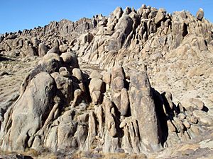
The rocks in the Alabama Hills look smooth and rounded. This is very different from the sharp, jagged peaks of the Sierra Nevada mountains nearby. Even though they look different, both areas formed at the same time. The rounded shapes of the Alabama Hills are due to different ways the rocks have worn down over time.
Mount Whitney, the tallest mountain in the lower United States, stands much higher than the Alabama Hills. The hills themselves are about 1,500 feet (457 meters) above the Owens Valley floor. Scientists believe the Owens Valley is filled with about 10,000 feet (3,048 meters) of dirt and rocks. This means the Alabama Hills are actually the very top of a huge, steep rock wall. This wall might have been created by many earthquakes, like the big Lone Pine earthquake in 1872. That earthquake caused the ground to move up or down by 15–20 feet (4.6–6.1 meters) in one event!
Types of Rocks and Natural Arches
There are two main types of rock you can see in the Alabama Hills. One type is an orange, dull-looking rock that was once volcanic rock. It changed over time into a metamorphosed rock, and it's about 150 to 200 million years old. The other main type of rock is called biotite monzogranite. This rock is younger, about 82 to 85 million years old. It breaks down into large, potato-shaped boulders. Many of these boulders stand upright because of a process called spheroidal weathering, which rounds off the edges of rocks.
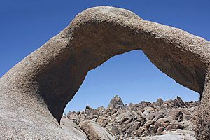
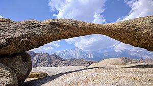
One of the biggest attractions in the Alabama Hills are the many natural arches. These are rock formations that look like giant doorways or bridges. You can reach them by taking short walks from roads like Whitney Portal Road, Movie Flat Road, and Horseshoe Meadows Road. Some of the most famous arches include Mobius Arch, Lathe Arch, the Eye of Alabama, and Whitney Portal Arch.
History: How the Hills Got Their Name
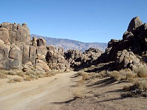
The Alabama Hills were named during the American Civil War. They got their name from a ship called the CSS Alabama. This was a warship used by the Confederate side. When people looking for gold in California heard about the ship's adventures, some who supported the Confederates named their mining claims after it. Soon, the name "Alabama Hills" was used for the whole area.
Later, in 1864, the CSS Alabama was sunk by another ship, the USS Kearsarge, off the coast of France. After this, people who supported the Union (the other side in the war) named a mining district, a mountain pass, a mountain peak, and even a town after the Kearsarge.
Filming Location: Movies and TV Shows
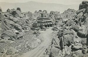
The Alabama Hills are a very popular place for making movies and TV shows. Many Westerns (cowboy movies) have been filmed here because the landscape looks so rugged and wild. Since the 1920s, over 150 movies and about a dozen TV shows have used the Alabama Hills as a backdrop.
Some famous films shot here include Tom Mix movies, Hopalong Cassidy films, The Gene Autry Show, The Lone Ranger and Bonanza. Classic movies like Gunga Din, Bad Day at Black Rock (1955), and parts of How the West Was Won were also filmed here. In the late 1940s and early 1950s, many B-westerns starring Tim Holt were made in this area. More recent productions often use specific spots known as Movie Flats and Movie Flat Road.
Astronomy: Stargazing in Dark Skies
The Alabama Hills offer some of the best skies for stargazing in Central California. It's considered a Bortle class 2 area, which means it has "average dark skies." This is much darker than many other popular places for looking at stars, like Joshua Tree National Park. On a clear night without a moon, if your eyes are used to the dark, you might even see the Andromeda and Triangulum galaxies without a telescope! The central part of the Milky Way galaxy also looks amazing and full of detail under these dark conditions.
 | Jewel Prestage |
 | Ella Baker |
 | Fannie Lou Hamer |


