
Algonquin Peak facts for kids
Quick facts for kids Algonquin Peak |
|
|---|---|

Algonquin Peak seen from road to Adirondak Loj
|
|
| Highest point | |
| Elevation | 5,114 ft (1,559 m) |
| Prominence | 2,100 ft (640 m) |
| Listing | Adirondack High Peaks 2nd |
| Geography | |

Algonquin Peak
Location in New York
|
|
| Parent range | MacIntyre Mountains |
| Topo map | USGS Keene Valley |
| Climbing | |
| First ascent | 1837 by Ebenezer Emmons and party |
| Easiest route | Hike from the Adirondak Loj |
Algonquin Peak is a tall mountain in the MacIntyre Mountains in New York. It is located in the town of North Elba, in Essex County. This mountain is the second highest in New York State. It is also one of the 46 special mountains called Adirondack High Peaks found in Adirondack Park.
The name "Algonquin" comes from the Algonquian peoples. It is believed the mountain was near a border between the Algonquian people and their neighbors, the Iroquois.
Contents
Exploring Algonquin Peak
Algonquin Peak is a favorite spot for people who love to hike. You can start your climb from the Adirondak Loj trailhead. This spot is near Heart Lake, just outside Lake Placid. Many hikers enjoy it as a day trip.
The Main Hiking Trail
The most common way to reach the top is by following the Van Hoevenberg Trail. This trail is marked with blue blazes. After about 1.0 mile (1.6 km), you will meet the MacIntyre Range Trail. This trail is marked with yellow blazes.
You will follow the yellow-blazed trail for another 3.3 miles (5 km) to the summit. As you get closer to the top, the path becomes steeper and rockier. You will go over many steep rock sections called "slides."

The Mountain Top
The very top of Algonquin Peak is an alpine tundra zone. This means it is above the tree line, where trees cannot grow because of the harsh weather. From the summit, you can see amazing views of the other Adirondack High Peaks all around you.
Many hikers visit the summit, which can harm the delicate plants there. To protect this special area, strict rules are in place. All hikers must sign in at the trailhead. Dogs are allowed only if they are on a leash. On busy days, a "Summit Steward" is often there. This person helps hikers follow the rules and teaches them about the unique plants and animals.
Other Trails
Sometimes, hikers approach the mountain from the southeast. This route uses the Boundary Trail from Lake Colden. This trail is about 2.1-mile (3.4 km) long. It is known for being steep and narrow. This trail can also be tricky because its markings are not always clear. It also has slippery sections where streams have created slides.
Images for kids
-
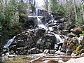
Waterfall on the trail to Algonquin Peak

